- Connecticut Route 136
-
Route 136
Route information Maintained by ConnDOT Length: 20.46 mi[1] (32.93 km) Existed: 1932 – present Major junctions West end:  US 1 in Darien
 I-95 in Westport
East end:  Route 59 in Easton
Highway system Routes in Connecticut
Special Service Roads • State Roads←  Route 135
Route 137  →
→Route 136 is a state highway in southwestern Connecticut, running from Darien to Easton. The route was initially established in 1932 to serve the beach communities between Darien and Southport. Its eastern end was relocated in 1963 to head northeast from Westport to Easton instead.
Contents
Route description
Route 136 begins at an intersection with US 1 in Darien and heads east, intersecting I-95 before crossing into Norwalk. In Norwalk, it continues south, east, and northeast through the Rowayton section of the city before a 1.11 miles (2 km) section maintained by the city between the intersection of Wilson and Meadow Streets and the intersection of Water and Washington Street, after which it continues east across the Norwalk River, through a triangular one-way couplet and into Westport. In Westport, Route 136 turns northeast along the Saugatuck River, intersecting I-95 again before crossing the Saugatuck (via the Saugatuck River Bridge), briefly overlapping Route 57, passing beneath Route 15 without a junction, and continuing northeast across the northwest corner of Fairfield into Easton. In Easton, it continues northeast before ending at an intersection with Route 59.[1]
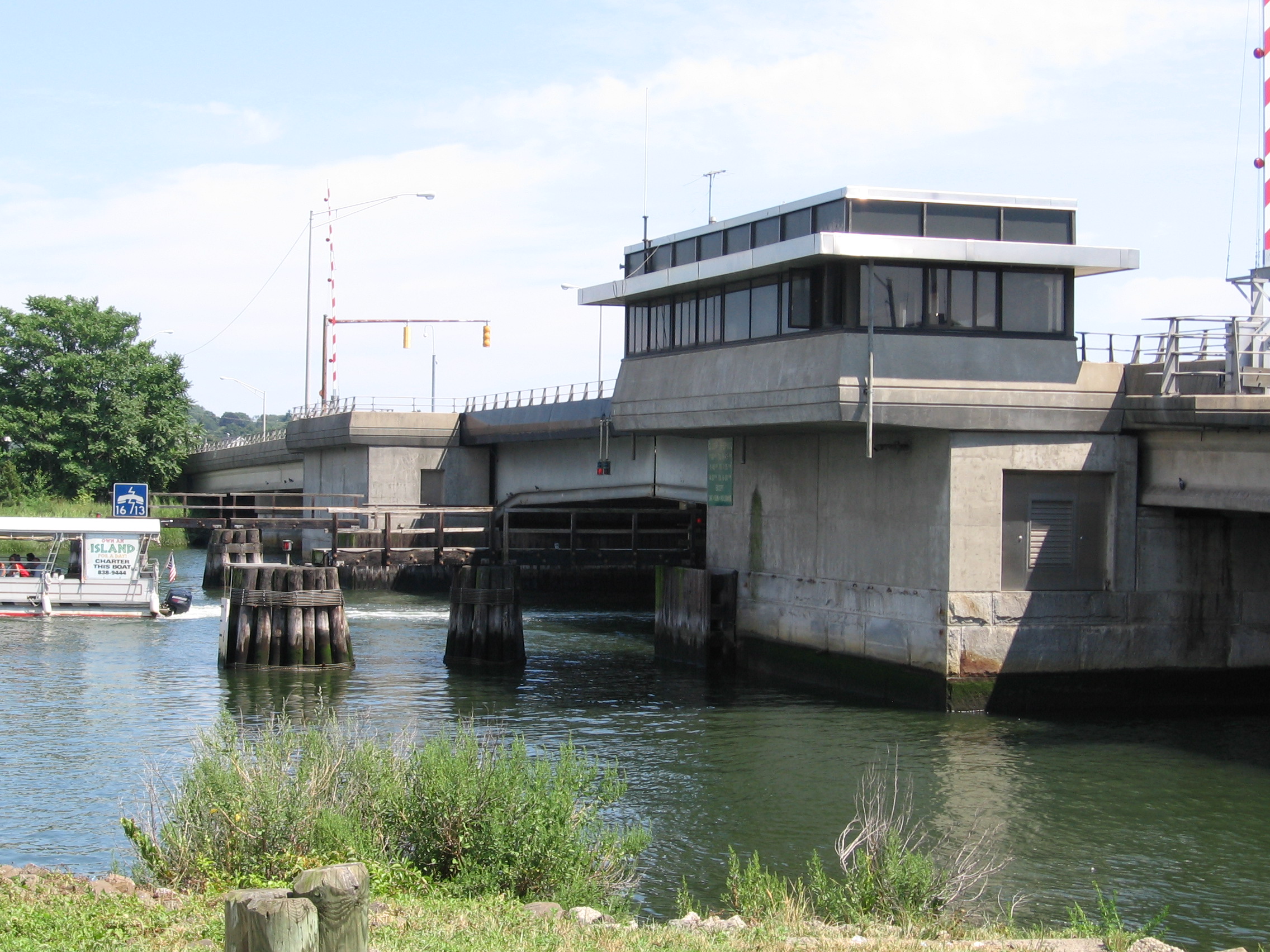
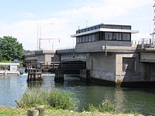 The Stanley Stroffolino Memorial Bridge is a bascule bridge that takes Route 136 over the Norwalk River. This view is facing southeast taken from a lot adjacent to Water Street in South Norwalk.
History
Modern Route 136 in Westport and Easton was the southern portion of an early 19th-century private turnpike known as the Branch Turnpike, which was incorporated in 1831. The road ran from Wesport center, through Easton center and the Upper Stepney section of Monroe, to the Housatonic River at Bennett's Bridge in Newtown, and collected tolls until 1851. Between Easton center and Upper Stepney, the old turnpike is now part of Route 59.
In the early 1920s, Connecticut assigned numbers to its state roads. A coastal road in the Gold Coast region of the state running parallel to U.S. Route 1, from Darien to Southport, was designated as State Highway 335. The former Branch Turnpike, however, remained unnumbered. Route 136 was formed as part of the 1932 state highway renumbering as a renumbering of old Highway 335. In 1963, Route 136 was relocated to its current route, including the portion along the old Branch Turnpike, as a result of the 1961 Route Reclassification Act. Maintenance of the coastal portion of old Route 136 in Westport and Fairfield was returned to the towns. Additionally, a 1.1-mile (1.8 km) section in the South Norwalk section of Norwalk is still maintained by the city and is one of only two such maintenance gaps in a state highway in Connecticut (the other gap is at Route 83).[2]
Junction list
Town Road names Junction Milepost Darien
(1.26 miles (2.03 km))[1]Tokeneke Road US 10.00 I-950.29 Norwalk
(5.99 miles (9.64 km))Cudlipp Avenue, Rowayton Avenue, McKinley Street, Highland Avenue, Wilson Avenue, Meadow Street, Woodward Avenue, Burritt Avenue, Water Street, Washington Street, Fort Point Street, Van Zant Street, East Avenue, Cemetery Street, Gregory Boulevard, Winfield Street (Begin city maintenance) 4.14 (End city maintenance) 5.25 Westport
(7.26 miles (11.68 km))Saugatuck Ave., Park St., Charles St., Riverside Ave., Bridge St.,
S. Compo Rd., N. Compo Rd., Main St., Easton Rd. I-95 / Route 33
8.28 US 110.49  Route 57
11.78-12.08 Fairfield
(0.17 miles (0.27 km))Westport Turnpike (No major junctions) Easton
(4.41 miles (7.10 km))Westport Road  Route 58
17.25 Route 5920.46 References
Categories:- Transportation in Fairfield County, Connecticut
- State highways in Connecticut

Wikimedia Foundation. 2010.