- Rokycany
Geobox | Settlement
name = Rokycany
other_name =
category = Town

image_caption = Town Hall
| flag_border = 1
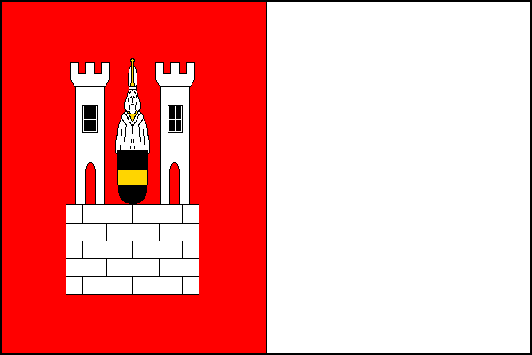
symbol = Rokycany CoA CZ.png
official_name =
motto =
nickname =
country = Czech Republic
country_
state =
region = Plzeň
region_type = Region
district = Rokycany
district_type = District
commune = Rokycany
municipality =
part =
river = Klabava
location = Masarykovo náměstí
elevation = 362
lat_d = 49
lat_m = 44
lat_s = 33
lat_NS = N
long_d = 13
long_m = 35
long_s = 44
long_EW = E
highest =
highest_elevation =
highest_lat_d =
highest_long_d =
lowest =
lowest_elevation =
lowest_lat_d =
lowest_long_d =
area = 30.98
area_round = 2
population = 14299
population_date = 2006
population_density = auto
established = 1110
established_type = First mentioned
mayor = Jan Baloun
timezone =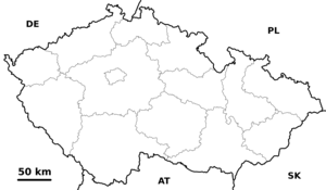
map_background = Czechia - background map.png
map_locator = Czechia
commons = Rokycany
statistics =
website = [http://www.rokycany.cz/ www.rokycany.cz]
footnotes =
name = Rokycany
native_name =
other_name =
other_name1 =
category = Municipality with Extended Competence
image_size =
image_caption =
flag_size =
symbol =
symbol_size =
country = Czech Republic
state =
region = Pilsen
district =
capital =
capital_lat_d =
capital_lat_m =
capital_lat_s =
capital_lat_NS =
capital_long_d =
capital_long_m =
capital_long_s =
capital_long_E =
capital_elevation =
part_type =
part_label = Municipalities with Commissioned Local Authority
part_count = 3
part = Radnice
part1 = Rokycany
part2 = Zbiroh
area = 575.13
area_round = 2
highest =
highest location =
highest_lat_d =
highest_lat_m =
highest_lat_s =
highest_lat_NS =
highest_long_d =
highest_long_m =
highest_long_s =
highest_long_EW =
highest_elevation = 718
lowest =
lowest_location =
lowest_lat_d =
lowest_lat_m =
lowest_lat_s =
lowest_lat_NS =
lowest_long_d =
lowest_long_m =
lowest_long_s =
lowest_long_EW =
lowest_elevation =
population_as_of = 2005-31-12
population = 45823
population_density =
established_type =
established =
leader =
timezone =
utc_offset =
timezone_DST =
utc_offset_DST =
code_type =
code =
code1_type =
code1 =
free_type =
free =
free1_type =
free1 =
map_size =
map_caption =
map_locator =
map_locator_x =
map_locator_y =
website =
footnotes = Geobox Region | geobox_width = 270
name = Rokycany
native_name =
other_name =
other_name1 =
category = Municipality with Commissioned Local Authority
image_size =
image_caption =
flag_size =
symbol =
symbol_size =
country = Czech Republic
state =
region = Pilsen
district = Rokycany
district_type = Little District
district_label = Municipality with Commissioned Local Authority
capital =
capital_lat_d =
capital_lat_m =
capital_lat_s =
capital_lat_NS =
capital_long_d =
capital_long_m =
capital_long_s =
capital_long_E =
capital_elevation =
part_type = Municipalities
part_label =
part_count = 34
part = Březina
part1 = Bušovice
part2 = Dobřív
part3 = Ejpovice
part4 = Holoubkov
part5 = Hrádek
part6 = Hůrky
part7 = Cheznovice
part8 = Kakejcov
part9 = Kamenný Újezd
part10 = Klabava
part11 = Kornatice
part12 = Litohlavy
part13 = Medový Újezd
part14 = Mešno
part15 = Mirošov
part16 = Mýto
part17 = Nevid
part18 = Osek
part19 = Příkosice
part20 = Raková
part21 = Rokycany
part22 = Skořice
part23 = Smědčice
part24 = Strašice
part25 = Svojkovice
part26 = Štítov
part27 = Těně
part28 = Těškov
part29 = Trokavec
part30 = Veselá
part31 = Vísky
part32 = Volduchy
part33 = Všenice
area = 272.91
area_round = 2
highest =
highest location =
highest_lat_d =
highest_lat_m =
highest_lat_s =
highest_lat_NS =
highest_long_d =
highest_long_m =
highest_long_s =
highest_long_EW =
highest_elevation =
lowest =
lowest_location =
lowest_lat_d =
lowest_lat_m =
lowest_lat_s =
lowest_lat_NS =
lowest_long_d =
lowest_long_m =
lowest_long_s =
lowest_long_EW =
lowest_elevation =
population_as_of = 2005-12-31
population = 34470
population_density =
established_type =
established =
leader =
timezone =
utc_offset =
timezone_DST =
utc_offset_DST =
code_type =
code =
code1_type =
code1 =
free_type =
free =
free1_type =
free1 =
map_size =
map_caption =
map_locator =
map_locator_x =
map_locator_y =
website =
footnotes =Rokycany (IPA2|ˈrokɪtsanɪ), ( _de. Rokitzan), is a town in the
Plzeň Region of theCzech Republic . It lies Unit length|km|17 to the East from the region capital ofPilsen on the confluence of the River Klabava and the Holoubkov Brook ( _cs. Holoubkovský potok). Alternatively, the Holoubkovský potok is referred to as the Borecký potok and the section of the Klabava River down to the confluence as the Padrťský potok. There is another smaller brook (Rakovský potok or Rakováček) in the western part of the town.The town is located in the lowland, 362 meters above sea-level, bordered by hilly woodlands, especially the Brdy mountains to the east (highest elevation - Tok, 865 meters above sea-level) or the Radeč massif - 718 meters above sea-level.
Rokycany is also the seat of the Municipality with Extended Competence and Municipality with Commissioned Local Authority.
Demography
In 19th century Rokycany´s population quickly expanded pushing the number of inhabitants towards 5,000 in 1880. In the wake of
Long Depression (economic slowdown of 1870´s which affected the economy of Austria-Hungary) the growth stopped. In late 1890´s however population began to expand again, only to halt during WWI. In post-1918 era Rokycany grew rapidly. In late 1930´s this growth was further spurred by influx of ethnic Czech refugees fromSudetenland . In 1939 Rokycany´s population touched 10,000 mark briefly. After WWII many citizens of Rokycany left the town for border regions from where the ethnic Germans were expelled. From 1950´s new wave of massive growth started, pushing the town´s population past 10,000 in mid 1950´s and past 15,000 in 1980´s. Demographic maximum was reached in 1989 with more than 16,000 inhabitants. Since that time the population dropped to ca.14,000 as a result of economic a social transition and also of separation of 3 villages from the community of Rokycany. The population of Rokycany currently stands at 14,302, as of1 January 2007 (as stated by the Czech ministry of Interior, [http://www.mvcr.cz/sprava/informat/cetnost/obce/pocet_obcane_leden07.xls link] ) or 13,773 (as stated by the Czech statistical office, [http://www.czso.cz/xp/redakce.nsf/i/seznam_mest_a_obci_plzenskeho_kraje_k_1_1_2007] ).Year 1811 1848 1869 1880 1890 1900 1910 1921 1930 1939 1950 1961 1970 1980 1991 2001 2007 Population 2,226 3,292 4,187 4,927 5,010 5,501 6,492 6,728 7,741 9,865 8,789 11,934 12,585 15,041 15,188 14,369 14,302 Source: [http://rokycanyhomepage.ic.cz/rokycanyhomepage.htm unofficial pages of Rokycany by David Borek]
Ethnically, Rokycany has been a predominately Czech settlement since
Middle Ages . The German minority accounted for no more than couple of dozens individuals. In 1938 the town's population was boosted by influx of ethnic Czechs fleeing the border regions of Czechoslovakia which had been ceded toNazi Germany . After 1945 most ethnic Germans were expelled. The ethnic mix of Rokycany was in the post-WWII era enriched by Romas (Gypsies) and Slovaks.History
The place was inhabited since
Stone Age .Celt ic and early Slavic settlements were discovered. First written document mentions Rokycany in 1110. At that time it was a village owned by theBishop of Prague and major Bohemian and German noblemen met here for diplomatic talks with Emperor Henry V. In 1295 a stockade fortifications in Rokycany are mentioned (probably defending the district around the main church). Major changes occurred in the 14th century when the village finally transformed into town and new western part of the settlement with rectangular grid was added. In 14th century Rokycany also had the main church rebuilt in Gothic style and by 1399 system of town fortification is mentioned. Rokycany took an active role in Hussite movement. MasterJohn of Rokycan (1397—1471),Archbishop ofPrague , active duringHussite Wars was born here. In 1406 Rokycany obtainedcity rights . In 16th century new prosperity of the town started. Rokycany was given rights as "free King's city" in 1584 making it self-administered entity. The prosperity came to an abrupt end with theThirty Years' War . Rokycany was repeatedly afflicted by various armies, most notably by Swedish army led by Banner who completely burned the town. By the end of the war Rokycany´s population stood at merely 774. Another period of prosperity started in 18th century. Town was partially destroyed by fire in 1757 (52 housed damaged) and completely destroyed by another fire in 1784 (260 houses damaged). After the fire town-hall and main church had to be rebuilt as well as most of the private houses. Thanks to favorable economic conditions of the residents the post-1784 renewal proceeded rather quickly. In 19th century crafts and industry became main source of Rokycany´s economy. The traditional iron-ore mining and processing industry was strengthened and linked with coal mining industry in nearbyMirošov (Rokycany District) basin. In 1862 Rokycany was connected via railway withPrague andPlzeň . Industrial development continued for most of the 20th century. Population soared (from 4,187 in 1869 to more than 16,000 in late 1980´s) and town expanded with new neighborhoods, some of them inspired by concepts ofGarden city movement (Rašínov neighborhood in the southern outskirts). On May 7th 1945 Rokycany was liberated by theAmerican army which stopped its eastward advance here meeting with the allied Soviet troops in the eastern part of the town (creating so-called Demarcation line). In the post-WWII era, the development of the town was carried out in line with the rulingcommunist regime . The new massive construction activity focused on uniform tenement houses, from 1960´s built with concrete panels (so-called "panelák "). The local industry was further expanded and the life of the town was strongly influenced by strong army garrison (located in two barracks built in 1899 and 1933 respectively). In 1960 neighboring village Borek was merged with Rokycany, in 1980 another three rural communities (Kamenný Újezd (Rokycany District) ,Litohlavy ,Svojkovice (Rokycany District) ) joined Rokycany (however all 3 have separated in 1990´s) [http://rokycanyhomepage.ic.cz/rokycanyhomepage.htm]Geography
Rokycany is officially divided into 4 districts, namely „Střed“ (Center), „Nové Město“ (New Town), „Plzeňské předměstí“ (Plzeň Suburb) and “Borek”.Střed encompasses the historical core of the town with two main squares, main church of Panna Marie Sněžná and town-hall. Since 1992 the historical core of Rokycany has been declared protected zone in order to protect the architecture. The border of this district largely follows the path of former town´s fortification. The medieval walls are still standing in several short sections. On the southern side the walls have been replaced by an representative avenue (Jiráskova ulice) with several major public buildings such as “sokolovna” (
Sokol organization headquarters) from 1903, new railway-station from 1931, gymnázium (grammar-school) from 1905 or municipal bank from 1933.Nové Město is by far most populous district surrounding the historical core from north, east and south. It evolved from traditional "Pražské předměstí suburb" which was located on both banks of the Klabava river along the road to Prague (Pražská ulice) and Nerudovo náměstí square. In post WWII era most of the old suburb was demolished and replaced by several housing projects. With the population growth the built-up area of Nové Město expanded in all directions. There are thus several distinct modern neighborhoods. "Práchovna" is located in the southeastern section of Rokycany on the banks of the Klabava River. Several industrial estates and colony of cheap tenement houses for local workers from early 20th century form most of Práchovna. "Páclovna" is situated along the road to Prague on Rokycany´s eastern outskirts. It mainly consists of private houses, the Demarcation line memorial is located here (commemorating the meeting of American and Russian troops that occurred here in 1945), "Osecký vrch" lies in the north along the road to the village of Osek. In 1957 large hospital was built here. There are large parks covering the surrounding slopes (Husovy sady and Kalvárie) and large complex of town swimming-pool and football stadium. "Jižní předměstí" covers territory south of the Prague-Plzeň railway. It consists of several industrial zones and populous housing projects from 1950´s and 1970´s. The military barracks built in 1933 have been converted into a residential and industrial zone recently.Plzeňské předměstí forms western part of Rokycany. It started in medieval era as a small cluster of rural houses adjoining Rokycany’s historical core. In early 17th century Protestant church Nejsvětější Trojice was built here, soon after taken by Catholics. In 19th century Plzeňské předměstí quickly grew along the road to Plzeň (Plzeňská ulice), mainly industrial development was later accompanied by residential houses. In 1920´s massive housing project started on Rokycany´s southern outskirts. The new neighborhood was later called "Rašínov" (Alois Rašín was finance minister of Czechoslovakia, assassinated in 1923). In consists solely of private houses inart-deco style. In 1930´s another neighborhood was inaugurated in the western periphery, called "Za Rakováčkem". It also features almost exclusively private residential houses. Borek is formerly independent village located ca.2 km east of Rokycany. In 1960 Borek came under the jurisdiction of Rokycany. The Borecký rybník lake is most notorious landmark of this district. In 20th century the built-up area of Borek expanded amalgamating the village with Rokycany.Famous People from Rokycany
*
John of Rokycan , (ca. 1396, Rokycany – 1471, Prague), archbishop of Prague
*Adolf Kraus , (1850,Blovice – 1928, USA), Chicago lawyer,B'nai B'rith officer, lived in Rokycany
*Čestmír Řanda (1923, Rokycany – 1986, Prague), Czech actor
*Jana Preissová (born 1948, Plzeň), Czech actress, lived in Rokycany
*Věra Bílá , (born 1954, Rokycany),World music Romani singer
*Jaroslav Špaček (born 1974, Rokycany),Buffalo Sabres (National Hockey League ) defensemanResources
*citation
last = Czech Statistical Office
year = 2005
title = Vybrané údaje podle správních obvodů obcí s rozšířenou působností a správních obvodů obcí s pověřeným obecním úřadem k 31. 12. 2005
url = http://www.czso.cz/xp/redakce.nsf/i/B78124165F6D1D93C1256F1800285EDB/$File/1-vybr.xls
accessdate = 2005-03-08External links
* [http://www.rokycany.cz/ Municipal website]
* [http://www.bohemianet.com/plzensko/rokycany/rokycany_en.htm History of the town, its current state]


Wikimedia Foundation. 2010.