- Mint Hill, North Carolina
-
Town of Mint Hill — Town — Location of Mint Hill, North Carolina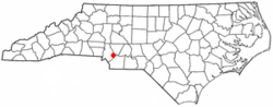
Country  United States
State  North Carolina
Counties Mecklenburg, Union Government - Town Manager Brian L. Welch, Elevation 780 ft (238 m) Population (2007 census) - Town 18,462 - Metro 2,191,604 Time zone EST (UTC-5) - Summer (DST) EDT (UTC-4) Area code(s) 704, 980 Website http://www.minthill.com Mint Hill is a suburban town in southeastern Mecklenburg and northwestern Union counties in the U.S. state of North Carolina, it is a major suburb on the outskirts of Charlotte and near the Cabarrus County line. The population was 14,922 at the 2000 census.
Contents
Geography
Mint Hill is located at 35°10′49″N 80°39′52″W / 35.180189°N 80.664432°WCoordinates: 35°10′49″N 80°39′52″W / 35.180189°N 80.664432°W (35.180189, -80.664432).[1]
According to the United States Census Bureau, the town has a total area of 21.3 square miles (55 km2), of which, 21.2 square miles (55 km2) of it is land and 0.04 square miles (0.10 km2) of it (0.19%) is water.
Demographics
As of the census[2] of 2000, there were 14,922 people, 5,581 households, and 4,431 families residing in the town. The population density was 702.9 people per square mile (271.4/km2). There were 5,763 housing units at an average density of 271.5 per square mile (104.8/km2). The racial makeup of the town was 95.11% White, 0.81% African American, 0.72% Native American, 1.15% Asian, 0.03% Pacific Islander, 1.07% from other races, and 1.12% from two or more races. Hispanic or Latino of any race were 3.16% of the population.
There were 5,581 households out of which 33.9% had children under the age of 18 living with them, 68.9% were married couples living together, 7.4% had a female householder with no husband present, and 20.6% were non-families. 16.4% of all households were made up of individuals and 5.2% had someone living alone who was 65 years of age or older. The average household size was 2.67 and the average family size was 2.98.
In the town the population was spread out with 24.3% under the age of 18, 7.1% from 18 to 24, 28.5% from 25 to 44, 29.8% from 45 to 64, and 10.3% who were 65 years of age or older. The median age was 39 years. For every 100 females there were 98.1 males. For every 100 females age 18 and over, there were 95.8 males.
The median income for a household in the town was $60,822, and the median income for a family was $67,055. Males had a median income of $45,368 versus $30,467 for females. The per capita income for the town was $26,487. About 2.9% of families and 4.8% of the population were below the poverty line, including 4.9% of those under age 18 and 11.4% of those age 65 or over.
Schools and libraries
The citizens of Mint Hill, NC attend the Charlotte-Mecklenburg Schools. Elementary schools include Clear Creek Elementary, Bain Elementary, Crown Point Elementary, and Lebanon Road Elementary. Middle schools include Northeast Middle, and Mint Hill Middle. High schools include Independence, Butler, East Mecklenburg and Rocky River. Mint Hill is also home to the Queens Grant Charter schools.
Mint Hill is served by a branch of the Public Library of Charlotte and Mecklenburg County.[3]
References
- ^ "US Gazetteer files: 2010, 2000, and 1990". United States Census Bureau. 2011-02-12. http://www.census.gov/geo/www/gazetteer/gazette.html. Retrieved 2011-04-23.
- ^ "American FactFinder". United States Census Bureau. http://factfinder.census.gov. Retrieved 2008-01-31.
- ^ "Mint Hill branch of the Public Library of Charlotte and Mecklenburg County". http://plcmc.org/Locations/branches.asp?id=13. Retrieved 2008-10-25.
External links
- Town website of Mint Hill, NC
- Mint Hill Chamber of Commerce
- Mint Hill's Neighborhood Website
- Mint Hill branch of the Public Library of Charlotte and Mecklenburg County
Charlotte Metropolitan Area Counties 
Major city Cities and towns
20k-99kConcord • Gastonia • Huntersville • Kannapolis • Matthews • Monroe • Hickory • Mooresville • Rock Hill • Salisbury • Shelby • StatesvilleCities and towns
5k-20kAlbemarle • Belmont • Bessemer City • Chester • Cherryville • Conover • Cornelius • Davidson • Fort Mill • Indian Trail • Kings Mountain • Lancaster • Lincolnton • Mint Hill • Mount Holly • South Gastonia • Unionville • Wadesboro • Weddington • YorkFootnotes Bold = principal metro cities • Italic = places and counties part of CSAMunicipalities and communities of Mecklenburg County, North Carolina County seat: Charlotte City 
Towns Cornelius | Davidson‡ | Huntersville | Matthews | Midland‡ | Mint Hill‡ | Pineville | Stallings‡ | Weddington‡
Footnotes ‡This populated place also has portions in an adjacent county or counties
Municipalities and communities of Union County, North Carolina County seat: Monroe City 
Towns Fairview | Hemby Bridge | Indian Trail | Marshville | Mineral Springs | Mint Hill‡ | Stallings‡ | Unionville | Waxhaw | Weddington‡ | Wingate
Villages CDP Unincorporated
communityDogwood Acres | Jackson | New Salem | Roughedge
Footnotes ‡This populated place also has portions in an adjacent county or counties
Categories:- Populated places in Mecklenburg County, North Carolina
- Populated places in Union County, North Carolina
- Towns in North Carolina


Wikimedia Foundation. 2010.