- Ocracoke, North Carolina
-
Ocracoke, North Carolina — CDP —  Location within the state of North Carolina
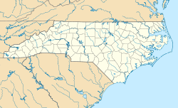
 Ocracoke, North Carolina
Coordinates: 35°6′46″N 75°58′33″W / 35.11278°N 75.97583°WCoordinates: 35°6′46″N 75°58′33″W / 35.11278°N 75.97583°W Country United States State North Carolina County Hyde Area – Total 9.6 sq mi (24.9 km2) – Land 9.6 sq mi (24.8 km2) – Water 0.1 sq mi (0.2 km2) Elevation 3 ft (1 m) Population (2000) – Total 688 (July 2,007)UNIQ3fc7eb693c20bcdb-ref-00,000,000-QINU – Density 80.4/sq mi (31.1/km2) Time zone Eastern (EST) (UTC-5) – Summer (DST) EDT (UTC-4) ZIP code 27960 Area code(s) 252 FIPS code 37-48740[2] GNIS feature ID 1021718[3] Demonym Ococker Website http://www.ocracokevillage.com/ Ocracoke is a census-designated place (CDP) and unincorporated town located at the southern end of Ocracoke Island, located entirely within Hyde County, North Carolina. The population was 769 as of the 2000 census. It is also the location of Blackbeard's death.
The Ocracoke area made headlines during the Independence Day weekend in July 2009 when a truck carrying fireworks exploded, eventually killing three, and injuring several more.[4]
Contents
History
The Outer Banks area was occasionally visited by Algonquian-speaking Native Americans, but was never permanently settled. Ocracoke, then called Wokokkon,[5] was used as a subsistence hunting and fishing ground for the Hatterask Indians. Yaupon Tea or Black Drink, made from the dried leaves of the indigenous yaupon, a native holly, was used ceremonially by the Native Americans in the area. A small village on Hatteras Island is said[when?] to have had forty fighting men. The area was first described in detail by Giovanni da Verrazzano, an Italian navigator, in 1524. Verrazzano was unable to navigate the tortuous channels leading into the Pamlico Sound and assumed that China lay beyond the Outer Banks.
 Howard Street
In 1585, Sir Walter Raleigh's colony, in their ship the Tiger, in search of Roanoke Island collided with a sand bar in Ocracoke Inlet and were forced to land on the island for repairs.[6]
An attempt at an English settlement was tried at Roanoke Island in the late 16th century, but it failed. This effectively halted European settlement until 1663, when Carolina Colony was chartered by King Charles II. However, remote Ocracoke Island was not permanently settled until 1750, being a pirate haven at times before then. It was a favorite anchorage of Edward Teach, better known as the pirate Blackbeard. He was killed in November 1718. The grounds of what is now the Springer's Point Nature Preserve were said to be the pirate's favored hang-out during those days.
 Sand Dunes
Throughout the mid-to-late 18th century, the Island was home to a number of especially skilled schooner pilots, who could get smaller ships through the inlet to the Pamlico Sound. As population increased on the mainland, demand for transshipment of goods from ocean-going vessels increased. The population was listed as 139 in the 1800 census. Warehouses were built to hold goods off-loaded from larger ships offshore and then loaded onto smaller schooners to be delivered to plantations and towns along the mainland rivers.
By the late 19th century, the shipping business was gone, and the United States Lifesaving Service became a major source of steady income for local men. Fishing, including charters for tourists, became more important to the livelihood of the area.
Fort Ocracoke
 Fort Ocracoke
Fort Ocracoke, a Confederate fortification constructed at the beginning of the American Civil War, was situated on Beacon Island in Ocracoke Inlet, two miles to the west-southwest of Ocracoke village. The Confederates abandoned and partially destroyed the fort in August 1861 after Union victories on nearby Hatteras Island. Union forces razed it a month later. Beacon Island subsided beneath the waves of the inlet in the early 20th century. The remnants of Fort Ocracoke were located and identified in 1998.
Geography
 Ocracoke Island
The island of Ocracoke is a part of the Outer Banks of North Carolina. It is one of the most remote islands in the Outer Banks, as it can only be reached by one of three public ferries (two of which are toll ferries), private boat, or private plane. Other than the village of Ocracoke and a few other areas (a ferry terminal, a pony pen, a small runway), the entire island is part of the Cape Hatteras National Seashore.
 View of Ocracoke Lighthouse across Silver Lake
The village of Ocracoke is located around a small sheltered harbor called Silver Lake, with a second smaller residential area built around a series of man-made canals called Oyster Creek. The village is located at the widest point of the island, protected from the Atlantic Ocean by sand dunes and a salt marsh. The average height of the island is less than five feet above sea level, and many of the buildings on the island are built on pilings to lift them off the ground. Flooding is a risk during both hurricanes and large storms. Ocracoke Lighthouse is situated near Silver Lake and has remained in continuous operation since 1823.
 Sunset over Silver Lake Harbor
The island is also home to a British cemetery. During World War II, German submarines sank several British ships including the HMT Bedfordshire, and the bodies of British sailors were washed ashore. They were buried in a cemetery on the island. A lease for the 2,290-square-foot (213 m2) plot, where a British flag flies at all times, was given to the Commonwealth War Graves Commission for as long as the land remained a cemetery, and the small site officially became a British cemetery. The United States Coast Guard station on Ocracoke Island takes care of the property.[7] A memorial ceremony is held each year in May.[8]
Ocracoke village is located at 35°6′46″N 75°58′33″W / 35.11278°N 75.97583°W (35.112687, -75.975895).[9] According to the United States Census Bureau, the CDP has a total area of 9.6 square miles (25 km2), of which, 9.6 square miles (25 km2) of it is land and 0.1 square miles (0.26 km2) of it (0.62%) is water.
Transportation
A single paved two-lane road, NC 12, runs from the village at the southern end of the island to the ferry dock at the northern tip of the island, where a 40-minute long free ferry connects to Hatteras Island. The second ferry dock, located in the village, has toll connections to Swan Quarter, North Carolina on the mainland and Cedar Island, near Atlantic, North Carolina.
A passenger ferry operates across Ocracoke Inlet to the deserted village of Portsmouth, at the northern end of the Core Banks.
Ocracoke Island Airport (FAA Identifier W95) is located slightly south-east of the village, allowing small aircraft to land.
Economy
 British Cemetery
The economy of Ocracoke Island is based almost entirely on tourism. During the winter, the population shrinks and only a few businesses remain open. During the spring, summer, and early fall, an influx of tourists occupy hotels, campgrounds and weekly rental houses — and day visitors arrive by ferry from Hatteras Island. Several bars, dozens of restaurants, and many shops, stores and other tourist-based businesses open for the tourist season, and every business on the island is independently owned and operated by residents. There are no chains or franchises.
Ocracoke was named America's Best Beach for 2007 by Dr. Stephen Leatherman, a professor of coastal ecology at Florida International University who compiles his annual list under the moniker "Dr. Beach". Ocracoke had previously earned the #2 and #3 spots in 2005 and 2006, respectively.
 Ocracoke Island Lighthouse
Commercial fishing contributes to the local economy with chartered sport fishing drawing tourism. With easy access to the Pamlico Sound, the Atlantic coast and the Gulf Stream, Ocracoke offers various fishing opportunities, from small Sound fish to tuna and drum.
During the winter, the island's only main employers are construction, the NC Department of Transportation and the businesses that support the small population. Many islanders use the winter as time off, since they tend to work between 60 and 80 hours a week during the tourist season.[10][11]
Music
 Sunset over Silver Lake Harbor
Despite its small size, the island has a sizable music scene with a larger than normal percentage of its residents being musicians. The island hosts an annual Ocrafolk Festival featuring a weekend full of live performances. Besides the numerous restaurants which host live music, visitors and locals can attend the Ocrafolk Opry each Wednesday evening at the Deep Water Theater during the season, featuring a panoply of local musicians and special visiting guests. The only radio station licensed to a community in Hyde County, WOVV 90.1 FM has "Locals Only Beach" music blocks playing only the music of local bands. Several local stores carry cds produced by the island's musicians. Local musicians recently received national attention when they appeared performing in the movie Nights in Rodanthe. Notable local musical acts include The Ocracoke Rockers, Martin and Friends, Aaron Caswell Band, Molasses Creek, Baby Dee and the Free Mustache Rides Again and Coyote. Other musical locals who left the island include Mya Rose and Ansley Wynn of Incognito Mosquito.
Local dialect
Ocracoke Island historically had its own distinct dialect of English, often referred to as a brogue.[12] A characteristic phrase is "high tide," pronounced somewhat like "hoi toid", and locals are referred to as high tiders or hoi toiders. Due to the influx of tourists and greater contact with the mainland in recent years, however, the Ocracoke brogue has been increasingly influenced by outside dialects.[13]
Demographics
As of the census[2] of 2000, there were 769 people, 370 households, and 219 families residing in the CDP. The population density was 80.4 people per square mile (31.1/km²). There were 784 housing units at an average density of 82.0/sq mi (31.7/km²). The racial makeup of the CDP was 96.10% White, 1.69% African American, 0.52% Native American, 0.26% Asian, 0.65% from other races, and 0.78% from two or more races. Hispanic or Latino of any race were 1.95% of the population.
 Ocracoke School
There were 370 households out of which 17.6% had children under the age of 18 living with them, 46.8% were married couples living together, 8.9% had a female householder with no husband present, and 40.8% were non-families. 30.8% of all households were composed of individuals and 8.9% had someone living alone who was 65 years of age or older. The average household size was 2.08 and the average family size was 2.55.
In the CDP the population was spread out with 13.0% under the age of 18, 6.1% from 18 to 24, 28.3% from 25 to 44, 34.6% from 45 to 64, and 17.9% who were 65 years of age or older. The median age was 46 years. For every 100 females there were 96.2 males. For every 100 females age 18 and over, there were 89.0 males.
The median income for a household in the CDP was $34,315, and the median income for a family was $38,750. Males had a median income of $26,667 versus $25,625 for females. The per capita income for the CDP was $18,032. About 7.7% of families and 9.3% of the population were below the poverty line, including 13.8% of those under age 18 and 10.4% of those age 65 or over.
 Ocracoke Airport
Public services
 Ocracoke Volunteer Fire Department
The residents of Ocracoke Island are served by the Ocracoke School (K-12), part of the Hyde County Schools, located near the center of the village. The island also has a small, local airport located southeast of the village on NC 12. Hyde County maintains the Ocracoke Volunteer Fire Department located on the Back Road.
References
- ^ http://www.city-data.com/city/Ocracoke-North-Carolina.html
- ^ a b "American FactFinder". United States Census Bureau. http://factfinder.census.gov. Retrieved 2008-01-31.
- ^ "US Board on Geographic Names". United States Geological Survey. 2007-10-25. http://geonames.usgs.gov. Retrieved 2008-01-31.
- ^ "Fireworks truck explodes on Ocracoke Island; one dead, four critically injured". WRAL.com. http://www.wral.com/news/local/story/5502082/. Retrieved 2009-08-16.
- ^ The inlet appears as "Okok" in the map "A New Description of Carolina", engraved by Francis Lamb (London, Tho. Basset and Richard Chiswell, 1676).
- ^ Ocracoke;[
- ^ http://www.ocracokeisland.com/walking_tour.htm
- ^ Neala Schwartzberg. "Offbeat Travel". http://www.offbeattravel.com/british-cemetery-outerbanks.html. Retrieved 2007-06-20.
- ^ "US Gazetteer files: 2010, 2000, and 1990". United States Census Bureau. 2011-02-12. http://www.census.gov/geo/www/gazetteer/gazette.html. Retrieved 2011-04-23.
- ^ http://www.ocracokeislandrealty.com/OcracokeIslandRealty/InTheCommunity/
- ^ http://www.ocracokeisland.info/history.php
- ^ Neal Hutcheson, director (2009). The Carolina Brogue (television documentary). Ocracoke Island, North Carolina. http://www.carolinabrogue.com.
- ^ Hoi Toide on the Outer Banks pp.117-136. The University of North Carolina Press. 1997.
External links
- Town of Ocracoke, North Carolina website
- Ocracoke Island, NC visitor information
- Cape Hatteras National Seashore - Ocracoke Island
- Clips from The Ocracoke Brogue documentary
- America's Best Beaches 2007
- Ocracoke Island tops best beaches list
Municipalities and communities of Hyde County, North Carolina CDP Ocracoke

Unincorporated
communitiesEngelhard | Fairfield | Last Chance | Nebraska | Stumpy Point | Swan Quarter
The Outer Banks of North Carolina Landforms Bodie Island · Roanoke Island · Pea Island · Little Hatteras Island · Hatteras Island · Cape Hatteras · Ocracoke Island · Portsmouth Island · Core Banks · Cape LookoutPlaces Currituck County · Dare County · Hyde County · Carteret County
Carova Beach · Corolla · Duck · Southern Shores · Kitty Hawk · Kill Devil Hills · Nags Head · Manteo · Wanchese · Rodanthe · Waves · Salvo · Avon · Buxton · Frisco · Hatteras · Ocracoke · PortsmouthWaterways Lighthouses Protected areas Transportation History Categories:- Populated places in Hyde County, North Carolina
- Islands of North Carolina
- Census-designated places in North Carolina
- Beaches of North Carolina
- Outer Banks
- Populated places established in 1750


Wikimedia Foundation. 2010.