- North Syracuse, New York
-
North Syracuse, New York — Village — Location within the state of New York
 North Syracuse, New York
Coordinates: 43°8′0″N 76°7′56″W / 43.133333°N 76.13222°WCoordinates: 43°8′0″N 76°7′56″W / 43.133333°N 76.13222°W Country United States State New York County Onondaga Area – Total 2.0 sq mi (5.1 km2) – Land 2.0 sq mi (5.1 km2) – Water 0.0 sq mi (0.0 km2) Elevation 420 ft (128 m) Population (2000) – Total 6,862 – Density 3,496.2/sq mi (1,349.9/km2) Time zone Eastern (EST) (UTC-5) – Summer (DST) EDT (UTC-4) ZIP code 13212 Area code(s) 315 FIPS code 36-53660 GNIS feature ID 0958933 North Syracuse is a village in Onondaga County, New York, United States. The population was 6,863 at the 2000 census.
The Village of North Syracuse is partly in the Town of Cicero[citation needed], but is primarily within the Town of Clay. North Syracuse is north of the City of Syracuse.
Contents
History
The village was originally called Centerville and changed to its present name in 1880. It became an incorporated village in 1925. Among the first settlers, the Fergerson family located there in 1826. They still occupy the same land located in what is now the village center. Many local streets are named in their honor.
On July 18, 1846, the United States' first plank road opened in North Syracuse, primarily for salt transportation. The road cost $23,000, was 16-1/2 miles long and planked its entire length. Thomas Alvord, State Legislator, who later became Lieutenant Governor helped secure the passage of an Act to construct, maintain and collect tolls. There were four tollgates about four miles apart that were operated by the company which was a profitable enterprise for many years. The fees were 1 cent per head of cattle, 5 cents for a single horse, and 25 cents for a horse and wagon.
There was a dirt side and planked side to the road; the East Side was dirt and the West Side planked 3" thick by 8' long. Loaded wagons had the right of way on the planked side, the other side being reserved for empty wagons, single horses and for passing. Bicycles used the plank side on Sunday for racing. Due to wear and tear by horses' shoes and iron hoops on wagon wheels, a gang was constantly busy just making repairs.
Geography
North Syracuse is located at 43°8′0″N 76°7′56″W / 43.133333°N 76.13222°W (43.133334, -76.132321)[1].
According to the United States Census Bureau, the village has a total area of 2.0 square miles (5.2 km2), all of it land.
US Route 11 passes through the village. Interstate 81 passes along the east side of the village.
Demographics
As of the census[2] of 2000, there were 6,862 people, 2,999 households, and 1,751 families residing in the village. The population density was 3,496.2 people per square mile (1,351.8/km²). There were 3,137 housing units at an average density of 1,598.3 per square mile (618.0/km²). The racial makeup of the village was 94.93% White, 1.36% African American, 0.86% Native American, 1.08% Asian, 0.03% Pacific Islander, 0.23% from other races, and 1.52% from two or more races. Hispanic or Latino of any race were 0.99% of the population.
There were 2,999 households out of which 28.8% had children under the age of 18 living with them, 41.9% were married couples living together, 12.1% had a female householder with no husband present, and 41.6% were non-families. 34.9% of all households were made up of individuals and 16.4% had someone living alone who was 65 years of age or older. The average household size was 2.28 and the average family size was 2.98.
In the village the population was spread out with 24.2% under the age of 18, 6.5% from 18 to 24, 30.9% from 25 to 44, 21.1% from 45 to 64, and 17.4% who were 65 years of age or older. The median age was 38 years. For every 100 females there were 90.1 males. For every 100 females age 18 and over, there were 86.2 males.
The median income for a household in the village was $37,031, and the median income for a family was $47,853. Males had a median income of $36,292 versus $24,484 for females. The per capita income for the village was $18,906. About 7.0% of families and 10.2% of the population were below the poverty line, including 15.7% of those under age 18 and 7.1% of those age 65 or over.
References
- ^ "US Gazetteer files: 2010, 2000, and 1990". United States Census Bureau. 2011-02-12. http://www.census.gov/geo/www/gazetteer/gazette.html. Retrieved 2011-04-23.
- ^ "American FactFinder". United States Census Bureau. http://factfinder.census.gov. Retrieved 2008-01-31.
External links
Municipalities and communities of Onondaga County, New York City 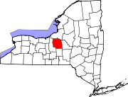
Towns Villages Baldwinsville | Camillus | East Syracuse | Elbridge | Fabius | Fayetteville | Jordan | Liverpool | Manlius | Marcellus | Minoa | North Syracuse | Skaneateles | Solvay | Tully
CDPs Brewerton‡ | Bridgeport‡ | Fairmount | Galeville | Lakeland | Lyncourt | Mattydale | Nedrow | Seneca Knolls | Village Green | Westvale
Other
hamletsAmber | Amboy | Apulia | Apulia Station | Borodino | Cardiff | Cedarvale | Clintonville | Collingwood | Delphi | Delphi Falls | Geddes | Hart Lot | Hinsdale | Howlett Hill | Indian Village | Jack's Reef | Jamesville | Long Branch | Marietta | Memphis | Messina Springs | Mottville | Mycenae | Navarino | Onondaga Hill | Oran | Otisco | Plainville | Pompey Center | Rose Hill | Shepard Settlement | Skaneateles Falls | South Onondaga | South Spafford | Southwood | Spafford Valley | Split Rock | State Fair Grounds | Taunton | Thorn Hill | Vesper | Warners | Watervale
Indian
reservationFootnotes ‡This populated place also has portions in an adjacent county or counties
Categories:- Villages in New York
- Syracuse metropolitan area
- Populated places in Onondaga County, New York


Wikimedia Foundation. 2010.