- Martinsburg, New York
-
Martinsburg, New York — Town — Location within the state of New York
 Martinsburg, New York
Coordinates: 43°43′57″N 75°28′55″W / 43.7325°N 75.48194°W Country United States State New York County Lewis Area - Total 76.1 sq mi (197.1 km2) - Land 75.8 sq mi (196.3 km2) - Water 0.3 sq mi (0.8 km2) Elevation 1,857 ft (566 m) Population (2000) - Total 1,249 - Density 16.5/sq mi (6.4/km2) Time zone Eastern (EST) (UTC-5) - Summer (DST) EDT (UTC-4) ZIP code 13404 Area code(s) 315 FIPS code 36-45854 GNIS feature ID 0979202 Martinsburg is a town in Lewis County, New York, United States. The population was 1,249 at the 2000 census. The town is named after founding father, Walter Martin.
The Town of Martinsburg is in the west-central part of the county, south of Lowville, the county seat.
Contents
History
Settlers began arriving around 1801.
Martinsburg was established from part of the Town of Turin in 1803. When it was formed the town name was spelled "Martinsburgh." In 1819, the town was augmented by more of Turin.
The community of Martinsburg in the town was the county seat for Lewis County until 1864, when it moved to Lowville. The town hall in Martinsburg, built in 1812, is the site of the first county court session, held the same year. In 1839, it was the site of the only execution in the county.
Notable people
- Morgan Lewis Martin, delegate to Congress from the Wisconsin territory.
Geography
According to the United States Census Bureau, the town has a total area of 76.1 square miles (197.1 km²), of which, 75.8 square miles (196.3 km²) of it is land and 0.3 square miles (0.8 km²) of it (0.39%) is water.
The east town line is the Black River. The western part of Martinsburg is on the Tug Hill Plateau.
New York State Route 12 and New York State Route 26 are north-south highways through the town with NY-12 being the more easterly route.
Demographics
As of the census[1] of 2000, there were 1,249 people, 473 households, and 347 families residing in the town. The population density was 16.5 people per square mile (6.4/km²). There were 627 housing units at an average density of 8.3 per square mile (3.2/km²). The racial makeup of the town was 98.00% White, 0.48% African American, 0.48% Native American, 0.24% from other races, and 0.80% from two or more races. Hispanic or Latino of any race were 0.48% of the population.
There were 473 households out of which 34.9% had children under the age of 18 living with them, 61.3% were married couples living together, 7.2% had a female householder with no husband present, and 26.6% were non-families. 22.8% of all households were made up of individuals and 8.2% had someone living alone who was 65 years of age or older. The average household size was 2.64 and the average family size was 3.11.
In the town the population was spread out with 28.3% under the age of 18, 7.8% from 18 to 24, 28.9% from 25 to 44, 22.3% from 45 to 64, and 12.7% who were 65 years of age or older. The median age was 36 years. For every 100 females there were 103.4 males. For every 100 females age 18 and over, there were 103.2 males.
The median income for a household in the town was $31,902, and the median income for a family was $35,978. Males had a median income of $26,705 versus $20,682 for females. The per capita income for the town was $13,894. About 7.9% of families and 11.9% of the population were below the poverty line, including 18.3% of those under age 18 and 9.6% of those age 65 or over.
Communities and locations in Martinsburg
- East Martinsburg – A hamlet east of Martinsburg village and located on NY-12.
- Glendale – A hamlet south of East Marinsburg.
- Glenfield – A hamlet east of Glendale on the shore of the Black River.
- Graves Corners – A location east of Wetmore.
- Martinsburg – The hamlet of Martinsburg is on NY-26 south of Lowville. It was the first county seat of Lewis County.
- McGraw Corners – A location east of Wetmore.
- Tabolt Corners – A location by the south town line.
- West Martinsburg – A hamlet southwest of Lowville, near the north town line. The Methodist Episcopal Church of West Martinsburg was listed on the National Register of Historic Places in 1983.[2]
- Wetmore – A hamlet in the south-central part of the town.
- Whetstone Gulf State Park – A state park at the south town line.
- Whittaker Falls Park – A park east of Martinsburg village.
References
- ^ "American FactFinder". United States Census Bureau. http://factfinder.census.gov. Retrieved 2008-01-31.
- ^ "National Register Information System". National Register of Historic Places. National Park Service. 2009-03-13. http://nrhp.focus.nps.gov/natreg/docs/All_Data.html.
External links
Coordinates: 43°44′15″N 75°28′11″W / 43.7375°N 75.46972°W
Municipalities and communities of Lewis County, New York County seat: Lowville Towns 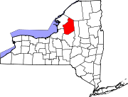
Villages Castorland | Constableville | Copenhagen | Croghan | Harrisville | Lowville | Lyons Falls | Port Leyden | Turin
Categories:- Towns in New York
- Populated places in Lewis County, New York


Wikimedia Foundation. 2010.