- Newbridge, Caerphilly
-
Coordinates: 51°40′12″N 3°08′10″W / 51.670°N 3.136°W
Newbridge Welsh: Trecelyn 
 Newbridge
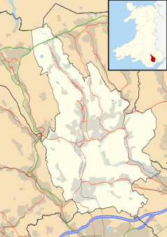
Newbridge shown within CaerphillyPopulation 6,000 (2001 census[1]) OS grid reference ST215975 Principal area Caerphilly Ceremonial county Gwent Country Wales Sovereign state United Kingdom Post town NEWPORT Postcode district NP11 Dialling code 01495 Police Gwent Fire South Wales Ambulance Welsh EU Parliament Wales UK Parliament Islwyn Welsh Assembly Islwyn List of places: UK • Wales • Caerphilly Newbridge (Welsh: Trecelyn) is a town in the county borough of Caerphilly, south Wales,
Contents
History
The town is located within the historic boundaries of Monmouthshire.
In medieval times what is now the separate townships of Abercarn, Cwmcarn and Newbridge were known as Abercarne, a manorial title which goes back to the Norman period. The three townships were also within the boundaries of the ancient parish of Mynyddislwyn and remained therein up until comparatively recent times.
Newbridge, as its name implies, was the name given by the people to land around the "new bridge" built across the Ebbw River towards the end of the 18th century. At this time Newbridge was a predominantly Welsh agrarian community of rural farms and sheep pasture with a low population count.
In the valley, the chief farms were Ty-Llydd, where the new vicarage now stands, Tynewydd, where the Newbridge Hotel stands, Ty-hir, the house which stands next to the Beaufort Arms, and the Newbridge Corn mill which stood near the South Celynen Colliery. The road pattern as we know it today was non-existent—all activity and commerce took place along the mountain tracks which led over Mynyddislwyn and Mynydd Maen. Adjacent to the tracks were the more prosperous farms, Hyfod Fach, Glanshon and Cillonydd.
The coal-mining boom
Towards the end of the 18th century, Newbridge was established as a farming community around a new bridge across the Ebbw River. Like many towns in the area, it experienced a population explosion and socio-economic change with the arrival of coal mining in the 19th century. The mines attracted workers from the English West Country and West Midlands, Cornwall, Scotland, Mid Wales and further afield. The Celynen Collieries Workingmen's Institute, ("the 'Stute") and Memorial Hall ("the 'Memo") became, like many miners' institutes, the communal heart of the town.[2] The local collieries enjoyed a reputation for highly skilled miners, a productive workforce, non-radical politics and the community became a fine example of a south Wales valley community with thriving shops, churches, chapels and sports teams.[citation?]
Modern Newbridge
Mining eventually ceased in the mid-1980s, after persevering on through the 1926 United Kingdom general strike, the 1930s Depression and post-war nationalisation, but became unsustainable following the UK miners' strike (1984-1985), with the Institute becoming a drinking club.
Since the end of coal mining, new leisure facilities have been constructed in Newbridge, and there are plans for improved rail links with Newport and Cardiff. Residents have also reported the return to the area of birds such as herons, buzzards and kestrels.
After some delays, the Ebbw Valley Railway, running from Ebbw Vale Parkway railway station to Cardiff Central railway station, opened in February 2008. Newbridge is one of seven stations on the line.
A bridge linking the main town of Newbridge with the School and Leisure centre over the Ebbw River was completed at a cost of over £3 million and was opened by Joe Calzaghe in November 2009.
Sport and leisure
Newbridge Rugby Union Football Club plays in the Welsh Division One East.
Newbridge Boxing Club is the base of Team Calzaghe whose famous member Joe Calzaghe retired in 2009 as an undefeated world champion.
 Newbridge Swimming Pool (photo 2007)
Newbridge has a public leisure centre[3] which was opened in January 1997. The complex includes a swimming pool and a fitness suite which was enlarged from one to two floors in 2007.
Institute & Memorial Hall
The Celynen Collieries' Institute (1908) and Memorial Hall (1925) on High Street, are both listed buildings, the Memo being Grade II*. The Institute is unusual as the miners themselves built it, borrowing the money through a private mortgage. The Memo was built to commemorate the 75 Newbridge men who died in the First World War. It is still the focus of Armistice Day and Remembrance Sunday activities every year. The Memo contains a ballroom with a sprung dance floor and an art deco auditorium which was designed to be both a theatre and a cinema. Both buildings now provide community facilities for local groups and societies, live music and community events but are both in urgent need of repair. After the mines closed, the Institute & Memorial Hall lost its income and became a drinking club. In 2004, when the local council was considering purchasing the land for a car park, a public meeting called by local MP Don Touhig led to the formation of The Friends of Newbridge Memo who got the buildings on to the BBC2 programme Restoration. They narrowly missed winning the final but received assistance from the Heritage Lottery Fund to begin the long process of raising money to restore both buildings. After a development grant was awarded by the Heritage Lottery Fund in the summer of 2009, Cadw and Caerphilly County Borough Council are actively supporting the scheme and the Big Lottery awarded £500,000 in December 2009. In July 2010 it was announced that the Heritage Lottery would grant the project £2.9 Million in order to see the buildings restored.
Education
Newbridge Comprehensive School is located in the town, catering for some 1,000 pupils aged 11 to 16. Tynewdd Primary School in Greenfield, Pantside Primary School and Pentwynmawr Primary School cater for 4 to 11-year-olds.
Notable people
- See also Category:People from Newbridge, Caerphilly
Notable people to have grown up in Newbridge include world-champion boxer Joe Calzaghe CBE, Kim Simmonds of Savoy Brown, Steve Strange, frontman of New Romantic band Visage and owner of the Celtic Manor Resort Sir Terry Matthews OBE. British Lions and Welsh rugby union captain and coach John Dawes OBE is from Chapel-Of-Ease, near Newbridge.
Etymology
The Welsh placename for Newbridge is often incorrectly shown on OS Maps as Cefn Bychan. It is in fact Trecelyn, meaning the town of the holly trees.[citation needed]
References
- ^ Office for National Statistics Parish Headcounts: Newbridge
- ^ "Newbridge Memorial Hall and Institute, Gwent". Restoration. BBC. July 2006. http://www.bbc.co.uk/history/programmes/restoration/2004/wales_newbridge_memorial_hall_01.shtml. Retrieved 20 February 2010.
- ^ Newbridge Leisure Centre on Caerphilly County Borough Council website
External links
Caerphilly County Borough Caerphilly County Borough Council Principal settlements Aberbargoed · Abercarn · Bargoed · Bedwas · Blackwood · Caerphilly · Crumlin · Gelligaer · Newbridge · Rhymney · Risca · Senghenydd · Ystrad Mynach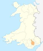
Towns and villages Abertridwr, Caerphilly · Abertysswg · Argoed · Blaen-carno · Bont Pren · Britannia · Brithdir · Bryn · Bryncenydd · Bute Town · Caledfryn · Castle Park · Cefn Fforest · Cefn Hengoed · Cefn Mably · Chapel of Ease · Churchill Park · Croespenmaen · Crosskeys · Cwmbargoed · Cwmcarn · Cwmgelli · Cwmfelinfach · Cwmsyfiog · Cwmnantygwynt · Darran Valley · Deri · Draethen · Eglwysilan · Elliotstown · Energleyn · Fernlea · Fleur de Lys · Fochriw · Gellihaf · Gelligroes · Gilfach · Gilfach Estate · Glan-y-nant · Graig-y-Rhacca · Groesfaen · Hafodyrynys · Hendredenny · Hengoed · Hollybush · Lansbury Park · Llanbradach · Llanfabon · Llanfach · Llechryd · Llwyn Gwyn · Machen · Maesycwmmer · Manmoel · Markham · Mornington Meadows · Mynyddislwyn · Nelson · New Tredegar · Oakdale · Ochrwyth · Pantside · Pantyresk · Penallta · Pengam · Penllwyn · Penmaen · Penpedairheol · Pentwyn (near Fochriw) · Pentwyn (near Penyrheol) · Pentwyn (near Trinant) · Pentwynmawr · Penybryn · Penyfan · Penyrheol · Phillipstown · Pontllanfraith · Pontlottyn · Pontymister · Pontywaun · Princetown · Pwllypant · Rhymney Bridge · Rudry · Ruperra · Springfield · Tirphil · Tir-y-berth · Trecenydd · Tredomen · Treowen · Trethomas · Trinant · Troedrhiwfwch · Ty Sign · Van · Waterloo · Watford · Wattsville · West End · Wernddu · Woodfieldside · Wyllie · YnysdduCategories:- Towns in Caerphilly county borough


Wikimedia Foundation. 2010.