- Converse, Blackford County, Indiana
-
Converse — Village — Blackford County map - Converse in southeast corner Blackford County map - Converse in southeast corner
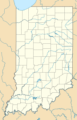
 Converse
Coordinates: 40°23′22″N 85°14′21″W / 40.38944°N 85.23917°WCoordinates: 40°23′22″N 85°14′21″W / 40.38944°N 85.23917°W Country United States State Indiana County Blackford Township Jackson Platted 1867 Elevation 922 ft (281 m) ZIP code 47336 FIPS code 18-14970[1] GNIS feature ID 432906[2] Converse is a nearly extinct American village in Indiana's Blackford County. Although not much of the community remains, the U.S. Geological Survey considers it a populated place. The community existed as a "flag" station along a railroad, and is named after railroad executive Joel N. Converse.[3] Like many communities in Blackford County, this village declined after the end of the Indiana Gas Boom, which ended in the early 20th century.
Contents
History
In 1837, Edward Crumley moved to the southeast corner of the Blackford County, and began a farm with his family. The area in this corner of the county would eventually be named Jackson Township. Crumley's farm was located at a crossroads, and the area became known as Crumley's Crossing. The crossroads area grew into a small community with several cabins, a blacksmith shop, and a sawmill.[3] The Union and Logansport Railroad Company reached Blackford County in 1867, and the community became a flag stop on the railroad.[4] The community was platted in 1867, and renamed for railroad executive Joel N. Converse.[3] In addition to a sawmill and blacksmith shop, the community had a store, school, and church. The church was a Methodist church, but later became the Kingsley Full Gospel church. For this reason, the area is sometimes called by a third name, which is "Kingsley". Thus, Crumley's Crossing, Converse, and Kingsley all refer to the same place in Blackford County.[3] Blackford County's Converse should not be confused with the town of Converse, which is located in Grant County.
Railroad
The railroad line that ran through Converse was named Union and Logansport Railroad Company by the time it entered Blackford County, and it was the county’s first railroad.[5] This line was proposed in 1862, and completed to Hartford City in 1867 — running through the Blackford County communities of Dunkirk, Converse, Millgrove, and Hartford City. Eventually, a stop named Renner was also added to the line west of Hartford City. (See railroad map — Converse was a flag stop east of Millgrove.).[6][7] The railroad was eventually named Pittsburgh, Cincinnati and St. Louis Railroad.[8] Other names for the railroad since that time include the Panhandle division of the Pennsylvania Railroad, Penn Central Railroad Company, Conrail, and Norfolk Southern Railway.[6] The line is now abandoned between Converse and Hartford City.[9]
Geography
Converse is located at 40°23′22″N 85°14′21″W / 40.38944°N 85.23917°W in East Central Indiana, between Dunkirk and Hartford City. The northern half of Indiana, including what became Jackson Township and Converse, was flattened by two glaciers millions of years ago.[10] These glaciers are also responsible for the rich Blackford County farmland.[11] The region is agriculture-oriented. Soybeans and corn are the most popular crops grown in Blackford County, and over 65,000 acres are devoted to these two crops.[12] Additional crops and livestock are also grown in the county.
Climate
Converse/Crumley’s Crossing has a typical Midwestern humid continental seasonal climate. There are four distinct seasons, with winters being cold with moderate snowfall, while summers can be warm and humid. The highest average temperature is in July at 84 °F (29 °C), while the lowest average temperature is in January at 15 °F (−9.0 °C). However, summer temperatures can top 90 °F (32 °C), and winter temperatures can drop below 0 °F (−17 °C). Average monthly precipitation ranges from about 2 to 4 inches (5 to 10 cm), with the heaviest occurring during May, June, and July. The highest recorded temperature was 110.0 °F (43.3 °C) on July 14, 1936, and the lowest recorded temperature was −25.0 °F (−31.7 °C) on January 21, 1985.
Climate data for Dunkirk, Indiana — which is less than 2 miles southeast of Blackford County’s Converse, Indiana Month Jan Feb Mar Apr May Jun Jul Aug Sep Oct Nov Dec Year Average high °F (°C) 32
(0)37
(3)48
(9)60
(16)71
(22)80
(27)84
(29)82
(28)76
(24)64
(18)50
(10)38
(3)60.2
(15.6)Average low °F (°C) 15
(−9)18
(−8)28
(−2)38
(3)49
(9)58
(14)62
(17)59
(15)50
(10)39
(4)31
(−1)21
(−6)39.0
(3.9)Precipitation inches (mm) 1.89
(48)1.84
(46.7)2.69
(68.3)3.50
(88.9)4.06
(103.1)4.42
(112.3)4.40
(111.8)3.65
(92.7)3.02
(76.7)2.62
(66.5)3.23
(82)2.58
(65.5)37.9
(962.7)Source: The Weather Channel[13] Notes
- ^ "American FactFinder". United States Census Bureau. http://factfinder.census.gov. Retrieved 2008-01-31.
- ^ "Converse, Blackford County, Indiana". Geographic Names Information System, U.S. Geological Survey. http://geonames.usgs.gov/pls/gnispublic/f?p=gnispq:3:::NO::P3_FID:432906. Retrieved 2011-6-19.
- ^ a b c d A History of Blackford County...., p. 129.
- ^ Biographical and historical record of Jay and Blackford Counties..., p. 758.
- ^ Biographical and historical record of Jay and Blackford Counties...., pp. 759-760, and pp. 239-240.
- ^ a b A History of Blackford County...., p. 19.
- ^ The railroad map shown herein shows Converse in the southeast corner of the county, between Dunkirk and Millgrove. A map from David Rumsey collection, which is over 100 years old, also shows the community.
- ^ Biographical and historical record of Jay and Blackford Counties..., pp. 759-760.
- ^ "Norfolk Southern Railway Company — Abandonment Exemption — in Blackford County, IN". Surface Transportation Board. http://www.stb.dot.gov/decisions/readingroom.nsf/0/2436bc3d202c92fe8525747300554ce9?OpenDocument. Retrieved 2011-07-01.
- ^ A History of Blackford County..., pp. 8-9.
- ^ A History of Blackford County..., p. 10.
- ^ Purdue University's Indiana CropMAP web site.
- ^ "Dunkirk Weather Records and Averages". Yahoo!. 2011. http://weather.yahoo.com/climo/USIN0167_f.html?woeid=2394454. Retrieved April 17, 2011.
References
- A History of Blackford County, Indiana : with historical accounts of the county, 1838-1986 [and] histories of families who have lived in the county.. Hartford City, Indiana: Blackford County Historical Society. 1986. pp. 302. OCLC 15144953.
- Biographical and historical record of Jay and Blackford Counties, Indiana: Containing ... portraits and biographies of some of the prominent men of the state : engravings of prominent citizens in Jay and Blackford Counties, with personal histories of many of the leading families and a concise history of Jay and Blackford Counties and their cities and villages. Chicago: The Lewis Publishing Company. 1887. pp. 901. OCLC 15560416. http://contentdm.lib.byu.edu/cdm4/document.php?CISOROOT=/FH26&CISOPTR=36087&CISOSHOW=35182.
Municipalities and communities of Blackford County, Indiana Cities 
Town Townships Harrison | Jackson | Licking | Washington
Unincorporated
communitiesFootnotes ‡This populated place also has portions in an adjacent county or counties
Categories:- Populated places in Blackford County, Indiana
- Unincorporated communities in Indiana


Wikimedia Foundation. 2010.