- Hardyston Township, New Jersey
-
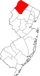
Hardyston Township, New Jersey — Township — Map of Hardyston Township in Sussex County. Inset: Location of Sussex County highlighted in the State of New Jersey. Census Bureau map of Hardyston Township, New Jersey
Coordinates: 41°6′34″N 74°33′12″W / 41.10944°N 74.55333°WCoordinates: 41°6′34″N 74°33′12″W / 41.10944°N 74.55333°W Country United States State New Jersey County Sussex Royal Charter February 25, 1762 Incorporated February 21, 1798 Government[1] – Type Special Charter – Mayor Stanley J. Kula – Manager Marianne Smith[2] Area – Total 32.6 sq mi (84.5 km2) – Land 32.1 sq mi (83.1 km2) – Water 0.5 sq mi (1.4 km2) Elevation 1,037 ft (316 m) Population (2007)[3] – Total 8,344 – Density 192.3/sq mi (74.2/km2) Time zone Eastern (EST) (UTC-5) – Summer (DST) EDT (UTC-4) ZIP code 07419 - Hamburg Area code(s) 973 FIPS code 34-29850[4][5] GNIS feature ID 0882269[6] Website http://www.hardyston.com Hardyston Township is a Township in Sussex County, New Jersey, United States. As of the United States 2000 Census, the township population was 6,171.
Contents
Geography
According to the United States Census Bureau, the township has a total area of 32.6 square miles (84 km2), of which, 32.1 square miles (83 km2) of it is land and 0.6 square miles (1.6 km2) of it (1.68%) is water.
In terms of physical geography, nearly all of Hardyston (excluding the portion of the Township west of Hamburg along Route 94) lies within the New York-New Jersey Highlands, part of the greater Crystalline Appalachians that extend as far south as the Blue Ridge Mountains. Hardyston is home to portions of Hamburg Mountain (east of Franklin) and Pochuck Mountain (near Scenic Lakes) within this region. The remaining northwestern portion of the township lies within the Ridge-and-valley Appalachians. The prominent feature in the ridge-and-valley portion of the Township is the Wallkill Valley, through which the Wallkill River flows northeast to New York state.
History
Hardyston Township was set off from portions of Newton Township by Royal Charter on February 25, 1762.[7][8] It was named after Josiah Hardy, who was royal governor of New Jersey from 1761–1763.[9] The original British spelling of Hardiston was Americanized to Hardyston after the American Revolutionary War.[10]
Hardyston was incorporated by an Act of the New Jersey Legislature as one of New Jersey's original 104 townships on February 21, 1798. Over the centuries, portions of the township were taken to form Vernon Township (April 8, 1793), Sparta Township (April 14, 1845), Franklin (March 18, 1913) and Hamburg (March 19, 1920).[7]
It includes named places of Stockholm, Beaver Run, Beaver Mountain (not shown on maps), North Church, Big Springs, Holland (or Holland Mountain), Hardistonville, Rudeville, and Monroe. Postal ZIP codes covering Hardyston Township are 07460 Stockholm, 07416 Franklin Borough, 07419 Hamburg Borough, and a small part of 07848 Lafayette Township.
Hardyston was serviced first by the New Jersey Midland Railway, which built the station in Stockholm. However, there was a dispute over the name as that area was known as Snufftown because of the snuff factory along the Pequannock River, which provide the water power. Through a series of events between the residents of Stockholm and the railroad, the area eventually changed the name from Snufftown to Stockholm. Later, it was the New York, Susquehanna and Western Railway, who provided service into the early 1960s when a mud slide removed a large section of trackage in West Milford Township and coupled with low productivity, the line was not repaired and service was disconnected. Today, the New York Susquehanna and Western Railway runs freight through Hardyston. The main highways are Route 23 and Route 94. A large eastern portion of the township is part of the Pequannock Watershed, which is owned by the City of Newark in Essex County for their water supply.
Demographics
Historical populations Census Pop. %± 1930 946 — 1940 1,034 9.3% 1950 1,279 23.7% 1960 2,206 72.5% 1970 3,499 58.6% 1980 4,553 30.1% 1990 5,275 15.9% 2000 6,171 17.0% Est. 2007 8,344 [3] 35.2% Population 1930–1990.[11] As of the census[4] of 2000, there were 6,171 people, 2,319 households, and 1,716 families residing in the township. The population density was 192.3 people per square mile (74.2/km2). There were 2,690 housing units at an average density of 83.8 per square mile (32.4/km2). The racial makeup of the township was 95.56% White, 0.84% African American, 0.16% Native American, 1.57% Asian, 0.49% from other races, and 1.38% from two or more races. Hispanic or Latino of any race were 3.22% of the population.
There were 2,319 households out of which 35.3% had children under the age of 18 living with them, 62.4% were married couples living together, 7.9% had a female householder with no husband present, and 26.0% were non-families. 21.6% of all households were made up of individuals and 6.8% had someone living alone who was 65 years of age or older. The average household size was 2.66 and the average family size was 3.12.
In the township the population was spread out with 25.7% under the age of 18, 5.4% from 18 to 24, 31.9% from 25 to 44, 26.8% from 45 to 64, and 10.2% who were 65 years of age or older. The median age was 38 years. For every 100 females there were 97.0 males. For every 100 females age 18 and over, there were 95.7 males.
The median income for a household in the township was $65,511, and the median income for a family was $72,199. Males had a median income of $51,503 versus $32,319 for females. The per capita income for the township was $28,457. About 2.7% of families and 4.7% of the population were below the poverty line, including 4.9% of those under age 18 and 5.6% of those age 65 or over.
Government
Hardyston Township operates under a Special Charter granted by the New Jersey Legislature. The government consists of a five-member Township Council elected at-large in partisan elections to serve three-year terms of office on a staggered basis, with one or two seats coming up for election each year. At a reorganization meeting held after each election, the council selects a mayor and a deputy mayor from among its members.[1]
As of 2011[update], the members of the Hardyston Township Council are Mayor Stanley J. Kula, Deputy Mayor Carl Miller, Leslie Hamilton, Kenneth P. Kievit, and Wayne Ross.[12]
Local government
Federal, state and county representation
Hardyston Township is in the 5th Congressional district. New Jersey's Fifth Congressional District is represented by Scott Garrett (R, Wantage Township). New Jersey is represented in the United States Senate by Frank Lautenberg (D, Cliffside Park) and Bob Menendez (D, Hoboken).
Hardyston Township is in the 24th Legislative District of the New Jersey Legislature, which is represented in the New Jersey Senate by Steve Oroho (R, Franklin) and in the New Jersey General Assembly by Gary R. Chiusano (R, Augusta) and Alison Littell McHose (R, Franklin).[13]
Sussex County is governed by a Board of Chosen Freeholders whose five members are elected at-large on a staggered basis, with one or two seats coming up for election each year. As of 2011, Sussex County's Freeholders are Freeholder Director Richard A. Zeoli (R, term ends December 31, 2012; Byram Township)[14], Deputy Director Susan M. Zellman (R, 2012; Stanhope)[15], Phillip R. Crabb (R, 2011; Franklin)[16], Parker Space (R, 2013; Wantage Township)[17] and Richard Vohden (R, 2013; Green Township).[18][19]
Education
Public school students in Kindergarten through eighth grade attend the schools of the Hardyston Township School District. Schools in the district (with 2005-06 enrollment data from the National Center for Education Statistics[20]) are Hardyston Township School (grades K-5, 495 students) and those in grades 6 - 8 attend Hardyston Middle School (grades 6-8, 251 students).
For grades 9 - 12, public school students attend Wallkill Valley Regional High School which is also serves Franklin Borough, Hamburg Borough and Ogdensburg Borough, and is part of the Wallkill Valley Regional High School District.[21]
In 2008 Hardyston lost superintendent of schools and middle school principal Dennis Tobin, who left to become principal of Sparta High School (New Jersey).[22]
Cemetery
The town contains North Church Cemetery / North Hardyston Cemetery. Notable burials there include:
- Samuel Fowler (1779–1844), who served in the House of Representatives from 1833 to 1837.[23]
- Samuel Fowler (1851–1919), represented New Jersey's 4th congressional district from 1893–1895.[24]
- Daniel Haines (1801–1877) 14th Governor of New Jersey, from 1843 to 1845, and from 1848 to 1851.[25]
- John Linn (1763–1821) was a U.S. Representative from New Jersey from 1817 to 1821.[26]
References
- ^ a b 2005 New Jersey Legislative District Data Book, Rutgers University Edward J. Bloustein School of Planning and Public Policy, April 2005, p. 110.
- ^ Township Manager, Hardyston Township. Accessed March 5, 2011.
- ^ a b Census data for Hardyston townshiph, United States Census Bureau. Accessed November 20, 2008.
- ^ a b "American FactFinder". United States Census Bureau. http://factfinder.census.gov. Retrieved 2008-01-31.
- ^ A Cure for the Common Codes: New Jersey, Missouri Census Data Center. Accessed July 14, 2008.
- ^ "US Board on Geographic Names". United States Geological Survey. 2007-10-25. http://geonames.usgs.gov. Retrieved 2008-01-31.
- ^ a b "The Story of New Jersey's Civil Boundaries: 1606–1968", John P. Snyder, Bureau of Geology and Topography; Trenton, New Jersey; 1969. p. 230.
- ^ Snell, James P. (1881) History of Sussex and Warren Counties, New Jersey, With Illustrations and Biographical Sketches of its Prominent Men and Pioneers. (Centennial ed., Harmony, NJ: Harmony Press, 1981, p. 335)
- ^ Haines, Alanson A. Hardyston Memorial: A History of The Township and the North Presbyterian Church, Hardyston, Sussex County, New Jersey. (New Jersey Herald Print, Newton, N.J., 1888, p. 19)
- ^ History of Sussex County, Sussex County Gen Web. Accessed September 30, 2007. "Hardyston is the American spelling of the British Hardiston, which was changed after the American Revolutionary War."
- ^ New Jersey Resident Population by Municipality: 1930–1990, Workforce New Jersey Public Information Network. Accessed March 1, 2007.
- ^ Township Council, Hardyston Township. Accessed March 5, 2011.
- ^ "Legislative Roster: 2010-2011 Session". New Jersey Legislature. http://www.njleg.state.nj.us/members/roster.asp. Retrieved 2010-08-04.
- ^ Richard A. Zeoli, Sussex County, New Jersey. Accessed January 6, 2011.
- ^ Susan M. Zellman, Sussex County, New Jersey. Accessed January 6, 2011.
- ^ Phillip R. Crabb, Sussex County, New Jersey. Accessed January 6, 2011.
- ^ Parker Space, Sussex County, New Jersey. Accessed January 6, 2011.
- ^ Richard A. Vohden, Sussex County, New Jersey. Accessed January 6, 2011.
- ^ Sussex County Board of Chosen Freeholders, Sussex County, New Jersey. Accessed January 6, 2011.
- ^ Data for Hardyston Township Public School, National Center for Education Statistics. Accessed March 11, 2008.
- ^ Wallkill Valley Rangers, Sussex County Interscholastic League. Accessed March 11, 2008.
- ^ District loses schools chief to Sparta, Advertiser-News, June 2008
- ^ Samuel Fowler (1779–1844), Biographical Directory of the United States Congress. Accessed August 12, 2007.
- ^ Samuel Fowler (1851–1919), Biographical Directory of the United States Congress. Accessed August 12, 2007.
- ^ New Jersey Governor Daniel Haines, National Governors Association. Accessed August 12, 2007.
- ^ John Linn, Biographical Directory of the United States Congress. Accessed August 12, 2007.
Further reading
- Truran, William R. Franklin, Hamburg, Ogdensburg, and Hardyston (Images of America). (Charleston, SC: Arcadia Publishing, 2004).
External links
- Hardyston Township website
- Hardyston Township School District
- Hardyston Township Public School's 2009–10 School Report Card from the New Jersey Department of Education
- National Center for Education Statistics data for Hardyston Township Public School
- Advertiser-News, community newspaper
- Abandoned Mines of northwest NJ
Municipalities and communities of Sussex County, New Jersey Boroughs Andover | Branchville | Franklin | Hamburg | Hopatcong | Ogdensburg | Stanhope | Sussex
Town Townships CDPs Unincorporated
communitiesCategories:- Townships in Sussex County, New Jersey


Wikimedia Foundation. 2010.