- Manahawkin, New Jersey
-
Manahawkin, New Jersey — CDP — Map of Manahawkin CDP in Ocean County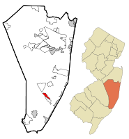
Coordinates: 39°41′45″N 74°15′13″W / 39.69583°N 74.25361°WCoordinates: 39°41′45″N 74°15′13″W / 39.69583°N 74.25361°W Country United States State New Jersey County Ocean Area - Total 1.9 sq mi (5.0 km2) - Land 1.8 sq mi (4.7 km2) - Water 0.1 sq mi (0.2 km2) Elevation 0 ft (0 m) Population (2000) - Total 2,004 - Density 1,098.9/sq mi (425.1/km2) Time zone Eastern (EST) (UTC-5) - Summer (DST) EDT (UTC-4) ZIP code 08050 Area code(s) 609 FIPS code 34-42930[1] GNIS feature ID 0878052[2] Manahawkin is a census-designated place and unincorporated area contained within Stafford Township, in Ocean County, New Jersey, United States. As of the United States 2000 Census, the CDP population was 2,004.
Manahawkin is the gateway to the resort communities on Long Beach Island, with Route 72 providing the sole road access, ending in Ship Bottom as it crosses Manahawkin Bay via the Manahawkin Bay Bridge (formally known as the Dorland J. Henderson Memorial Bridge).
Contents
Geography
Manahawkin is located at 39°41′45″N 74°15′13″W / 39.695866°N 74.253511°W.[3]
According to the United States Census Bureau, the CDP has a total area of 4.9 km2 (1.9 mi²). 4.7 km2 (1.8 mi2) of it is land and 0.2 km2 (0.1 mi2) of it (4.71%) is water.
Demographics
Historical populations Census Pop. %± 1990 1,594 — 2000 2,004 25.7% source:[4] As of the census[1] of 2000, there were 2,004 people, 757 households, and 555 families residing in the CDP. The population density was 425.1/km2 (1,098.9/mi2). There were 827 housing units at an average density of 175.4/km2 (453.5/mi2). The racial makeup of the CDP was 96.86% White, 0.05% African American, 0.10% Native American, 1.45% Asian, 0.55% from other races, and 1.00% from two or more races. Hispanic or Latino of any race were 1.90% of the population.
There were 757 households out of which 30.5% had children under the age of 18 living with them, 56.4% were married couples living together, 12.8% had a female householder with no husband present, and 26.6% were non-families. 21.7% of all households were made up of individuals and 10.8% had someone living alone who was 65 years of age or older. The average household size was 2.56 and the average family size was 2.97.
In the CDP the population was spread out with 22.9% under the age of 18, 6.9% from 18 to 24, 26.8% from 25 to 44, 25.6% from 45 to 64, and 17.8% who were 65 years of age or older. The median age was 41 years. For every 100 females there were 86.9 males. For every 100 females age 18 and over, there were 86.9 males.
The median income for a household in the CDP was $59,663, and the median income for a family was $62,702. Males had a median income of $53,396 versus $24,688 for females. The per capita income for the CDP was $22,875. About 1.4% of families and 3.4% of the population were below the poverty line, including 1.7% of those under age 18 and 14.7% of those age 65 or over.
Education
For grades K through 6, students attend the Stafford Township School District. The Primary Learning Center [1] is for Kindergarten, and Ocean Acres School with 736 students and Oxycocus School serve grades 1 and 2. McKinley Avenue School serves grades 3 and 4, and Stafford Intermediate School grades 5 and 6.
For grades 7 through 12, students attend the Southern Regional Middle School (grades 7 and 8) and Southern Regional High School (grades 9 - 12). These schools are part of the Southern Regional School District.
Notable residents
Notable current and former residents of Manahawkin include:
- Doc Cramer (1905–1990), center fielder who played for four American League teams from 1929 to 1948.[5]
- Clark Harris (1984-), tight end for the Houston Texans. He played his college football at Rutgers University.[6]
- Drew Kelly (1942-), distinguished retired Lieutenant of the FDNY and member of the New York City Board of Education.
- William A. Newell (1817–1901), Governor of New Jersey who represented the state in the United States House of Representatives.[7]
References
- ^ a b "American FactFinder". United States Census Bureau. http://factfinder.census.gov. Retrieved 2008-01-31.
- ^ "US Board on Geographic Names". United States Geological Survey. 2007-10-25. http://geonames.usgs.gov. Retrieved 2008-01-31.
- ^ "US Gazetteer files: 2010, 2000, and 1990". United States Census Bureau. 2011-02-12. http://www.census.gov/geo/www/gazetteer/gazette.html. Retrieved 2011-04-23.
- ^ "Population Finder: Manahawkin CDP, New Jersey". U.S. Census Bureau. http://factfinder.census.gov/servlet/SAFFPopulation?_event=Search&geo_id=16000US3404120&_geoContext=01000US%7C04000US34%7C16000US3404120&_street=&_county=manahawkin&_cityTown=manahawkin&_state=&_zip=&_lang=en&_sse=on&ActiveGeoDiv=geoSelect&_useEV=&pctxt=fph&pgsl=160&_submenuId=population_0&ds_name=null&_ci_nbr=null&qr_name=null®=null%3Anull&_keyword=&_industry=. Retrieved 2007-03-16.
- ^ Goldstein, Steve. "ROGER 'DOC' CRAMER, 85, OUTFIELDER WHO PLAYED FOR ATHLETICS, RED SOX", The Philadelphia Inquirer, September 10, 1990. Accessed July 29, 2007. "Roger Maxwell "Doc" Cramer, 85, who hit .296 during an illustrious 19- year career in baseball that began when Connie Mack signed him for the Philadelphia Athletics in 1929, died yesterday at his home in Manahawkin, N.J., after a seven-month battle with cancer."
- ^ Clark Harris player profile, accessed April 7, 2007.
- ^ Kowalczyk, Frank. "The Shipwreck of the Powhatan", The Society Scroll newsletter of the Ocean county Historical Society, September 2007. Accessed January 12, 2008.
External links
Municipalities and communities of Ocean County, New Jersey County seat: Toms River Boroughs 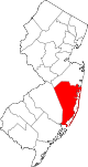
Townships Barnegat | Berkeley | Brick | Eagleswood | Jackson | Lacey | Lakewood | Little Egg Harbor | Long Beach | Manchester | Ocean | Plumsted | Stafford | Toms River
CDPs Barnegat | Beach Haven West | Cassville | Cedar Glen Lakes | Cedar Glen West | Crestwood Village | Dover Beaches North | Dover Beaches South | Forked River | Holiday City-Berkeley | Holiday City South | Holiday Heights | Lakewood | Leisure Knoll | Leisure Village | Leisure Village East | Leisure Village West-Pine Lake Park | Manahawkin | Mystic Island | New Egypt | North Beach Haven | Ocean Acres | Pine Ridge at Crestwood | Silver Ridge | Toms River | Vista Center | Waretown
Communities Bayville | Chadwick Beach Island | Harmony | High Bar Harbor | Jackson Mills | Lanoka Harbor | Loveladies | Parkertown | Silverton | Warren Grove | West Creek | West Tuckerton | Whitesville | Whiting
 State of New Jersey
Trenton (capital) Topics Delegations · Demographics · Economy · Elections · Geography · Government · History · Media · Municipalities · Music · People · Politics · Symbols · Transportation · Parks
Regions Atlantic Coastal Plain · Central Jersey · Delaware River Region · Delaware Valley · Gateway Region · Gold Coast · Highlands · Jersey Shore · Meadowlands · New York metro area · North Hudson · North Jersey · Pascack Valley · Piedmont · Pine Barrens · Raritan Bayshore · Ridge-and-Valley Appalachians · Southern Shore Region · Skylands Region · South Jersey · Tri‑State Region · West Hudson
Counties Major cities Atlantic City · Camden · Edison · Elizabeth · Hackensack · Jersey City · Newark · New Brunswick · Ocean City · Paterson · Trenton · Vineland
Categories:- Populated places in Ocean County, New Jersey
- Census-designated places in New Jersey
- Place names in New Jersey of Native American origin


Wikimedia Foundation. 2010.