- Yardville-Groveville, New Jersey
Infobox Settlement
official_name = Yardville-Groveville, New Jersey
settlement_type = CDP
nickname =
motto =
imagesize =
image_caption =
image_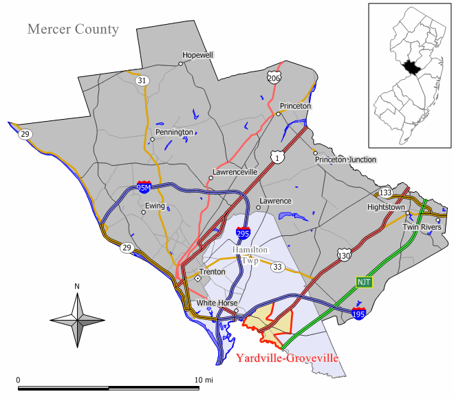
mapsize = 250x200px
map_caption = Map of Yardville-Groveville CDP in Mercer County
mapsize1 =
map_caption1 =subdivision_type = Country
subdivision_name =United States
subdivision_type1 = State
subdivision_name1 =New Jersey
subdivision_type2 = County
subdivision_name2 = Mercer
government_footnotes =
government_type =
leader_title =
leader_name =
leader_title1 =
leader_name1 =
established_title =
established_date =area_footnotes =
area_magnitude =
area_total_km2 = 9.0
area_land_km2 = 8.9
area_water_km2 = 0.0
area_total_sq_mi = 3.5
area_land_sq_mi = 3.4
area_water_sq_mi = 0.0population_as_of = 2000
population_footnotes =
population_total = 9208
population_density_km2 = 1032.3
population_density_sq_mi = 2673.7timezone = Eastern (EST)
utc_offset = -5
timezone_DST = EDT
utc_offset_DST = -4
elevation_footnotes =
elevation_m =
elevation_ft =
latd = 40 |latm = 10 |lats = 50 |latNS = N
longd = 74 |longm = 40 |longs = 16 |longEW = Wpostal_code_type =
postal_code =
area_code =
blank_name = FIPS code
blank_info = 34-83185GR|2
blank1_name =
blank1_info =
website =
footnotes =Yardville-Groveville is a
census-designated place and unincorporated area located within Hamilton Township, in Mercer County,New Jersey . As of theUnited States 2000 Census , the CDP population was 9,208.Geography
Yardville-Groveville is located at coor dms|40|10|50|N|74|40|16|W|city (40.180608, -74.671154)GR|1.
According to the
United States Census Bureau , the CDP has a total area of 9.0km² (3.5 mi²). 8.9 km² (3.4 mi²) of it is land and 0.1 km² (0.04 mi²) of it (0.58%) is water.Demographics
USCensusPop
1990=9248
2000=9208
footnote=source: [cite web
url=http://factfinder.census.gov/servlet/SAFFPopulation?_event=Search&geo_id=16000US3480630&_geoContext=01000US%7C04000US34%7C16000US3480630&_street=&_county=yardville&_cityTown=yardville&_state=04000US34&_zip=&_lang=en&_sse=on&ActiveGeoDiv=geoSelect&_useEV=&pctxt=fph&pgsl=160&_submenuId=population_0&ds_name=null&_ci_nbr=null&qr_name=null®=null%3Anull&_keyword=&_industry=
title=Population Finder: Yardville-Groveville CDP, New Jersey
publisher=U.S. Census Bureau
accessdate=2007-03-18] As of thecensus GR|2 of 2000, there were 9,208 people, 3,438 households, and 2,619 families residing in the CDP. Thepopulation density was 1,033.5/km² (2,673.7/mi²). There were 3,528 housing units at an average density of 396.0/km² (1,024.4/mi²). The racial makeup of the CDP was 93.09% White, 3.02% African American, 0.08% Native American, 2.00% Asian, 0.08% Pacific Islander, 0.80% from other races, and 0.93% from two or more races. Hispanic or Latino of any race were 3.01% of the population.There were 3,438 households out of which 33.4% had children under the age of 18 living with them, 63.6% were married couples living together, 9.1% had a female householder with no husband present, and 23.8% were non-families. 19.2% of all households were made up of individuals and 8.8% had someone living alone who was 65 years of age or older. The average household size was 2.68 and the average family size was 3.09.
In the CDP the population was spread out with 23.7% under the age of 18, 6.5% from 18 to 24, 31.2% from 25 to 44, 24.4% from 45 to 64, and 14.2% who were 65 years of age or older. The median age was 39 years. For every 100 females there were 94.8 males. For every 100 females age 18 and over, there were 91.8 males.
The median income for a household in the CDP was $60,893, and the median income for a family was $68,171. Males had a median income of $46,897 versus $34,236 for females. The
per capita income for the CDP was $25,391. About 0.2% of families and 1.4% of the population were below thepoverty line , including 0.4% of those under age 18 and 2.0% of those age 65 or over.References
External links
Wikimedia Foundation. 2010.