- Dutton Park, Queensland
-
Dutton Park
Brisbane, Queensland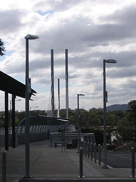
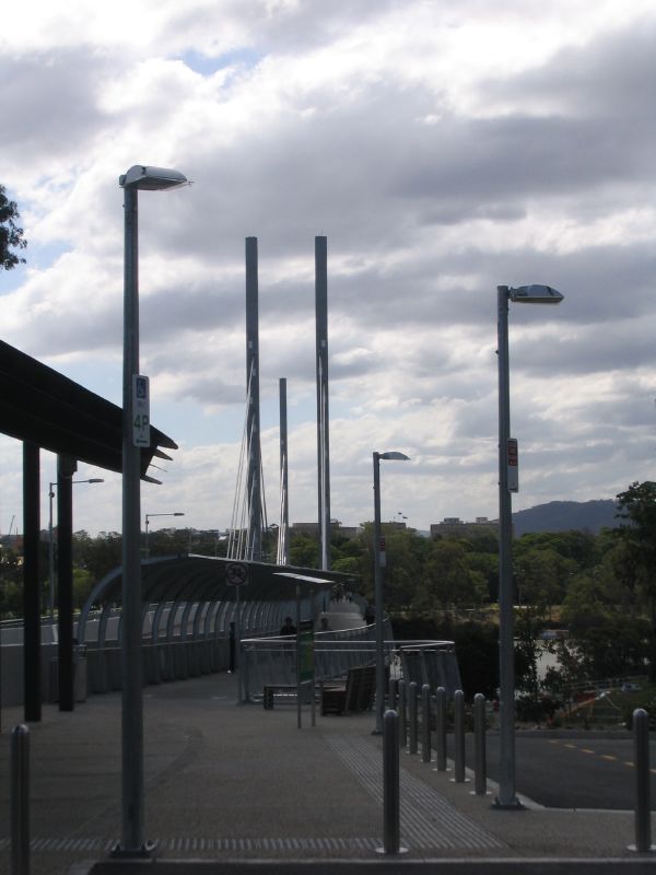
Dutton Park's pedestrian entry of the Eleanor Schonell BridgePopulation: 1,349 (2004) [1] Postcode: 4102 Area: 0.9 km² (0.3 sq mi) Location: 5 km (3 mi) from Brisbane LGA: City of Brisbane,
Dutton Park WardState District: South Brisbane Federal Division: Griffith Suburbs around Dutton Park: Highgate Hill South Brisbane Woolloongabba West End Dutton Park Woolloongabba St Lucia Fairfield Annerley Dutton Park is a suburb of Brisbane, Australia located 5 km south of the Brisbane CBD. The suburb is predominantly residential, with some light industrial and commercial areas.
The name Dutton comes from Charles Boydell Dutton, the Queensland Minister for Lands from 1883 to 1887, who created the recreation reserve in 1884. This became known as 'Dutton's Park', a name which was later applied to surrounding estates, a school (originally known as the "Jail School"[2]) and a railway station before becoming the name of the suburb.[3]
Contents
Geography
Dutton Park lies on a ridge to the east of the Brisbane River, opposite from St Lucia. The site slopes down from Gladstone Road with an average gradient of 0.026.
Attractions
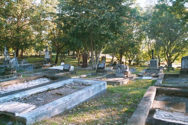
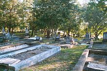 South Brisbane cemetery
The suburb is dominated by Dutton Park, which includes a large recreation area and public cemetery (colloquially known as Dutton Park Cemetery but officially known as South Brisbane Cemetery). The cemetery was reserved in 1866 and is Brisbane's oldest surviving municipal cemetery.[4] The former Boggo Road Gaol was located in the suburb and the remaining structure is now a historical museum.
On 17 December 2006, the Eleanor Schonell Bridge was opened, linking the St Lucia campus of the University of Queensland with southern Brisbane. The area is a popular place for picnics and tranquil riverside walks along the banks of the Brisbane River.
History
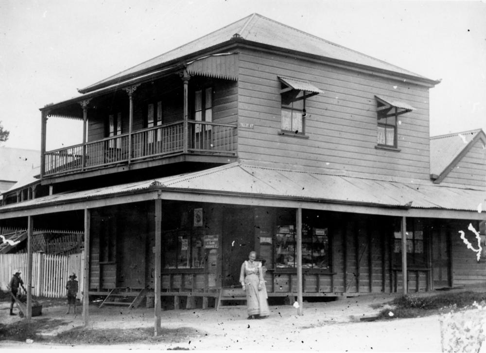
 Shop of Janet Martin (nee Gray) - Grandmother Martin - on the corner of Annerley Road and Tillot Street (ca. 1900)
Development in the suburb was slow because of difficult terrain, and the fact that a large part of the area was surveyed for government reserves by HC Rawnsley in 1863.[5] In 1884, the South Coast railway line was built, which included a station at Dutton Park. In 1886, the Dutton Park State School was opened.[6]
On 2 July 1883 the Boggo Road Gaol opened, firstly serving as a holding place for prisoners who were to be transported to St Helena Island but by 1989 housed over 300 prisoners. In 1093 a separate structure was opened adjacent to the main prison to house the female prisoners. After a Queensland Government inquiry into the living conditions of the inmates the female section of the prison was closed in 1989 with the male section closing in 1992 and later being demolished in 1996.
Between 1901 and 1969 the suburb was served by electric trams. Tram services operated along Gladstone Road [7] and Annerley Road, with a connecting line to the Ipswich Road tram depot along Cornwall Street. J.S. Badger, owner of the Brisbane Tramway Company, developed the Dutton Park recreation reserve in order to increase patronage on the trams. For several years from 1908, open-air movie and variety shows known as 'Continentals' were held at the park, and proved enormously popular, drawing up to 5,000 people a night.[8]
Between 1912 and 1927 a tram depot was located in Lang Street (now Tamar Street).
Demographics
In 2006, Dutton Park had 41.1% of residents born overseas and 34.7% of residents speaking a language other than English. The Most common languages with exception of English were Greek 6.1%, Vietnamese 2.7%, Italian 1.5%, Tongan 1.1% and Arabic 0.9%.[9]
Transport
By Bus, Brisbane Transport bus routes 192, 196, 197 and 198 served the suburb along Gladstone Road. Annerley Road to the City (via the Busway) is served by routes 105, 107, 108, 109, 116 and 202. With the opening of the Eleanor Schonell Bridge and the Boggo Road Busway which opened on 3 August 2009 the suburb has become a major hub for the Brisbane City Busway as well as the terminating point for the Boggo Road Busway.
By Train, Dutton park is served by the Dutton Park Railway Station which lies on the Beenleigh/Ferny Grove Line.
References
- ^ ABS Statistics
- ^ Annerley District: Growth of a Valuable Suburb, Brisbane Courier, Saturday 10 January 1931, page 19
- ^ Christopher Dawson, Absolute Fairyland: Heady days in Dutton Park, Brisbane, Inside History, 2006, pp.1-8.
- ^ Tracey Olivieri, In the Beginning: The early years of South Brisbane Cemetery, Inside History, Brisbane, 2008.
- ^ Christopher Dawson, Brisbane Beginnings: Dutton Park, Brisbane, Inside History, 2009, p.10.
- ^ DPSS, Dutton Park State School 2009 to 1884: A journey, Brisbane, DPSS, 2009.
- ^ Brisbane tramway museum
- ^ Dawson, Absolute Fairyland, pp.8-22.
- ^ Australian Bureau of Statistics: Census data
External links
- Friends of South Brisbane Cemetery
- Boggo Road Gaol Historical Society
- University of Queensland: Queensland Places: Dutton Park
- Dutton Park Resource
Categories:- Suburbs of Brisbane
Wikimedia Foundation. 2010.