- Monroe Township, Gloucester County, New Jersey
-
- For the municipality of the same name in Middlesex County, see Monroe Township, Middlesex County, New Jersey.
Monroe Township, New Jersey — Township — Monroe Township highlighted in Gloucester County. Inset map: Gloucester County highlighted in the State of New Jersey.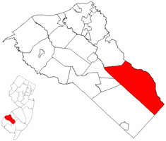 Census Bureau map of Monroe Township, Gloucester County, New Jersey
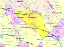
Coordinates: 39°40′10″N 74°59′1″W / 39.66944°N 74.98361°WCoordinates: 39°40′10″N 74°59′1″W / 39.66944°N 74.98361°W Country United States State New Jersey County Gloucester Incorporated March 3, 1859 Government[1] – Type Faulkner Act (Mayor-Council) – Mayor Mike Gabbianelli Area – Total 46.9 sq mi (121.5 km2) – Land 46.6 sq mi (120.6 km2) – Water 0.4 sq mi (1.0 km2) Elevation[2] 102 ft (31 m) Population (2006)[3] – Total 31,461 – Density 622.3/sq mi (240.3/km2) Time zone Eastern (EST) (UTC-5) – Summer (DST) EDT (UTC-4) ZIP code 08094 - Williamstown Area code(s) 856 FIPS code 34-47250[4][5] GNIS feature ID 0882137[6] Website http://www.monroetownshipnj.org Monroe Township is a township in Gloucester County, New Jersey, United States. As of the United States 2000 Census, the township population was 28,967.
Monroe Township was originally formed as a township by an Act of the New Jersey Legislature on March 3, 1859, from portions of Washington Township, while the area was still part of Camden County. Monroe Township was shifted to Gloucester County on February 28, 1871, along with the majority of Washington Township. In 1950, portions of the township were transferred to Winslow Township in Camden County.[7]
Victory Lakes and Williamstown are census-designated places and unincorporated areas located within Monroe Township. Cross Keys is an unincorporated area within the township.
Contents
Geography
According to the United States Census Bureau, the township has a total area of 46.9 square miles (121 km2), of which, 46.5 square miles (120 km2) of it is land and 0.4 square miles (1.0 km2) of it (0.81%) is water.
Monroe Township borders Franklin Township, Clayton, Glassboro, and Washington Township. Monroe Township also borders Camden County and Atlantic County.
Demographics
Historical populations Census Pop. %± 1930 4,064 — 1940 4,310 6.1% 1950 5,531 28.3% 1960 9,396 69.9% 1970 14,071 49.8% 1980 21,639 53.8% 1990 26,703 23.4% 2000 28,967 8.5% Est. 2005 31,461 [3] 8.6% Population 1930 - 1990.[8] As of the census[4] of 2000, there were 28,967 people, 10,521 households, and 7,848 families residing in the township. The population density was 622.3 people per square mile (240.3/km²). There were 11,069 housing units at an average density of 237.8 per square mile (91.8/km²). The racial makeup of the township was 84.83% White, 11.15% African American, 0.25% Native American, 1.23% Asian, 0.03% Pacific Islander, 0.99% from other races, and 1.52% from two or more races. Hispanic or Latino of any race were 2.71% of the population.
There were 10,521 households out of which 34.1% had children under the age of 18 living with them, 58.5% were married couples living together, 11.7% had a female householder with no husband present, and 25.4% were non-families. 21.0% of all households were made up of individuals and 9.6% had someone living alone who was 65 years of age or older. The average household size was 2.73 and the average family size was 3.18.
In the township the population was spread out with 25.6% under the age of 18, 7.4% from 18 to 24, 30.0% from 25 to 44, 24.0% from 45 to 64, and 12.9% who were 65 years of age or older. The median age was 37 years. For every 100 females there were 93.4 males. For every 100 females age 18 and over, there were 89.1 males.
The median income for a household in the township was $50,037, and the median income for a family was $56,810. Males had a median income of $41,062 versus $29,849 for females. The per capita income for the township was $20,488. About 4.0% of families and 6.2% of the population were below the poverty line, including 7.5% of those under age 18 and 7.1% of those age 65 or over.
Government
Local government
Monroe Township is governed under the Faulkner Act (Mayor-Council) system of municipal government.[1] Monroe Township is governed by a Mayor and a seven-member Council, consisting of three At Large seats and four seats selected from wards, all of whom serve four-year terms of office. Elections are held every two years on a staggered basis, with the Mayor and the two Council at Large seats up for vote and two years later the four ward council seats.[9]
The Mayor of Monroe Township is Mike Gabbianelli.[10] Members of the Township Council are[11]:
- Ward 1: Marvin G. Dilks, Jr.
- Ward 2: Bill A. Julio
- Ward 3: Walt Bryson
- Ward 4: Frank Caligiuri
- At Large: Ron Garbowski
- At Large: Bill Sebastian
- At Large: Dan Teefy
Federal, state and county representation
Monroe Township is in the 1st Congressional district. New Jersey's First Congressional District is represented by Rob Andrews (D, Haddon Heights). New Jersey is represented in the United States Senate by Frank Lautenberg (D, Cliffside Park) and Bob Menendez (D, Hoboken).
Monroe Township is in the 4th district of the New Jersey Legislature, which is represented in the New Jersey Senate by Fred H. Madden (D, Washington Township) and in the New Jersey General Assembly by Domenick DiCicco (R, Franklin Township) and Paul Moriarty (D, Washington Township).[12]
Gloucester County is governed by a Board of Chosen Freeholders, whose seven members are elected at-large to three-year terms of office on a staggered basis, with two or three seats coming up for election each year. Each year, the Board selects a Freeholder Director and Deputy Director from among its members. As of 2011, Gloucester County's Freeholders are Freeholder Director Robert M. Damminger (D, West Deptford Township, 2012), Deputy Freeholder Director Dr. Warren S. Wallace (D, Washington Township, 2011), Giuseppe "Joe" Chila (D, Woolwich Township, 2012), Frank J. DiMarco (D, Deptford Township, 2011), Vincent H. Nestore, Jr. (R, Deptford Township, 2013), Heather Simmons (D, Glassboro Borough, 2011), Larry Wallace (R, Woolwich Township, 2013).[13]
Education
The Monroe Township Public Schools is a comprehensive district serving the educational needs of resident students from grades kindergarten through twelve. Services are also provided for preschool handicapped students as well as other students with special needs. Schools in the district (with 2005-06 enrollment data from the National Center for Education Statistics[14]) are Holly Glen Elementary School (569 students), Oak Knoll Elementary School (520), Radix Elementary School (700) and Whitehall Elementary School (365) for grades K-4; Williamstown Middle School (1,815) for grades 5-8 and Williamstown High School (1,769) for grades 9-12.
Transportation
The Black Horse Pike is a four-lane, arterial highway which traverses the entire Township NW-SE and provides direct access to downtown Philadelphia (30 minutes) and direct access to Atlantic City (35 minutes). U.S. Route 322 is a two-lane arterial highway which traverses the Township east to west and provides access to the New Jersey Turnpike, north and south (30 minutes), with access to the Commodore Barry Bridge and Delaware Memorial Bridge to Interstate 95 (40 minutes). The Atlantic City Expressway is a four-lane, limited access highway which parallels the Black Horse Pike and provides direct access to downtown Atlantic City (30 minutes) and access to the Garden State Parkway, north and south. Route 42 goes through the township, as do County Route 536 and County Route 538.
Cross Keys Airport is located in the Cross Keys section.[15]
References
- ^ a b 2005 New Jersey Legislative District Data Book, Rutgers University Edward J. Bloustein School of Planning and Public Policy, April 2005, p. 24.
- ^ U.S. Geological Survey Geographic Names Information System: Township of Monroe, Geographic Names Information System. Accessed June 13, 2008.
- ^ a b Census data for Monroe township, United States Census Bureau, accessed March 1, 2007
- ^ a b "American FactFinder". United States Census Bureau. http://factfinder.census.gov. Retrieved 2008-01-31.
- ^ A Cure for the Common Codes: New Jersey, Missouri Census Data Center. Accessed July 14, 2008.
- ^ "US Board on Geographic Names". United States Geological Survey. 2007-10-25. http://geonames.usgs.gov. Retrieved 2008-01-31.
- ^ "The Story of New Jersey's Civil Boundaries: 1606-1968", John P. Snyder, Bureau of Geology and Topography; Trenton, New Jersey; 1969. p. 139.
- ^ New Jersey Resident Population by Municipality: 1930 - 1990, accessed March 1, 2007
- ^ Government Structure, accessed November 1, 2006
- ^ Mayor Michael Gabbianelli, accessed March 13, 2007
- ^ Home Page, Monroe Township. Accessed July 28, 2008.
- ^ "Legislative Roster: 2010-2011 Session". New Jersey Legislature. http://www.njleg.state.nj.us/members/roster.asp. Retrieved 2010-02-08.
- ^ Gloucester County Board of Chosen Freeholders, Gloucester County, New Jersey. Accessed May 27, 2011.
- ^ Data for the Monroe Township Public Schools, National Center for Education Statistics. Accessed July 28, 2008.
- ^ "Pilot survives small plane crash", WPVI, July 16, 2008. Accessed July 28, 2008. "Chopper 6 was over Cross Keys Airport in Monroe Township, Gloucester County."
External links
- Monroe Township website
- Monroe Township Public Schools
- Monroe Township Public Schools's 2009–10 School Report Card from the New Jersey Department of Education
- Data for the Monroe Township Public Schools, National Center for Education Statistics
Municipalities and communities of Gloucester County, New Jersey City 
Boroughs Clayton | Glassboro | National Park | Newfield | Paulsboro | Pitman | Swedesboro | Wenonah | Westville | Woodbury Heights
Townships Deptford | East Greenwich | Elk | Franklin | Greenwich | Harrison | Logan | Mantua | Monroe | South Harrison | Washington | West Deptford | Woolwich
CDPs Communities Almonesson | Bridgeport | Clarksboro | Cooper | Cross Keys | Ferrell | Franklinville | Greenfields Village | Harrisonville | Hurffville | Malaga | Mickleton | Monroeville | Mount Royal | New Brooklyn | Red Bank | Repaupo | Richwood | Sewell | Thorofare
Categories:- Faulkner Act Mayor-Council
- Townships in Gloucester County, New Jersey


Wikimedia Foundation. 2010.