- Claremont, New Hampshire
-
Claremont, New Hampshire — City — City Hall Location within Sullivan County, New Hampshire
Coordinates: 43°22′20″N 72°20′15″W / 43.37222°N 72.3375°WCoordinates: 43°22′20″N 72°20′15″W / 43.37222°N 72.3375°W Country United States State New Hampshire County Sullivan Settled 1762 Incorporated 1764 (town), 1947 (city) Government - City Manager Guy A. Santagate - Mayor Deborah Cutts - Asst. Mayor Andrew Austin - City Council Christopher Lewis
Nicholas Koloski
Jeffrey Goff
Keith Raymond
Adam Burke
Kyle Messier
Victor BergeronArea - Total 44.1 sq mi (114.2 km2) - Land 43.1 sq mi (111.7 km2) - Water 1.0 sq mi (2.5 km2) 2.18% Elevation 561 ft (171 m) Population (2010) - Total 13,355 - Density 302.8/sq mi (116.9/km2) Time zone EST (UTC-5) - Summer (DST) EDT (UTC-4) ZIP code 03743 Area code(s) 603 FIPS code 33-12900 GNIS feature ID 0866173 Website www.claremontnh.com *Year Settled is from the following page Claremont is a city in Sullivan County, New Hampshire, United States. The population was 13,355 at the 2010 census.[1]
Contents
History
 Ashley's Ferry c. 1906
It was named after Claremont, the country mansion of Thomas Pelham-Holles, Earl of Clare. On October 26, 1764, Colonial Governor Benning Wentworth granted the township to Josiah Willard, Samuel Ashley and 67 others. Although first settled in 1762 by Moses Spafford and David Lynde, many of the proprietors arrived in 1767, with a large number from Farmington, Hebron and Colchester, Connecticut. The undulating surface of rich, gravelly loam made agriculture an early occupation.[2]
It was water power from the Sugar River, however, which brought the town prosperity during the Industrial Revolution. Large brick factories were built along the stream, including the Sunapee Mills, Monadnock Mills, Claremont Machine Works, Home Mills, Sanford & Rossiter, and Claremont Manufacturing Company. Principal products were cotton and woolen textiles, lathes and planers, as well as paper.[2] Although like other New England mill towns, much industry moved away or closed in the 20th-century, the city's former prosperity is evident in some fine Victorian architecture, including the 1897 city hall and opera house.
In March 1989, the Claremont School Board voted to initiate a lawsuit against the State of New Hampshire, claiming that the state's primary reliance upon local property taxes for funding education resulted in inequitable educational opportunities among children around the state and a violation of their constitutional rights. Following a lawsuit and a series of landmark decisions, the New Hampshire Supreme Court agreed. Known as "The Claremont Decision", the suit continues to drive the statewide debate on equitable funding for education; and Claremont continues to play a primary role in this legal challenge.[3]
Geography
Claremont is located at 43°22′38″N 72°20′40″W / 43.37722°N 72.34444°W (43.377207, -72.344555).[4]
According to the United States Census Bureau, the city has a total area of 44.1 square miles (114.2 km2), of which 43.1 sq mi (111.6 km2) is land and 1.0 sq mi (2.6 km2) is water, comprising 2.18% of the town. The Connecticut River forms the western boundary of the city, as well as the boundary between New Hampshire and Vermont. The Sugar River flows from east to west through the center of Claremont and empties into the Connecticut. The highest point in the city is the summit of Green Mountain, at 2,018 feet (615 m) above sea level. Claremont lies fully within the Connecticut River watershed.[5]
Transportation
See also: Claremont (Amtrak station)The only city within Sullivan County, Claremont is home to Claremont Municipal Airport. By highway, it is located 30 minutes south of Interstate 89 in Lebanon and 5 minutes east of Interstate 91 in Weathersfield, Vermont. It is served by state routes 11, 12, 103, and 120. Amtrak, the national passenger rail system, provides daily service aboard its Vermonter between Washington, D.C. and St. Albans, Vermont.
Demographics
As of the census[6] of 2000, there were 13,151 people, 5,685 households, and 3,428 families residing in the city. The population density was 305.0 people per square mile (117.8/km²). There were 6,074 housing units at an average density of 140.9 per square mile (54.4/km²). The racial makeup of the city was 97.67% White, 0.31% African American, 0.33% Native American, 0.62% Asian, 0.03% Pacific Islander, 0.12% from other races, and 0.92% from two or more races. Hispanic or Latino of any race were 0.50% of the population.
Historical populations Census Pop. %± 1790 1,435 — 1800 1,889 31.6% 1810 2,094 10.9% 1820 1,702 −18.7% 1830 2,526 48.4% 1840 3,217 27.4% 1850 3,606 12.1% 1860 4,026 11.6% 1870 4,053 0.7% 1880 4,704 16.1% 1890 5,565 18.3% 1900 6,498 16.8% 1910 7,529 15.9% 1920 9,524 26.5% 1930 12,377 30.0% 1940 12,144 −1.9% 1950 12,811 5.5% 1960 13,563 5.9% 1970 14,221 4.9% 1980 14,557 2.4% 1990 13,902 −4.5% 2000 13,151 −5.4% 2010 13,355 1.6% There were 5,685 households out of which 27.4% had children under the age of 18 living with them, 45.5% were married couples living together, 10.3% had a female householder with no husband present, and 39.7% were non-families. 32.2% of all households were made up of individuals and 14.7% had someone living alone who was 65 years of age or older. The average household size was 2.28 and the average family size was 2.86.
In the city the population was spread out with 23.3% under the age of 18, 7.8% from 18 to 24, 28.5% from 25 to 44, 23.5% from 45 to 64, and 16.9% who were 65 years of age or older. The median age was 39 years. For every 100 females there were 92.6 males. For every 100 females age 18 and over, there were 89.4 males.
The median income for a household in the city was $34,949, and the median income for a family was $42,849. Males had a median income of $30,782 versus $22,078 for females. The per capita income for the city was $20,267. About 5.4% of families and 10.0% of the population were below the poverty line, including 9.2% of those under age 18 and 11.3% of those aged 65 or over.
Education
Claremont is part of New Hampshire's School Administrative Unit 6, or SAU 6. Stevens High School is the city's only public high school, and is located on Broad Street, just a few blocks from City Hall. Claremont Middle School, the city's only public middle school, is located just down the street to the south.
Claremont is home to three elementary schools: Maple Avenue School, Bluff Elementary and Disnard Elementary. Also located in town are St. Mary's School, a private, Catholic school, and the Claremont Christian Academy, a private, parochial school offering education through 12th grade.
Three elementary schools — North Street School, Way Elementary and the West Claremont Schoolhouse — were shut down, Way becoming home to several luxury apartments and North Street turned into offices.
The city's opportunities for higher education include a branch of Granite State College, River Valley Community College, and the Sugar River Valley Regional Technical Center.
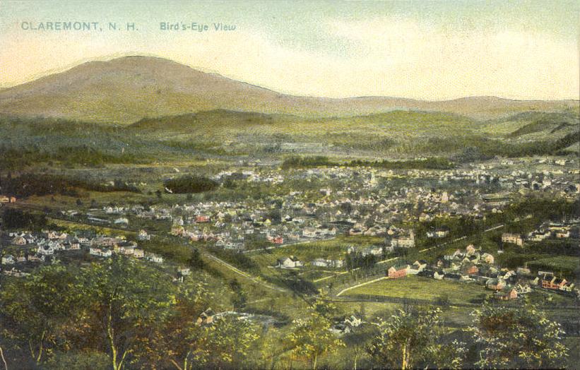
Old postcards
-

Bird's-eye view in c. 1910
-

Sugar River falls c. 1905
-

Tremont Square c. 1912
-

Hotel Claremont in 1907
-

Broad Street in 1908
-

Fiske Free Library in 1908
-

Sullivan Street c. 1910
-

Monadnock Mills in 1910
Culture
 Broad Street Park in 1909
A commercial area known as Washington Street is Claremont's primary commercial district. An Italian Renaissance-styled City Hall faces Broad Street Park, a rotary-style town square. This square connects Washington Street, Broad Street, and Main Street, each branching into different portions of the city. Broad Street Park contains war monuments to World War I, World War II, Korea and Vietnam, and Freedom Garden Memorial dedicated to the victims and families of September 11. The park is also home to a historic bandstand, which primarily serves as performance space for the Claremont American Band, a community band with roots in the 1800s.[7] Parallel to Broad Street lies Pleasant Street, which was once a thriving commercial zone.
A number of mill buildings dot the city center, along the Sugar River, and several attempts have been made at historic preservation of some of them.
To the north end of the town lies the Valley Regional Hospital, an out-patient resource of the popular Dartmouth-Hitchcock Medical Center of Lebanon.
 Moody Park
On the southern artery out of Claremont, Route 12, was the large William H. H. Moody horse-farm, having five large barns (the last of which burned in 2004), which once hosted several hundred imported horses on over 500 acres (2.0 km2). Its Victorian farmhouse stands at the top of Arch Road. A multi-hundred-acre plot of land was donated by Moody to the city of Claremont for a city park, the entrance of which is on Maple Avenue; facilities include tennis. A lone access road leads through a coniferous forest to the top of a hill, maintained as a large field by the city, with a large, open-air stone structure suitable for picnics. The park has several miles of interconnected walking trailways; several of these trails terminate at the Boston and Maine Railroad.
In the media
Claremont was the filming location, though not the setting, of the 2006 movie Live Free or Die, co-written and co-directed by Gregg Kavet and Andy Robin and starring Aaron Stanford, Paul Schneider, Michael Rapaport, Judah Friedlander, Kevin Dunn, and Zooey Deschanel. Set in fictional Rutland, New Hampshire, it is a picaresque comedy-drama about a small-town would-be crime legend.
Sites of interest
- Claremont Historical Society & Museum
- Claremont Opera House
- Lower Village Historic District
- Monadnock Mills Historic District
- Sugar River Rail Trail
- Twin State Speedway
- Union Episcopal Church (Claremont, New Hampshire)
Notable residents
 Mount Ascutney (Vermont), seen from Claremont
- Doug Berry, football coach
- Derastus Clapp, detective
- Franceway Ranna Cossitt, minister
- Caleb Ellis, congressman
- Kirk Hanefeld, golfer
- Jule Murat Hannaford, railway president
- Jeffrey R. Howard, judge
- Larry McElreavy, college football coach
- Jennifer Militello, poet
- Hosea Washington Parker, congressman
- Orrin W. Robinson, politician and businessman
- George B. Upham, congressman
- Constance Fenimore Woolson, novelist and short story writer
References
- ^ United States Census Bureau, American FactFinder, 2010 Census figures. Retrieved March 23, 2011.
- ^ a b Coolidge, Austin J.; John B. Mansfield (1859). A History and Description of New England. Boston, Massachusetts. pp. 445–448. http://books.google.com/books?id=OcoMAAAAYAAJ&lpg=PA9&ots=cUndZkVSIF&dq=coolidge%20mansfield%20history%20description%20new%20england%201859&pg=PA445#v=onepage&q&f=false.
- ^ Claremont Coalition
- ^ "US Gazetteer files: 2010, 2000, and 1990". United States Census Bureau. 2011-02-12. http://www.census.gov/geo/www/gazetteer/gazette.html. Retrieved 2011-04-23.
- ^ Foster, Debra H.; Batorfalvy, Tatianna N.; and Medalie, Laura (1995). Water Use in New Hampshire: An Activities Guide for Teachers. U.S. Department of the Interior and U.S. Geological Survey. http://nh.water.usgs.gov/Publications/nh.intro.html.
- ^ "American FactFinder". United States Census Bureau. http://factfinder.census.gov. Retrieved 2008-01-31.
- ^ "Claremont Parks & Recreation: May - August 2007 Brochure" (PDF). http://www.claremontnh.com/residents/departments/documents/SpringSummer2007Brochure.pdf. Retrieved 2007-06-21.
External links
- City website
- Fiske Free Library
- New Hampshire Economic and Labor Market Information Bureau Profile
- Interactive Aerial photo
- Claremont Stream Tunnels @ www.thisplaceiknow.com
- Public Domain Photographs of Claremont NH
Municipalities and communities of Sullivan County, New Hampshire City Claremont
Towns Acworth | Charlestown | Cornish | Croydon | Goshen | Grantham | Langdon | Lempster | Newport | Plainfield | Springfield | Sunapee | Unity | Washington
Villages Balloch | Cornish Flat | East Lempster | Georges Mills | Guild | Meriden
Categories:- Claremont, New Hampshire
- Cities in New Hampshire
- Populated places in Sullivan County, New Hampshire
- Populated places established in 1764
- Populated places on the Connecticut River
- Micropolitan areas of New Hampshire
-


Wikimedia Foundation. 2010.