- Newbury, New Hampshire
-
Newbury, New Hampshire — Town — 
SealLocation in Merrimack County, New Hampshire
Coordinates: 43°19′17″N 72°02′09″W / 43.32139°N 72.03583°WCoordinates: 43°19′17″N 72°02′09″W / 43.32139°N 72.03583°W Country United States State New Hampshire County Merrimack Incorporated 1772 Government – Board of Selectmen James Powell, Chair
Richard Wright
Gary BuddArea – Total 38.1 sq mi (98.7 km2) – Land 35.8 sq mi (92.7 km2) – Water 2.3 sq mi (5.9 km2) 6.01% Elevation 1,119 ft (341 m) Population (2010) – Total 2,072 – Density 54.4/sq mi (21/km2) Time zone Eastern (UTC-5) – Summer (DST) Eastern (UTC-4) ZIP codes 03255, 03272 Area code(s) 603 FIPS code 33-50900 GNIS feature ID 0873675 Website www.newburynh.org Newbury is a town in Merrimack County, New Hampshire, United States. The population was 2,072 at the 2010 census.[1] Newbury is home to part of Lake Sunapee, including Mount Sunapee State Park Beach. Mount Sunapee Resort, a ski area in Mount Sunapee State Park, is in the west. The town includes the village of Blodgett Landing.
Contents
History
 The Fells c. 1905
Situated at the south end of Lake Sunapee, this town has gone through numerous name changes. It started in 1753 as "Dantzic", after the Baltic seaport. The first provincial grant in 1754 named the town "Hereford", in honor of Edward Devereaux, Viscount Hereford. Colonial Governor John Wentworth renewed the grant in 1772 under the name "Fishersfield", for his brother-in-law, John Fisher. The town was finally incorporated as "Newbury" in 1837, as suggested by settlers originally from Newbury, Massachusetts.
The Fells Historic Site, located adjacent to the John Hay National Wildlife Refuge, is part of 876 acres (3.55 km2) protected of a forest country estate. Protection efforts have enabled Lake Sunapee to consistently be named one of the cleanest lakes in the state.
Notable inhabitants
- John Milton Hay (1838–1905), U.S. Secretary of State
Geography
According to the United States Census Bureau, the town has a total area of 38.1 square miles (99 km2), of which 35.8 sq mi (93 km2) is land and 2.3 sq mi (6.0 km2) is water, comprising 6.01% of the town. Mount Sunapee, the highest point in town, has an elevation of 2,726 feet (831 m) above sea level.
Demographics
 Blodgett's Landing in 1908
As of the census[2] of 2000, there were 1,702 people, 691 households, and 507 families residing in the town. The population density was 47.5 people per square mile (18.4/km²). There were 1,311 housing units at an average density of 36.6 per square mile (14.1/km²). The racial makeup of the town was 98.35% White, 0.41% African American, 0.06% Native American, 0.12% Asian, 0.29% from other races, and 0.76% from two or more races. Hispanic or Latino of any race were 1.18% of the population.
There were 691 households out of which 30.7% had children under the age of 18 living with them, 63.5% were married couples living together, 6.9% had a female householder with no husband present, and 26.5% were non-families. 20.7% of all households were made up of individuals and 8.0% had someone living alone who was 65 years of age or older. The average household size was 2.46 and the average family size was 2.84.
 Forest House in 1907
In the town the population was spread out with 22.8% under the age of 18, 4.8% from 18 to 24, 28.3% from 25 to 44, 28.0% from 45 to 64, and 16.2% who were 65 years of age or older. The median age was 42 years. For every 100 females there were 102.9 males. For every 100 females age 18 and over, there were 97.3 males.
The median income for a household in the town was $58,026, and the median income for a family was $61,389. Males had a median income of $42,031 versus $29,022 for females. The per capita income for the town was $29,521. None of the families and 1.8% of the population were living below the poverty line, including no under eighteens and none of those over 64.
Sites of interest
- Bell Cove Historic Caboose Museum
- The Fells Historic Site
- Chicken Farmer I Still Love You
References
- ^ United States Census Bureau, American FactFinder, 2010 Census figures. Retrieved March 23, 2011.
- ^ "American FactFinder". United States Census Bureau. http://factfinder.census.gov. Retrieved 2008-01-31.
External links
- Town website
- Lake Sunapee Protective Association
- Mount Sunapee State Park
- New Hampshire Economic and Labor Market Information Bureau Profile
- Sunapee-Ragged-Kearsarge Greenway Coalition
- Blodgetts Landing History in photographs
Municipalities and communities of Merrimack County, New Hampshire Cities 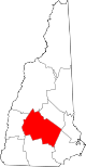
Towns Allenstown | Andover | Boscawen | Bow | Bradford | Canterbury | Chichester | Danbury | Dunbarton | Epsom | Henniker | Hill | Hooksett | Hopkinton | Loudon | New London | Newbury | Northfield | Pembroke | Pittsfield | Salisbury | Sutton | Warner | Webster | Wilmot
Villages Blodgett Landing | Contoocook | East Andover | Elkins | Penacook | South Hooksett | Suncook | Tilton-Northfield‡
Footnotes ‡This populated place also has portions in an adjacent county or counties
Categories:- Towns in Merrimack County, New Hampshire
- Populated places established in 1772


Wikimedia Foundation. 2010.