- Cyril E. King Airport
-
Cyril E. King Airport 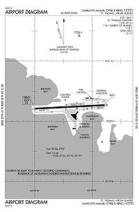
FAA airport diagram IATA: STT – ICAO: TIST – FAA LID: STT Summary Airport type Public Owner Virgin Islands Port Authority Location Saint Thomas, U.S. Virgin Islands Elevation AMSL 23 ft / 7 m Coordinates 18°20′14″N 064°58′24″W / 18.33722°N 64.97333°WCoordinates: 18°20′14″N 064°58′24″W / 18.33722°N 64.97333°W Map Location in the Virgin Islands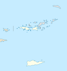
 TIST
TISTRunways Direction Length Surface ft m 10/28 7,000 2,134 Asphalt Statistics (2008) Aircraft operations 84,273 Based aircraft 84 Source: Federal Aviation Administration[1]  The Cyril E. King Airport from an observation overlook
Cyril E. King Airport (IATA: STT, ICAO: TIST, FAA LID: STT) is a public airport located two miles (3 km) west of the central business district of Charlotte Amalie on the island of St. Thomas in the United States Virgin Islands.[1] It is currently the busiest airport in the United States Virgin Islands, and one of the busiest in the eastern Caribbean. The airport also serves nearby St. John and is often used by those traveling to the British Virgin Islands.
It was known as Harry S Truman Airport until 1984, when it was renamed to honor Cyril Emmanuel King, the second elected governor of the U.S. Virgin Islands. A new airport opened in November 1990 and retained the name.
The airport operates one main runway, 7,000 × 150 ft (2,134 × 46 m) long. The terminal operates 11 gates.
Contents
Facilities and aircraft
Cyril E. King Airport covers an area of 280 acres (110 ha) which contains one asphalt paved runway (10/28) measuring 7,000 × 150 ft (2,134 × 46 m). For the 12-month period ending January 31, 2008, the airport had 84,273 aircraft operations, an average of 230 per day: 50% air taxi, 15% scheduled commercial, 33% general aviation and 1% military. During the same period, there were 84 aircraft based at this airport: 57% multi-engine, 37% single engine, 5% helicopters and 1% ultralight.[1]
Airlines and destinations
Airlines Destinations Air Canada Seasonal: Toronto-Pearson [begins December 24] Air Sunshine Beef Island, San Juan, Vieques, Virgin Gorda American Airlines Miami, New York-JFK
Seasonal: BostonAmerican Eagle San Juan Cape Air St. Croix, San Juan Continental Airlines Chicago-O'Hare, Newark, Washington-Dulles Delta Air Lines Atlanta, New York-JFK JetBlue Airways San Juan [begins December 12]
Seasonal: Boston [begins December 15]LIAT Anguilla, Antigua, St. Kitts, St. Maarten Seaborne Airlines St. Croix, San Juan-Isla Grande, San Juan,[2] Vieques Spirit Airlines Fort Lauderdale Sun Country Airlines Seasonal: Minneapolis/St. Paul US Airways Charlotte, Philadelphia Vieques Air Link Vieques Cargo
- Ameriflight (for UPS and DHL)
- Four Star Aviation
- FedEx
Accidents and incidents
On December 28, 1970, Trans Caribbean Airways Flight 505 made a hard landing and ran off the side of the runway. Two of the 48 passengers died in the subsequent fire.
On April 27, 1976, American Airlines Flight 625 ran off the end of the runway, killing 37 of the 88 on board the aircraft. Following the crash, American Airlines suspended jet service to the airport, using propliners until the runway was rebuilt to its present length.
On 25 March 1977, Douglas C-53 N692A of Island Traders was damaged beyond economic repair in a heavy landing.[3]
On 17 September 1989, Douglas DC-3 N4425N, Douglas C-47s N100SD, N4471J and N4577Z; and Douglas C-49J N28346 of Aero Virgin Islands; along with Douglas C-47A N101AP of Four Star Air Cargo; were damaged beyond economic repair by Hurricane Hugo.[4][5][6][7][8][9]
On 30 December 2003, Douglas DC-3C N781T of Tol-Air Services was substantially damaged when the starboard undercarriage collapsed on landing after a flight that originated at San Juan, Puerto Rico.[10]
On 19 July 2006, Douglas DC-3C N782T of Tol-Air Services ditched into the sea off Charlotte Amalie after an engine failure shortly after take-off from Cyril E. King Airport.[11] All four people on board escaped as the aircraft floated for about ten minutes before sinking.[12] The aircraft now lies in 100 feet (30 m) of water and is a dive site.[13]
World War II
During World War II, the United States Army Air Forces Sixth Air Force 23rd Fighter Squadron (36th Fighter Group) deployed P-40 Warhawk fighters to the airport from March 1942-May 1943.
References
 This article incorporates public domain material from websites or documents of the Air Force Historical Research Agency.
- ^ a b c FAA Airport Master Record for STT (Form 5010 PDF), retrieved 11/27/2008
- ^ New flights to San Juan International Seaborne Airlines
- ^ "N692A Accident description". Aviation Safety Network. http://aviation-safety.net/database/record.php?id=19770325-0. Retrieved 4 August 2010.
- ^ "N4425N Hull-loss description". Aviation Safety Network. http://aviation-safety.net/database/record.php?id=19890917-0. Retrieved 27 July 2010.
- ^ "N100SD Hull-loss description". Aviation Safety Network. http://aviation-safety.net/database/record.php?id=19890917-2. Retrieved 27 July 2010.
- ^ "N4471J Hull-loss description". Aviation Safety Network. http://aviation-safety.net/database/record.php?id=19890917-3. Retrieved 27 July 2010.
- ^ "N4577Z Hull-loss description". Aviation Safety Network. http://aviation-safety.net/database/record.php?id=19890917-4. Retrieved 27 July 2010.
- ^ "N28346 Hull-loss description". Aviation Safety Network. http://aviation-safety.net/database/record.php?id=19890917-5. Retrieved 27 July 2010.
- ^ "N101AP Hull-loss description". Aviation Safety Network. http://aviation-safety.net/database/record.php?id=19890917-6. Retrieved 27 July 2010.
- ^ "N781T Accident description". Aviation Safety Network. http://aviation-safety.net/database/record.php?id=20031230-0. Retrieved 21 June 2001.
- ^ "N782T Accident description". Aviation Safety Network. http://aviation-safety.net/database/record.php?id=20060719-0. Retrieved 21 June 2010.
- ^ "MIA06LA125". National Transportation Safety Board. http://www.ntsb.gov/ntsb/brief.asp?ev_id=20060724X00998&key=1. Retrieved 22 June 2010.
- ^ "Jul 2006 Gooney bird becomes latest dive site". Blue Island Divers. http://www.blueislanddivers.com/09_news/DC3/DC3.html. Retrieved 22 June 2010.
External links
- Virgin Islands Port Authority, Airport Facilities (official site)
- Pictures of the Cyril E. King Airport
- FAA Airport Diagram (PDF), effective 20 October 2011
- Resources for this airport:
- AirNav airport information for TIST
- ASN accident history for STT
- FlightAware airport information and live flight tracker for TIST
- NOAA/NWS latest weather observations for TIST
- SkyVector aeronautical chart for STT
 USAAF Sixth Air Force in World War II
Previously: Panama Canal Air Force (1940-1941); Caribbean Air Force (1941-1942) Airfields Caribbean Coolidge (Antigua) · Dakota (Aruba) · Batista (Cuba) · Camaguey (Cuba) · Hato (Curacao) · Vernam (Jamaica) · Arecibo (Puerto Rico) · Borinquen (Puerto Rico) · Losey (Puerto Rico) · Benedict (Saint Croix) · Beane (Saint Lucia) · St. Thomas Airport (Saint Thomas) · Carlsen (Trinidad) · Piarco Airport (Trinidad) · Waller (Trinidad)Canal Zone Panama Aguadulce · Anton · Calzada Larga · Chame · David · La Chorrera · Madden · Patilla Point · Pocri · Rio HatoCentral and South
America
Units Commands VI Bomber Command · VI Fighter Command · XXVI Fighter Command · XXXVI Fighter Command · VI Air Force Service · Antilles Air CommandGroups Fighter Bomber Reconnaissance Squadrons United States Army Air Forces
First · Second · Third · Fourth · Fifth · Sixth · Seventh · Eighth · Ninth · Tenth · Eleventh · Twelfth · Thirteenth · Fourteenth · Fifteenth · TwentiethCategories:- Airfields of the United States Army Air Forces
- Airports in the United States Virgin Islands


Wikimedia Foundation. 2010.