- Harrisonville, Missouri
Infobox Settlement|
official_name = Harrisonville, Missouri
settlement_type =City
nickname =
imagesize =
image_caption =
image_
imagesize =
image_caption =
image_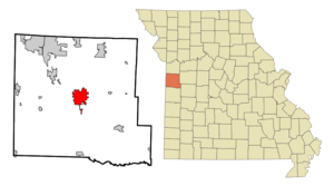
mapsize = 250x200px
map_caption = Location in the state ofMissouri
mapsize1 =
map_caption1 =
subdivision_type = Country
subdivision_type1 = State
subdivision_type2 = County
subdivision_name =United States
subdivision_name1 =Missouri
subdivision_name2 = Cass
government_type =
leader_title =Mayor
leader_name = Kevin W. Wood
population_
population_as_of =
population_total = 8946
established_date =
area_magnitude = 1 E7
area_total_km2 = 22.6
area_total_sq_mi = 8.7
area_land_km2 = 22.4
area_land_sq_mi = 8.6
area_water_km2 = 0.3
area_water_sq_mi = 0.1
timezone = CST
utc_offset = -6
timezone_DST = CDT
utc_offset_DST = -5
elevation_m = 290
elevation_ft = 951
latd = 38 |latm = 39 |lats = 13 |latNS = N
longd = 94 |longm = 20 |longs = 49 |longEW = W
website = http://ci.harrisonville.mo.us/
postal_code_type =ZIP code
postal_code = 64701
area_code = 816
blank_name = FIPS code
blank_info = 29-30610GR|2
blank1_name = GNIS feature ID
blank1_info = 0719166GR|3
footnotes =Harrisonville is a city in Cass County,
Missouri ,United States . The population was 8,946 at the 2000 census. It is thecounty seat of Cass CountyGR|6.Geography
Harrisonville is located at coor dms|38|39|13|N|94|20|49|W|city (38.653592, -94.346915)GR|1. According to the
United States Census Bureau , the city has a total area of 8.7square mile s (22.6km² ), of which, 8.6 square miles (22.4 km²) of it is land and 0.1 square miles (0.3 km²) of it (1.14%) is water.Demographics
As of the
census GR|2 of 2000, there were 8,946 people, 3,457 households, and 2,302 families residing in the city. Thepopulation density was 1,035.2 people per square mile (399.8/km²). There were 3,646 housing units at an average density of 421.9/sq mi (162.9/km²). The racial makeup of the city was 96.15% White, 0.97% African American, 0.66% Native American, 0.47% Asian, 0.01% Pacific Islander, 0.39% from other races, and 1.34% from two or more races. Hispanic or Latino of any race were 1.41% of the population.There were 3,457 households out of which 35.5% had children under the age of 18 living with them, 50.6% were married couples living together, 12.4% had a female householder with no husband present, and 33.4% were non-families. 28.9% of all households were made up of individuals and 14.0% had someone living alone who was 65 years of age or older. The average household size was 2.48 and the average family size was 3.05.
In the city the population was spread out with 27.6% under the age of 18, 8.1% from 18 to 24, 29.4% from 25 to 44, 19.6% from 45 to 64, and 15.3% who were 65 years of age or older. The median age was 35 years. For every 100 females there were 87.4 males. For every 100 females age 18 and over, there were 82.8 males.
The median income for a household in the city was $39,498, and the median income for a family was $47,761. Males had a median income of $31,931 versus $22,416 for females. The
per capita income for the city was $17,280. About 4.7% of families and 6.5% of the population were below thepoverty line , including 8.4% of those under age 18 and 5.1% of those age 65 or over.References
External links
* [http://ci.harrisonville.mo.us/ City of Harrisonville]
Wikimedia Foundation. 2010.