- Manor House, London
-
This article is about the district in North London. For the building in Soho, see Manor House, 21 Soho Square.
Coordinates: 51°34′19″N 0°05′48″W / 51.57182°N 0.09671°W
Manor House 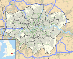
 Manor House
Manor House shown within Greater LondonOS grid reference TQ320876 London borough Hackney Ceremonial county Greater London Region London Country England Sovereign state United Kingdom Post town LONDON Postcode district N4 Police Metropolitan Fire London Ambulance London EU Parliament London UK Parliament Hackney North and Stoke Newington London Assembly North East List of places: UK • England • London Manor House is a district of North London.
Contents
Location
Built up in the mid 19th century as part of an area called Brownswood Park, today, like other areas of London, it is a district without a formal town centre, but distant enough from other town centres that it has come to be recognised as an area in its own right. It is centred on Manor House tube station on the Piccadilly line, at the important crossroads of Seven Sisters Road and Green Lanes. Most of the streets of the district lie within the London Borough of Hackney. However, it is close to the border with the London Borough of Haringey so some residents living within the Borough of Haringey would consider themselves to be living in Manor House.[1]
 Manor House, looking East along Seven Sisters Road, c 1905
Manor House's most notable features are the eponymous tube station and the eastern fringe of Finsbury Park, which lies in the London Borough of Haringey. There is a small shopping area, and the district includes some high-density housing, such as the Woodberry Down Estate.History
The Manor House Pub
 The Original Manor House pub, looking north towards Harringay, c.1860
The pub is the source of both the name of the tube station and the area. The first pub on the site was built by Thomas Widdows[2] c. 1810[3] as a roadside tavern next to the turnpike on Green Lanes. The pub was within sight of the Hornsey Wood Tavern, which had been formed out of the old Copt Hall, the manor house of the Manor of Brownswood.[2][4] It is likely its name was taken from this connection. Later in the century a tablet was placed on the pub with the following inscription:
“ QVEENE VICTORIA HALTED HERE
YE 25TH Oct A.D.
1843” However, nothing more is known of the incident. Towards the end of the century the building was remodelled and modernised. In 1930 the old tavern was demolished[5] and the current building erected. Behind the new building, offices were built for London Transport. Although the latter building still exists, TfL no longer occupies it.
In later years the pub was the first employer of Richard Desmond, now the owner of the Daily Express and Daily Star. The building also housed a nightclub[6] that was popular among Goths in the mid-1980s. The ground floor of the building is now occupied by a branch of Costcutter.
Early development
After the construction of the pub early in the 19th century, building continued on Green Lanes with the appearance in 1821 of a large house at the junction with Woodberry Down. Further north on Green Lanes, Northumberland House, a three-storeyed building with a pillared entrance, balustrade, and urns on its roof, had been built by 1824 just to the south of the New River. It was used as a private mental hospital until it was demolished in 1955;[7] one of its most famous patients was Vivienne Haigh-Wood Eliot, first wife of the American poet T.S. Eliot,[8] She lived at the hospital from 1938 until her death in 1947.[9]
A thatched cottage, with Gothic windows, was constructed on the boundary with the borough of Tottenham by 1825. Woodberry Down Cottages, four detached houses on the south side of Woodberry Down, had been built by 1829. With the development of Finsbury Park almost a certainty, the land to the south and east of the present-day park was acquired by the Ecclesiastical Commissioners as ideal for building. The park was laid out between 1857 and 1869 and the adjacent land was sold to builders.
During the 1860s, Thomas John Angell, who appears to have been a speculator rather than a builder,[2] built Finsbury Park Villas. This was a terrace of at least twelve houses, which, starting with the Finsbury Park Tavern, ran northward along Green Lanes from its junction with the new Woodberry Grove.
At around the same time building spread eastward along the north side of Seven Sisters Road, built by Angell and a London builder Thomas Oldis. From 1868 to 1870 large detached houses with gardens running down to the New River were built at the east end of Seven Sisters Road. In 1867 3 acres (12,000 m2) were leased on the southern side of the eastern end of the road, for the building of four detached or nine 'substantial' houses; three detached houses were built by 1871. An architect, William Reddall of Finsbury, was one of those who leased the houses.[2] Woodberry Down was laid out in 1868, when it was extended eastward from Lordship Road, and villas were built on the south side in the late 1860s. The area was the northern section of a district called Brownswood Park (named after Brownswood Manor) and was regarded as a particularly select suburb.[2]
However, with the increasing suburbanisation of the area, mainly for the middle and lower middle classes, many of the original families had moved out by 1895 and others were being replaced by poorer people in 1913. Social decline continued, until in 1954 the district was inhabited mainly by students, foreigners, and the working class, with most houses containing four or five families and all in decay.[2]
Twentieth Century redevelopment
 Manor House tube station entrance on the western side of Green Lanes, north of Seven Sisters' Road
From 1949 through to the 1970s much of the area was redeveloped, the old houses being demolished and replaced with large council developments. One such development was Woodberry Down, a large council estate built shortly after the Second World War by the LCC to alleviate chronic housing shortages.
The estate is currently subject to a phased redevelopment that will see modern flats built on the site.[10] It is among the largest urban regeneration projects in the UK, led by Genesis Housing Association, Berkeley Homes and Hackney Council. The first phase of the development produced 117 homes let by Genesis on social rents, and won the top prize for social housing at the Daily Telegraph British Homes Awards 2011.[11]
Education
- For details of education in Manor House, London see the London Boroughs of Hackney and Haringey articles.
Transport and locale
Nearby places
Nearest railway stations
External links
References and notes
- ^ In the area of Manor House the boundary between Hackney & Haringey Borough runs:
-
- North and East of Manor House crossroads, it skirts the Eastern edge of Finsbury Park for a short while before heading East along Eade Road.
- To its West, it follows the Southern edge of Finsbury Park.
- To the South the whole area is Hackney.
- Finsbury Park is all within Haringey.
- Source Map within London Borough of Haringey Unitary Plan, March 2006
-
- ^ a b c d e f T. F. T. Baker & R. B. Pugh (Editors) (1976). A History of the County of Middlesex, Volume 6: Friern Barnet, Finchley, Hornsey with Highgate. Accessed online at British History Online.
- ^ Baker & Pugh (see previous reference) state that the pub was built "by 1832". However, the date of c. 1810 is probably more accurate since the building is not shown on map OSD 152 / Serial 104 Hampstead 1807 - 08 at Hackney Archives, but does appear on the 1814 Map of the Parish and Prebendal Manor of the Parish of Stoke Newington, also at Hackney Archives
- ^ See also Settlement section in History of Harringay Prehistory to 1750
- ^ North London Recorder, 28th February 1930
- ^ 'The Catacomb' nightclub accessed 14 April 2007
- ^ Roberts, Andrew. Northumberland House, The 1832 Madhouse Act and the Metropolitan Commission in Lunacy from 1832, Middlesex University, accessed November 11, 2009. Roberts cites Murphy, Elaine (2000) The Administration of Insanity in East London 1800-1870 PhD Thesis, University of London.
- ^ Seymour-Jones, Carole. Painted Shadow, Doubleday 2001.
- ^ http://www.guardian.co.uk/books/2001/oct/14/features.review Tom and Viv... and Bertie, The Observer, Sunday 14 October 2001
- ^ GLA press release 27 Jul 2001 accessed 14 April 2007
- ^ Genesis scoops top social housing prize at Daily Telegraph awards, 29 September 2011. Retrieved 2011-09-30.
London Borough of Haringey Districts Bounds Green · Bowes Park · Crouch End · Finsbury Park · Fortis Green · Harringay · Highgate · Hornsey · Manor House · Muswell Hill · Noel Park · Northumberland Park · St Ann's · Seven Sisters · South Tottenham · Stroud Green · Tottenham (incl. Broadwater Farm and Little Russia) · Tottenham Hale · West Green · Wood Green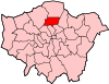
Attractions Alexandra Palace · Bruce Castle · Jacksons Lane · Markfield Beam Engine · White Hart Lane (football stadium)Parks and open spaces Alexandra Park · Bruce Castle Park · Chestnuts Park · Coldfall Wood · Downhills Park · Down Lane Park · Finsbury Park · Highgate Wood · Hollickwood Park · Markfield Park · Priory Park · Queen's Wood · Railway FieldsConstituencies Tube and railway stations Alexandra Palace railway station · Bounds Green · Bowes Park railway station · Bruce Grove railway station · Harringay railway station · Harringay Green Lanes railway station · Highgate · Hornsey railway station · Manor House · Northumberland Park railway station · Seven Stations · South Tottenham railway station · Tottenham Hale · Turnpike Lane · White Hart Lane railway station · Wood GreenOther topics People · Public art · SchoolsParks and open spaces in Haringey Categories:- Districts of London
- Districts of Hackney
- Districts of Haringey
- History of Haringey


Wikimedia Foundation. 2010.