- Mont Blanc Tramway
-
Mont Blanc Tramway 
A train of the Mont-Blanc TramwayOverview Type Tramway Termini Gare de Saint-Gervais-les-Bains-Le Fayet
Nid d'AigleOperation Opened 1907 Operator(s) Compagnie du Mont-Blanc Technical Line length 12.4 km (7.7 mi) No. of tracks 1 Track gauge 1,000 mm (3 ft 3 3⁄8 in) Electrification 11 kV 50 Hz AC Highest elevation 2,372 m (7,782 ft) asl Maximum incline 24% Rack system Strub The Mont Blanc Tramway or Tramway du Mont-Blanc is a mountain railway line in the Haute-Savoie department of France.
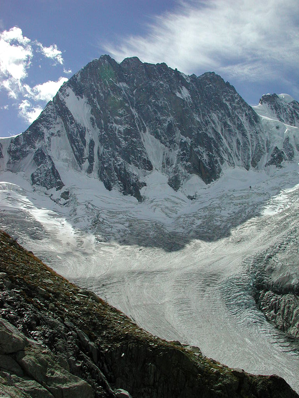
The spectacular views of Mont Blanc provided by the tramway make it very popular with tourists. Furthermore, mountaineers and hikers use the tramway because its stops provide the jumping off points for many trails, including the normal French route to Mont Blanc which starts at the tramway's terminus, Nid d'Aigle, and proceeds to the Tête Rousse Hut.[1]
Contents
Location
The line runs from a connection with the SNCF at Saint-Gervais-les-Bains Le Fayet station to the Nid d'Aigle station at the Bionnassay glacier at an altitude of 2,372 m (7,782 ft). The initial intention was for the line to reach the Aiguille du Goûter.
 Terminus at Saint-Gervais Le Fayet
 Snow blower
 Station at Saint-Gervais-les-Bains
Technology
The line is 12.4 km (7.7 mi) long and has a rail gauge of 1,000 mm (3 ft 3 3⁄8 in). It is a rack and adhesion railway, using the Strub design to overcome a height difference of 1,792 m (5,879 ft). The line has an average gradient of 15% and a maximum gradient of 24%. Some 85% of the line is equipped with rack rail, with adhesion being used at the foot of the line and at intermediate crossing stations. The line is electrified using an overhead line at 11 kV and 50 Hz AC.
Operations
The line is operated by the Compagnie du Mont-Blanc which also manages the Montenvers Railway and many ski lifts in the Mont Blanc region. The first section of the line, to the Col de Voza, was opened in 1907. The line reached its current terminus in August 1914 when work was suspended, because of World War I, and never resumed. The line was worked by steam locomotives until it was electrified in 1956.
The line is worked by three motor coaches which are named Anne, Marie and Jeanne. These were the names of the three daughters of the line's owner at the time of electrification.
The journey time is 1 hour from Fayet to Bellvue with four or five trips operating per day.
The Mont Blanc Tramway is featured in the film Malabar Princess.
References
- ^ SummitPost Tête Rousse Hut. Retrieved 17 August 2009.
- Web page http://www.compagniedumontblanc.fr/en/tramway/index.html and descendants, retrieved on the 15th March 2004 at 17:15 GMT.
External links
Categories:- Haute-Savoie
- Metre gauge railways in France
- Mountain railways
- Railway lines in France
- Rack railways
- Rack railways in France
- Railway companies of France
- Mont Blanc


Wikimedia Foundation. 2010.