- Heerhugowaard
Infobox Settlement
official_name = Heerhugowaard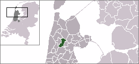

flag_size = 125px
image_shield = Heerhugowaard wapen.png
mapsize = 280px
subdivision_type = Country
subdivision_name =Netherlands
subdivision_type1 = Province
subdivision_name1 =North Holland
leader_name = H.M.W. ter Heegde
leader_party = VVD
area_footnotes = (2006)
area_total_km2 = 39.97
area_land_km2 = 39.25
area_water_km2 = 0.71
population_as_of =1 January ,2007
population_note = Source: CBS, [http://statline.cbs.nl/ Statline] .
settlement_type = Municipality
population_total = 49833
population_density_km2 = 1270
timezone = CET
utc_offset = +1
timezone_DST = CEST
utc_offset_DST = +2
latd = 52.67
latNS = N
longd = 4.85
longEW = E
website = [http://www.heerhugowaard.nl/ www.heerhugowaard.nl].
Population centres
The municipality of Heerhugowaard consists of the following cities, towns, villages and/or districts:
Broekhorn ,Butterhuizen ,De Noord ,Draai ,Frik , Heerhugowaard,Kabel ,'t Kruis ,Veenhuizen ,Verlaat ,Oostertocht ,Bomenwijk ,Schilderswijk ,Rivierenwijk ,Stad van de Zon .History
Around the year 800 the area of the modern
municipality of Heerhugowaard was covered inpeat fen . Because of peat-digging and storm floods many lakes developed in the region, including the Heerhugowaard. The name is derived from lord ('heer' in Dutch) Hugo vanAssendelft who was killed by the WestFrisians in this area in 1296. After two storms in 1248, the abbey ofEgmond , which had much property in this region, built theSchagerdam dam atSchagen . This became part of the West Friesland Ring-dike, which protected the pentagonSchagen -Alkmaar -Medemblik -Enkhuizen -Hoorn .Uncontrollable increase of the lake had been prevented. In the 17th century private investors decided to drain the lake to create farmland. In 1630 the
polder was drained and was 39.0 km², and the land was divided among the initiators. In contrast to e.g. theBeemster , the quality of the new land was very disappointing. In 1674 there was even a serious proposal to refill the polder with water, reasoning that the area would be more profitable as fishing water.A major event in the recent history of Heerhugowaard was the unexpected victory of Princess Margriet at the first-ever held
Keegelfestival of 1961. This bowling festival was an annual event until 1984, when the organising bowling club went into bankruptcy because of financial mismanagement.Building
In the course of time the population has grown. In 1960 Heerhugowaard had 6,800 inhabitants, in 1975, 25,000, in 2004 47.239 and in 2005 48,267. For several years in the 1970s Heerhugowaard was the fastest growing municipality in the Netherlands. It is intended that Heerhugowaard eventually will have about 55,000 inhabitants. But that number might never be reached, because there are problems with retaining the youth. As young people leave their parents' homes, they prefer to move to other places such as Alkmaar or Amsterdam. The major part of the inhabitants lives in so-called
Vinex -villages. The rural core of the North lies in the Middenwaard. The core of the south is at Stationsweg by the old church. In the polders there are small hamlets. The greater part of the town is new developments. The best rural core is in the villages of Centrumwaard and De Noord. Heerhugowaard has a small shopping area in Centrumwaard, and a large shopping centre in the district of Middenwaard. There are also several bars, clubs and also a cinema. Since 2004 there has been a coffee shop in Heerhugowaard. This coffee shop however, has met with fierce opposition from the local population, who have bombarded the coffee shop with stones several times. Heerhugowaard has a number of subdivisions which were set up the same as inAlmere , for example the writer district, the tree district, the planet district, and the nature area of Butterhuizen. In two of the newest districts, calledStad van de Zon I and II (= City of the Sun I and II) the energy supplies for a considerable part comes from solar energy.Accessibility
Heerhugowaard has good connections with the neighbouring places. Buses go to and from
Alkmaar -Bergen NH andWieringerwerf . Also Heerhugowaard hasInterliner links. Heerhugowaard is on therailway routes toHoorn andDen Helder ,Alkmaar -Amsterdam -Nijmegen , andAlkmaar -Haarlem -Den Haag . Heerhugowaard is on the n242 road.Heerhugowaard-Alkmaar-Langedijk
Heerhugowaard with Alkmaar and
Langedijk are linked to operate in, amongst other things, house construction, education, nature and such. The intention was that these three municipalities once would form a city (the HAL-city), but that has not yet been realised. However, all three municipalities press for building on the last free pieces of land which lay between the three municipalities to transform it into suburbs. As a result, an urbanised area has been established is quite large for the region. The complete city will count approximately 181,000 inhabitants after all extensions. This would be the second biggest "city" ofNorth Holland , afterAmsterdam .Urbanisation has spread across the region. The area has more or less grown attached to other places, and counts as complete agglomeration approximately 305,000 inhabitants. This agglomeration stretches widely from
Uitgeest up to and including the villages in the municipality ofHarenkarspel , and of Bergen, up to and includingObdam .Surroundings
The surroundings of Heerhugowaard are quite varied and beautiful. Not far from Heerhugowaard you will find several landscapes. East of the agglomeration there are different kinds of flower bulb fields. In the mid-eighties 61 hectares of woodland were planted, the "Waarderhout". Of course you will also find much farmland in the region of Heerhugowaard.
Local government
The municipal council of Heerhugowaard consists of 29 seats, which are divided as follows:
* Burgerbelang - 5 seats
* CDA - 5 seats
* VVD - 5 seats
* HOP - 4 seats
* PvdA - 4 seats
*GroenLinks - 3 seats
* D66 - 2 seats
*ChristenUnie - 1 seatSources
*Groenedijk, T. (2000). Nederlandse plaatsnamen. Slingenberg Boekproducties,
Hoogeveen , Netherlands, 2000.
*Van de Ven, G. (redactie) (1996) Leefbaar laagland (4th, revised printing). Uitgeverij Matrijs. p. 33-35, 57 en 131-136.
* Statistics are taken from the [http://www.sdu.nl/staatscourant/gemeentes/gem214nh.htm SDU Staatscourant]External links
* [http://www.plattegronden.nl/gemeenteheerhugowaard/index.html A map of the municipality Heerhugowaard]

Wikimedia Foundation. 2010.