- Dodge Center, Minnesota
-
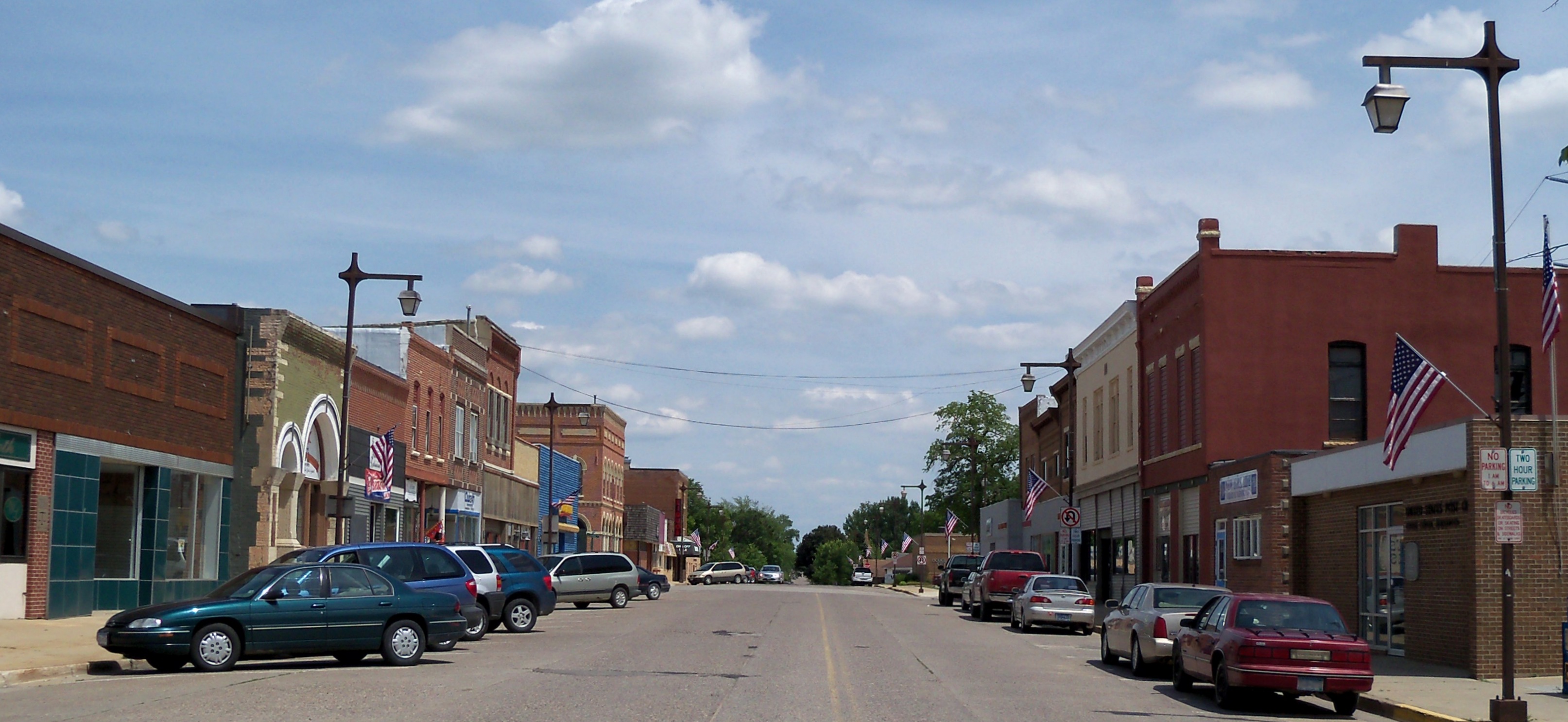
Dodge Center, Minnesota — City — Downtown Dodge Center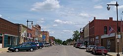
Nickname(s): Dodge Location of Dodge Center, Minnesota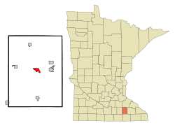
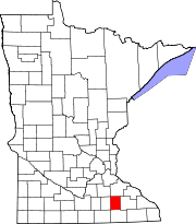
Coordinates: 44°1′44″N 92°51′18″W / 44.02889°N 92.855°WCoordinates: 44°1′44″N 92°51′18″W / 44.02889°N 92.855°W Country United States State Minnesota County Dodge Area – Total 1.9 sq mi (4.9 km2) – Land 1.9 sq mi (4.9 km2) – Water 0.0 sq mi (0.0 km2) Elevation 1,293 ft (394 m) Population (2010)[1] – Total 2,670 – Density 1,173.8/sq mi (453.2/km2) Time zone Central (CST) (UTC-6) – Summer (DST) CDT (UTC-5) ZIP code 55927 Area code(s) 507 FIPS code 27-15994[2] GNIS feature ID 0642860[3] Dodge Center is a city in Dodge County, Minnesota, United States. The population was 2,670 at the 2010 census.[1]
U.S. Route 14 and Minnesota State Highway 56 are two of the main arterial routes in the city. Dodge Center Airport (TOB) is located in this city.
Contents
Geography
According to the United States Census Bureau, the city has a total area of 1.9 square miles (4.9 km2), all of it land.
Demographics
Historical populations Census Pop. %± 1880 726 — 1890 633 −12.8% 1900 942 48.8% 1910 957 1.6% 1920 921 −3.8% 1930 854 −7.3% 1940 1,029 20.5% 1950 1,151 11.9% 1960 1,441 25.2% 1970 1,603 11.2% 1980 1,816 13.3% 1990 1,954 7.6% 2000 2,226 13.9% 2010 2,670 19.9% U.S. Decennial Census As of the census[2] of 2000, there were 2,226 people, 824 households, and 588 families residing in the city. The population density was 1,173.8 people per square mile (452.3/km²). There were 859 housing units at an average density of 452.9 per square mile (174.6/km²). The racial makeup of the city was 93.13% White, 0.31% African American, 0.27% Native American, 0.22% Asian, 4.76% from other races, and 1.30% from two or more races. Hispanic or Latino of any race were 6.29% of the population.
There were 824 households out of which 42.0% had children under the age of 18 living with them, 53.0% were married couples living together, 12.9% had a female householder with no husband present, and 28.6% were non-families. 23.5% of all households were made up of individuals and 11.0% had someone living alone who was 65 years of age or older. The average household size was 2.61 and the average family size was 3.03.
In the city the population was spread out with 30.2% under the age of 18, 8.4% from 18 to 24, 29.7% from 25 to 44, 17.6% from 45 to 64, and 14.1% who were 65 years of age or older. The median age was 32 years. For every 100 females there were 91.1 males. For every 100 females age 18 and over, there were 88.0 males.
The median income for a household in the city was $39,453, and the median income for a family was $44,632. Males had a median income of $31,525 versus $24,485 for females. The per capita income for the city was $16,858. About 8.0% of families and 9.3% of the population were below the poverty line, including 11.0% of those under age 18 and 10.2% of those age 65 or over.
Industry
The largest employer in Dodge Center is McNeilus, a manufacturer of ready-mixed concrete mixer trucks, garbage trucks, and related apparatus. McNeilus is a division of Oshkosh Corporation.
The city is located along the mainline of the Dakota, Minnesota and Eastern Railroad, a subsidiary of Canadian Pacific. This east-west line had been owned by the Chicago and North Western Railway until the 1980s when DM&E was formed. Dodge Center also used to be on the Chicago Great Western mainline which ran south from St. Paul down through Iowa and across to Chicago, Illinois. However, the CGW right-of-way has since been abandoned. There were at least three train stations built in the town over the years. Two of these still exist, though they have been repurposed.[4]
Schools
Dodge Center High School held its first commencement exercises in 1884. A new brick building opened in the 1890s and was torn down in 1972. Its replacement building is still in use. A gymnasium/auditorium (still standing) was erected in 1938 as part of President Franklin D. Roosevelt's Works Progress Administration program. An elementary school was added in 1958 and is now owned by a private entity. It houses apartments and some small businesses.
Dodge Center chose the DODGERS as its nickname and mascot. School colors were maroon and gold up until the 1930s, when the colors were changed to green and white. The first school annual, The Dodger Digest, was published in 1947. It later became known as the Centerite.
The 1952 Dodge Center Dodger football team is one of six Minnesota high school football teams to not allow a point in a season.
The city's school district combined with the towns of Claremont and West Concord in 1990 to form Triton Public Schools. Dodge Center is home to Triton Primary, Triton High School and Triton Middle School. The first commencement exerices were held in 1991.
Triton's school mascot is the Cobras. The school colors are maroon and gray. The annual yearbook is titled Triton Tradition and the first volume was published in 1991.
Triton, coached by Don Henderson, won the Minnesota State Football championship in 1994 (B Division), 2000 (AA Division) and in 2006 (AA Division). In 2006,Triton's football team won every game in the AA Division. The 2006 Cobras hold a Minnesota State High School League Prep Bowl record for both the highest scoring team in a championship game (70 points), as well as total scoring game for both teams (91 points). Two members of the 1994 state championship team also hold individual Minnesota State High School League Prep Bowl records. Kirk Midthun for Most Touchdowns Passing (6) and Judge Gisslen for Most Yards Pass Receptions (171 / 9 passes) and Most Touchdown Receptions (4). Source: http://www.mshsl.org Kirk Midthun was the Minnesota Player of the Year in 1995 and 1994 (a co-winner with Tim Rosga of Cretin Derham Hall).
The Triton athletic fields are named for former Dodge Center High School football coach, Wally Hitt.
Dodge Center is the reported hometown of Shirley Ardell Mason, the multi-personality case described in the 1973 book "Sybil" by Flora Rheta Schreiber.[5]
Dodge Center is the home of Dougy Brekke with one of the largest license plate collections in the world. He can quote any townsperson's license plate number at will and the dates tabs expire.[citation needed] http://www.licenseplates.cc/story.php?id=137
It is also the birthplace of astronomer Milton L. Humason.
References
- ^ a b "2010 Census Redistricting Data (Public Law 94-171) Summary File". American FactFinder. United States Census Bureau. http://factfinder2.census.gov/faces/tableservices/jsf/pages/productview.xhtml?pid=DEC_10_PL_GCTPL2.ST13&prodType=table. Retrieved 27 April 2011.
- ^ a b "American FactFinder". United States Census Bureau. http://factfinder.census.gov. Retrieved 2008-01-31.
- ^ "US Board on Geographic Names". United States Geological Survey. 2007-10-25. http://geonames.usgs.gov. Retrieved 2008-01-31.
- ^ Dan West. "Dodge County Minnesota Railroad Stations". Past and Present Minnesota Railroad Stations. http://www.west2k.com/mnstations/dodge.shtml. Retrieved December 31, 2009.
- ^ http://en.wikipedia.org/wiki/Shirley_Ardell_Mason
Municipalities and communities of Dodge County, Minnesota Cities Blooming Prairie‡ | Claremont | Dodge Center | Hayfield | Kasson | Mantorville | West Concord
Townships Unincorporated
communitiesBerne
Ghost town Rice Lake‡
Footnotes ‡This populated place also has portions in an adjacent county or counties
Over 100,000 Incorporated
Places(over 5,000) (under 5,000) Byron · Dodge Center · Plainview · Elgin · Millville · Wabasha · Eyota · Pine Island‡ · Blooming Prairie‡ · Dover · Chatfield‡ · Mazeppa · Minneiska‡ · Hammond · Kellogg · Zumbro Falls · Bellechester‡ · Oronoco · West Concord · ClaremontCounties ‡ indicates that it is partially in the metropolitan area.Categories:- Cities in Minnesota
- Populated places in Dodge County, Minnesota
- Rochester, Minnesota metropolitan area


Wikimedia Foundation. 2010.