- Pilsbach
Infobox Town AT
name=Pilsbach
name_local=
image_coa = Wappen at pilsbach.png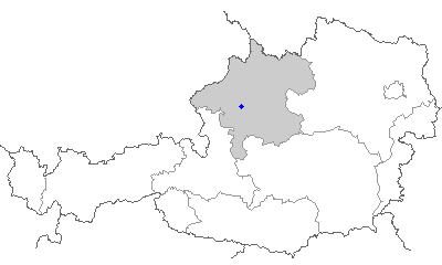
state =Upper Austria
regbzk =
district = Vöcklabruck
population =630
population_as_of =15.05.2001
population_ref =
pop_dens =
area = 10
elevation = 475
lat_deg=48
lat_min=02
lat_sec=23
lat_hem=N
lon_deg=13
lon_min=40
lon_sec=06
lon_hem=E
postal_code = 4840, 4841, 4800
area_code =07672, 07676
licence = VB
mayor = Alois Gruber (ÖVP )
website = [http://www.pilsbach.at www.pilsbach.at]Pilsbach is a small town in the
Austria n state ofUpper Austria . As of 2001 the population of Pilsbach was 630, an increase from 554 in 1991.Geography
Pilsbach lies in the area of Upper Austria known as the
Hausruckviertel , about 4 km fromVöcklabruck . The total area of the town is 10.2 km², of which 45.1 % is forested and 49 % is used for agriculture. The town is divided into the neighborhoods of Einwald, Kien, Kirchstetten, Mittereinwald, Oberpilsbach, Schmidham, Untereinwald, and Unterpilsbach.History
Originally in the eastern portion of the
Duchy of Bavaria , the town has belonged toDuchy of Austria since the 12th century. The town was occupied multiple times during theNapoleonic Wars . It became part of Upper Austria in 1918. After the Nazi annexation of Austria (Anschluss ), the town became part of "Gau Oberdonau", returning to Upper Austria in 1945.
Wikimedia Foundation. 2010.