- Crooked Lake Township, Cass County, Minnesota
-
Crooked Lake Township, Minnesota — Township — Location within the state of Minnesota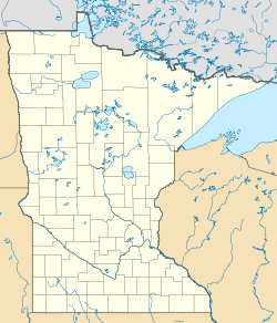
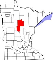
 Crooked Lake Township, Minnesota
Coordinates: 46°51′28″N 93°57′30″W / 46.85778°N 93.95833°WCoordinates: 46°51′28″N 93°57′30″W / 46.85778°N 93.95833°W Country United States State Minnesota County Cass Area - Total 36.1 sq mi (93.5 km2) - Land 30.0 sq mi (77.8 km2) - Water 6.0 sq mi (15.7 km2) Elevation 1,322 ft (403 m) Population (2000) - Total 498 - Density 16.6/sq mi (6.4/km2) Time zone Central (CST) (UTC-6) - Summer (DST) CDT (UTC-5) ZIP code 56662 Area code(s) 218 FIPS code 27-13834[1] GNIS feature ID 0663891[2] Crooked Lake Township is a township in Cass County, Minnesota, United States. The population was 498 as of the 2000 census.[3] It is named after Roosevelt Lake, formerly known as Crooked Lake, a large lake located in this township. Crooked Lake is a translation from the Ojibwe Wewaagigamaag-zaaga'igan.[4]
Contents
Geography
According to the United States Census Bureau, the township has a total area of 36.1 square miles (93 km2), of which 30.0 square miles (78 km2) is land and 6.1 square miles (16 km2) (16.76%) is water.
Unincorporated towns
(This list is based on USGS data and may include former settlements.)
Major highways
Lakes
- Abe Lake
- Andrus Lake
- Bear Lake
- Blue Bill Lake
- Donut Lake
- East Wood Lake
- Grasshopper Lake
- Lawrence Lake
- Lake George (east three-quarters)
- Lake Leavitt (west half)
- Margaret Lake
- Marion Lake
- Mule Lake
- Oxbox Lake (west three-quarters)
- Pavelgrit Lake
- Roosevelt Lake
- Smoky Hollow Lake
- Snake Lake
- Snowshoe Lake
- State Lake
- West Wood Lake
- Washburn Lake (vast majority)
- Wood Lake
- Woods Lake
- Wren Lake (west edge)
Adjacent townships
- Thunder Lake Township (north)
- Smoky Hollow Township (northeast)
- Beulah Township (east)
- Little Pine Township, Crow Wing County (southeast)
- Trelipe Township (west)
Demographics
As of the census[1] of 2000, there were 498 people, 249 households, and 164 families residing in the township. The population density was 16.6 people per square mile (6.4/km²). There were 1,023 housing units at an average density of 34.1/sq mi (13.1/km²). The racial makeup of the township was 98.39% White, 0.60% Native American, 0.20% Asian, and 0.80% from two or more races. Hispanic or Latino of any race were 0.40% of the population.
There were 249 households out of which 12.4% had children under the age of 18 living with them, 63.9% were married couples living together, 0.8% had a female householder with no husband present, and 34.1% were non-families. 30.1% of all households were made up of individuals and 15.7% had someone living alone who was 65 years of age or older. The average household size was 2.00 and the average family size was 2.45.
In the township the population was spread out with 13.1% under the age of 18, 2.4% from 18 to 24, 14.1% from 25 to 44, 39.0% from 45 to 64, and 31.5% who were 65 years of age or older. The median age was 57 years. For every 100 females there were 124.3 males. For every 100 females age 18 and over, there were 116.5 males.
The median income for a household in the township was $32,708, and the median income for a family was $40,625. Males had a median income of $35,833 versus $16,563 for females. The per capita income for the township was $21,294. About 2.1% of families and 6.3% of the population were below the poverty line, including none of those under age 18 and 6.1% of those age 65 or over.
References
- United States National Atlas
- United States Census Bureau 2007 TIGER/Line Shapefiles
- United States Board on Geographic Names (GNIS)
- ^ a b "American FactFinder". United States Census Bureau. http://factfinder.census.gov. Retrieved 2008-01-31.
- ^ "US Board on Geographic Names". United States Geological Survey. 2007-10-25. http://geonames.usgs.gov. Retrieved 2008-01-31.
- ^ United States Census Bureau American FactFinder - Crooked Lake Township total population
- ^ Upham, Minnesota Geographic Names: Their Origin and Historic Significance
Municipalities and communities of Cass County, Minnesota County seat: Walker Cities Backus | Bena | Boy River | Cass Lake | Chickamaw Beach | East Gull Lake | Federal Dam | Hackensack | Lake Shore | Longville | Motley‡ | Pillager | Pine River | Remer | Walker
Townships Ansel | Barclay | Becker | Beulah | Birch Lake | Blind Lake | Boy Lake | Boy River | Bull Moose | Bungo | Byron | Crooked Lake | Deerfield | Fairview | Gould | Hiram | Home Brook | Inguadona | Kego | Leech Lake | Lima | Loon Lake | Maple | May | McKinley | Meadow Brook | Moose Lake | Otter Tail Peninsula | Pike Bay | Pine Lake | Pine River | Ponto Lake | Poplar | Powers | Remer | Rogers | Salem | Shingobee | Slater | Smoky Hollow | Sylvan | Thunder Lake | Torrey | Trelipe | Turtle Lake | Wabedo | Walden | Wilkinson | Wilson | Woodrow
Unorganized
territoriesUnincorporated
communitiesIndian
reservationFootnotes ‡This populated place also has portions in an adjacent county or counties
Categories:- Townships in Cass County, Minnesota
- Brainerd micropolitan area


Wikimedia Foundation. 2010.