- Crofton, Maryland
-
Crofton, Maryland — CDP — Crofton Parkway Location of Crofton, Maryland
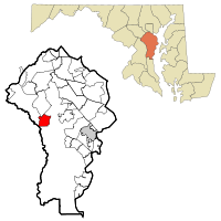
Coordinates: 39°0′32″N 76°40′52″W / 39.00889°N 76.68111°WCoordinates: 39°0′32″N 76°40′52″W / 39.00889°N 76.68111°W Country United States State Maryland County Anne Arundel Area - Total 5.0 sq mi (13.0 km2) - Land 5.0 sq mi (13.0 km2) - Water 0.0 sq mi (0.0 km2) Elevation 98 ft (30 m) Population (2010)[1] - Total 27,348 - Density 3,998.6/sq mi (1,543.9/km2) Time zone Eastern (EST) (UTC-5) - Summer (DST) EDT (UTC-4) ZIP code 21114 Area code(s) 410 FIPS code 24-20875 GNIS feature ID 0590046 Crofton is a census-designated place and planned community in Anne Arundel County, Maryland, United States. Established in 1964, Crofton held its 40th birthday celebration in 2004.
Contents
In July 2007 Crofton was named by Money magazine as one of "100 Best Places to Live" in the United States. Crofton placed 72nd out of 100 cities on the list. It was selected for its relative anonymity while still boasting many major amenities, excellent schools, and sought after location.[2] Crofton was selected again for the magazine's 2011 list, this time placing 82nd.[3]Community life frequently revolves around Crofton Parkway, actually a scenic loop 3.5 miles (5.6 km) long, tangentially touching the larger "triangle" made up of three nearby roads, which encloses the original Crofton community. Crofton Parkway is the scene of yearly parades, two of the community's five elementary schools, the Town Hall, Village Green, community events, Crofton Country Club, and walkers, joggers and bikers around the loop. The Crofton area now extends North from the triangle, including Crofton Park. Crofton also has a community pool, the Crofton Swim and Tennis Club [CSTC] but is restricted to those inhabitants of the triangle.
In 1963, after the Crawford Corporation accumulated over 1,600 acres (650 ha) of land, it announced that it would build a new community called Crofton. This new town and planned community was founded at the same time as Reston, Virginia (April 17, 1964) and Columbia, Maryland (1967). Crofton would be anchored by a community golf course, which later became the Crofton Country Club. Crofton was officially founded in the fall of 1964. The company considered picking an English name for the new town that "sounds well and implies that this is a pleasant place to live." It ended up picking the name "Crofton," named after a small township in Cumberland County, England. The English town was originally called Croft-town, derived from the word Croft, as the town standing upon the Crofts. Originally an exclusive gated community, Crofton's gates were opened and they now only serve as a symbol for this community just off Route 3.
Schools
- Crofton Elementary School
- Crofton Woods Elementary School
- Crofton Meadows Elementary School
- Nantucket Elementary School
- Four Seasons Elementary School
- Crofton Middle School
- Arundel High School
- South River High School
According to the United States Census Bureau, the Crofton ZIP code has a total area of 5 sq mi (13 km2), all of it land.
Demographics
As of the census[4] of 2000, there were 20,091 people, 7,404 households, and 5,478 families residing in the Crofton ZIP code. The following data only includes census-listed figures for the Crofton ZIP code and excludes other data for Crofton-area residents.
The population density was 3,998.6 people per square mile (1,545.3/km²). There were 7,573 housing units at an average density of 1,507.2 per square mile (582.5/km²). The racial makeup of the community was 90.21% White, 5.13% African American, 0.23% Native American, 2.33% Asian, 0.04% Pacific Islander, 0.60% from other races, and 1.44% from two or more races. Hispanic or Latino of any race were 2.48% of the population.
There were 7,404 households out of which 40.9% had children under the age of 18 living with them, 60.9% were married couples living together, 10.0% had a female householder with no husband present, and 26.0% were non-families. 20.1% of all households were made up of individuals and 3.4% had someone living alone who was 65 years of age or older. The average household size was 2.69 and the average family size was 3.13.
In the community the population was spread out with 28.6% under the age of 18, 6.0% from 18 to 24, 35.6% from 25 to 44, 23.2% from 45 to 64, and 6.5% who were 65 years of age or older. The median age was 35 years. For every 100 females there were 94.3 males. For every 100 females age 18 and over, there were 90.2 males.
According to a 2007 estimate,[5] the median income for a household in the area was $93,198, and the median income for a family was $101,644. Males had a median income of $56,819 versus $41,229 for females. The per capita income for the area was $33,518. About 2.0% of families and 2.7% of the population were below the poverty line, including 3.0% of those under age 18 and 2.3% of those age 65 or over.
Crime and law enforcement
The area of Crofton is policed by the Crofton Police Department and is aided by the Anne Arundel County Police Department and Sheriff's Office as directed by authority.
Crofton pond snakehead fish incident
Crofton was in the national news in late June and early July 2002 after a northern snakehead was discovered in a pond behind the Crofton post office (not the local landmark Lake Louise, but instead across Route 3 from it).
The snakehead species, which is highly aggressive, voracious, and can walk short distances on land, came from a live Asian food market, where the fish is a delicacy. In order to ensure that the fish were eliminated, the pond was dosed heavily with rotenone, and subsequently with potassium permanganate (September 17, 2002). Six adult snakeheads and more than one thousand juvenile fish were found and destroyed.
Ultimately, the incident initiated a national discussion on invasive species and comparisons with the mute swan, also an invasive and destructive species of the Chesapeake Bay watershed but, in comparison, quite beautiful, and which garnered support from some environmental and animal rights groups.
There have been several movies inspired by this incident. The SciFi Network has aired two movies in relation to the snakehead outbreak. In March 2004, a movie called Snakehead Terror was featured, and in June 2004, the movie Frankenfish was aired. There has also been a movie produced by Ten Pound Films titled Swarm of the Snakehead which related to this incident.
In 2007, a documentary on the National Geographic channel titled Fishzilla: Snakehead Invasion aired that discussed the ecological damage that the snakeheads found in Crofton have done to surrounding areas.
Crofton's population history from the U.S. Census Bureau
The following population history only includes census-listed figures for the Crofton ZIP code and excludes other Crofton-area residents.
- 1970.......4,478
- 1980......12,009
- 1990......12,781
- 2000......20,091
- 2010......27,348
Existing landmarks
- Whites Hall - birthplace for Johns Hopkins. Gerrard Hopkins was the first to come to America from England, settling in Crofton in 1660. The Hopkins family was in the Crofton area for 270 years and accumulated more than 1,000 acres (400 ha) of land. Whites Hall still exists near the corner of Reidel Road and Johns Hopkins Road. It is privately owned.
- Linthicum Walks - a home built over 200 years ago by Thomas Linthicum III, a member of an influential family in Anne Arundel County. The original grant for the land was to Evan Davis in 1672 and obtained in 1699 by Thomas Linthicum, a Welsh immigrant. It was part of a medium size tobacco farm. George Washington stayed here during his travels to and from Annapolis and Philadelphia and his home at Mount Vernon, Virginia. Located next to Crofton Middle School and the planned location for Crofton High School, Linthicum Walks is owned by Anne Arundel County, run by the Department of Recreation and Parks and is currently being restored. It was listed on the National Register of Historic Places in 1984.[6]
- Katcef Archeological Site - archaeological site listed on the National Register of Historic Places in 1991.[6]
Notable Croftonites
- Johns Hopkins - born at Whites Hall on present-day Johns Hopkins Road. Johns Hopkins was a famous businessman who was involved in the building of the B&O Railroad from Baltimore westward and, upon his death, founded world-renowned Johns Hopkins University and Johns Hopkins Hospital in Baltimore.
- Spiro Agnew - originally of Baltimore County, one of his homes following his resignation as Vice President of the United States was in Crofton.
- Peter Bondra - National Hockey League player and former Captain of the Washington Capitals from 1990 to 2004.
- Gheorghe Mureşan - former pro basketball player for the Washington Bullets (1993–1998), holds the record as being the tallest man ever to play in the NBA.
- Charles Thomas McMillen - former Democratic congressman, Rhodes Scholar, and pro basketball player.
- Kyle Beckerman - current Major League Soccer (MLS) player for Real Salt Lake in Utah. Raised in Crofton and starred at Arundel High School before turning pro in 2000.
- Bill Belichick - coach of the New England Patriots NFL team - was raised in Crofton and went to Annapolis High
- Steven Fischer - award-winning filmmaker and Emmy Award nominee, graduate of Arundel High School, residing in Crofton as of 2007.
- Chris Kubasik - President and Chief Operating Officer of Lockheed Martin Corporation, now living in Potomac, MD, was raised in Crofton and went to Arundel High School.
- Alan Linhart - also known as Cereal Killaz, a Nu skool breaks act, now resides in Crofton.[7]
References
- ^ "DP-1 - Profile of General Population and Housing Characteristics: 2010". 2010 United States Census Summary File 1. United States Census Bureau. http://factfinder2.census.gov/faces/tableservices/jsf/pages/productview.xhtml?pid=DEC_10_DP_DPDP1&prodType=table. Retrieved September 6, 2011.
- ^ Ashford, Kate; Andrea Bartz, Jeff Cox, Asa Fitch, Stephen Gandel, Josh Hyatt, Rob Kelley, Kathleen Knight, Joe Light, Ismat Sarah Mangla, Sarah Max, Jennifer Merritt, Brad Nelson, Donna Rosato, Ingrid Tharasook (2007). "Best Places to Live: Top 100". Money Magazine. Money Magazine. http://money.cnn.com/galleries/2007/moneymag/0707/gallery.BPTL_top_100.moneymag/72.html. Retrieved 2007-09-14.
- ^ "Best Places to Live 2011". Money Magazine. Money Magazine. 2011. http://money.cnn.com/magazines/moneymag/bplive/2011/snapshots/PL2420875.html. Retrieved 2011-09-02.
- ^ "American FactFinder". United States Census Bureau. http://factfinder.census.gov. Retrieved 2008-01-31.
- ^ http://factfinder.census.gov/servlet/ACSSAFFFacts?_event=Search&geo_id=16000US2408775&_geoContext=01000US%7C04000US24%7C16000US2408775&_street=&_county=crofton&_cityTown=crofton&_state=04000US24&_zip=&_lang=en&_sse=on&ActiveGeoDiv=geoSelect&_useEV=&pctxt=fph&pgsl=160&_submenuId=factsheet_1&ds_name=ACS_2007_3YR_SAFF&_ci_nbr=null&qr_name=null®=null%3Anull&_keyword=&_industry=
- ^ a b "National Register Information System". National Register of Historic Places. National Park Service. 2008-04-15. http://nrhp.focus.nps.gov/natreg/docs/All_Data.html.
- ^ http://www.facebook.com/zarbizarre
Sources
- Browne, Joseph L., From Sotweed to Suburbia: A History of the Crofton, Maryland Area, 40th Anniversary version, 1660-1960. Baltimore: Gateway Press, Inc., published by the Crofton Rotary to fund the restoration of Linthicum Walks.
- Crofton Small Area Plan
External links
- Crofton Regional Community Center
- Crofton Details & Statistics
- Suburban Scene Magazine
- Greater Crofton Chamber of Commerce
- Crofton Swim & Tennis Club
- Crofton Country Club
- Crofton Town Hall
Municipalities and communities of Anne Arundel County, Maryland City 
Town CDPs Arden-on-the-Severn | Arnold | Brooklyn Park | Cape St. Claire | Crofton | Crownsville | Deale | Ferndale | Fort Meade | Glen Burnie | Green Haven | Herald Harbor | Hillsmere Shores | Jessup‡ | Lake Shore | Linthicum | Londontowne | Maryland City | Mayo | Naval Academy | Odenton | Parole | Pasadena | Pumphrey | Riva | Riviera Beach | Selby-on-the-Bay | Severn | Severna Park | Shady Side | South Gate
Other
communitiesArundel on the Bay | Beverly Beach | Bristol | Churchton | Davidsonville | Fairhaven | Fairview | Franklin Manor-on-the-Bay | Friendship | Gambrills | Galesville | Germantown | Gibson Island | Hanover | Harmans | Harundale | Harwood | Iglehart | Jacobsville | Jennings | Lothian | Millersville | Orchard Beach | Owensville | Piney Orchard | Riverdale | Rose Haven | Russett | Saunders Point | Seven Oaks | Sherwood Forest | Skidmore | South River | Sudley | Tall Timbers | Tracys Landing | West River | Winchester-on-the-Severn | Woodland Beach | Woodwardville
Footnotes ‡This populated place also has portions in an adjacent county or counties
Categories:- Populated places established in 1964
- Unincorporated communities in Maryland
- Populated places in Anne Arundel County, Maryland
- Census-designated places in Maryland
- Planned cities in the United States


Wikimedia Foundation. 2010.