- Islesboro, Maine
-
Islesboro, Maine — Town — Pendleton Point Location of Islesboro (in yellow) in Waldo County and the state of Maine
Coordinates: 44°18′22″N 68°54′32″W / 44.30611°N 68.90889°W Country United States State Maine County Waldo Incorporated 1789 Area – Total 68.9 sq mi (178.5 km2) – Land 14.3 sq mi (36.9 km2) – Water 54.7 sq mi (141.6 km2) Elevation 30 ft (9 m) Population (2000) – Total 603 – Density 42.3/sq mi (16.3/km2) Time zone Eastern (EST) (UTC-5) – Summer (DST) EDT (UTC-4) ZIP code 04848 Area code(s) 207 FIPS code 23-35240 GNIS feature ID 0582531 Islesboro is a town in Waldo County, Maine, United States. The population was 603 at the 2000 census. It is a well-known summer colony accessible by ferry from Lincolnville Beach 3 miles to the west, or by air taxi service. Home to Warren Island State Park, Islesboro includes the villages of Dark Harbor, Pripet and North Islesboro.
Contents
History
Penobscot Indians called it Pitaubegwimenahanuk, meaning "the island that lies between two channels." Situated in upper Penobscot Bay, the narrow, 14 mile island is the marker between East and West Penobscot Bay. It was part of the Waldo Patent. First called Long Island Plantation, it was settled in 1769. It would be incorporated as Islesborough on January 28, 1789, although over time the spelling was contracted to Islesboro.[1]
With many harbors and coves, the island was home to the largest commercial shipping fleet in the bay during the 19th century. Following the Civil War, however, Islesboro developed as a Gilded Age resort community, and many large summer homes were built by the wealthy. Their large yachts cruised and raced throughout the Gulf of Maine. The town remains a famous upper-class enclave and well-known summer colony.[2]
Demographics
As of the census[3] of 2000, there were 603 people, 280 households, and 176 families residing in the town. The population density was 42.3 people per square mile (16.3/km²). There were 741 housing units at an average density of 52.0 per square mile (20.1/km²). The racial makeup of the town was 98.18% White, 0.17% African American, 0.17% Native American, 0.17% Asian, 0.50% from other races, and 0.83% from two or more races. Hispanic or Latino of any race were 1.33% of the population.
There were 280 households out of which 25.0% had children under the age of 18 living with them, 53.2% were married couples living together, 5.7% had a female householder with no husband present, and 36.8% were non-families. 30.7% of all households were made up of individuals and 13.6% had someone living alone who was 65 years of age or older. The average household size was 2.15 and the average family size was 2.69.
In the town the population was spread out with 20.2% under the age of 18, 3.3% from 18 to 24, 25.4% from 25 to 44, 31.2% from 45 to 64, and 19.9% who were 65 years of age or older. The median age was 46 years. For every 100 females there were 97.1 males. For every 100 females age 18 and over, there were 97.1 males.
The median income for a household in the town was $39,643, and the median income for a family was $48,750. Males had a median income of $35,000 versus $24,750 for females. The per capita income for the town was $25,653. About 5.5% of families and 7.2% of the population were below the poverty line, including 8.3% of those under age 18 and 9.7% of those age 65 or over.
Education
- Islesboro Central School (K-12)
Sites of interest
 Grindel Point Light
- Grindle Point Light
- Islesboro Historical Society & Museum
- Sailors' Memorial Museum, located in the former keepers' house at Grindle Point Lighthouse
- Spragues Beach located near Turtle Head
- Warren Island State Park
- Islesboro Community Center
Notable people
- Kirstie Alley, actress [4]
- Honor Blackman, actress
- Ruth Draper, dramatist [5]
- Charles Dana Gibson, illustrator
- Isabel Gillies, actress and author
- Bruce Claflin, executive chairman AMD
- J.P. Morgan, financier [6]
- Chris O'Donnell, actor[citation needed]
- Kelly Preston, actress[citation needed]
- Parker Stevenson, actor, director[citation needed]
- John Travolta, actor[citation needed]
.
See also
- Up-island spider
References
- ^ Coolidge, Austin J.; John B. Mansfield (1859). A History and Description of New England. Boston, Massachusetts. pp. 162–163. http://books.google.com/books?id=OcoMAAAAYAAJ&lpg=PA9&dq=coolidge%20mansfield%20history%20description%20new%20england%201859&pg=PA162#v=onepage&q&f=false.
- ^ Varney, George J. (1886), Gazetteer of the state of Maine. Islesborough, Boston: Russell, http://history.rays-place.com/me/islesborough-me.htm
- ^ "American FactFinder". United States Census Bureau. http://factfinder.census.gov. Retrieved 2008-01-31.
- ^ Kirstie Alley
- ^ Ruth Draper
- ^ J.P. Morgan
External links
- Official Web Page
- About Islesboro
- The Alice L. Pendleton Library
- Islesboro Community Center
- Islesboro Island Trust
- Islesboro Comprehensive Plan
- Islesboro Central School District
- Maine Genealogy: Islesboro, Waldo County, Maine
- Islesboro Maine overview
Municipalities and communities of Waldo County, Maine City 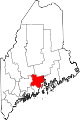
Towns CDPs Searsport | Unity | Winterport
Other
villageCoordinates: 44°18′30″N 68°54′12″W / 44.30833°N 68.90333°W
Categories:- Towns in Waldo County, Maine
- Islands of Waldo County, Maine


Wikimedia Foundation. 2010.