- Old Town, Maine
-
Old Town, Maine — City — Main Street

SealLocation of Old Town, Maine
Coordinates: 44°56′35″N 68°40′35″W / 44.94306°N 68.67639°WCoordinates: 44°56′35″N 68°40′35″W / 44.94306°N 68.67639°W Country United States State Maine County Penobscot Settled 1774 Incorporated (town) March 16, 1840 Incorporated (city) March 30, 1891 Area – Total 42.7 sq mi (110.5 km2) – Land 38.3 sq mi (99.2 km2) – Water 4.4 sq mi (11.3 km2) Elevation 108 ft (33 m) Population (2010) – Total 7,840 – Density 204.7/sq mi (79.0/km2) Time zone Eastern (EST) (UTC-5) – Summer (DST) EDT (UTC-4) ZIP code 04468 Area code(s) 207 FIPS code 23-55225 GNIS feature ID 0572733 Website www.old-town.org Old Town is a city in Penobscot County, Maine, United States. The population was 7,840 at the 2010 census. The city's developed area is chiefly located on a relatively large island, though its boundaries extend beyond that. The island is surrounded and defined by the Penobscot River to the east, and the Stillwater River to the west.
Contents
History
Abenaki Indians called it Pannawambskek, meaning "where the ledges spread out." The French established a mission here in the 1680s. Later the area was settled by English pioneers in 1774. The name Old Town derives from Indian Old Town, which was the English name for the largest Penobscot Indian village, now known as Indian Island.
Located in Old Town via bridge, the reservation is the current and historical home of the Penobscot Nation.[1]
In 1840, when the present city was set off from neighboring Orono (named for a Penobscot sachem), it was given the name Old Town because it contained the Penobscot village. Over time, the Penobscot village ceased to be called Old Town and the name migrated to the much newer American settlement across the river.[2]
Old Town may be best known for Old Town Canoe Co., a major manufacturer of canoes and kayaks, which has been based in Old Town for over 100 years. Its location along a series of drops in the Penobscot River, near the head of tide just downstream in Bangor, made it an ideal location in the 1800s for sawing lumber from the millions of board feet of spruce and pine logs floated annually down the Penobscot.[3]
Many of the residents work for the University of Maine in Orono and Eastern Maine Medical Center in Bangor, the two largest employers in the area. Old Town is home to a former Georgia-Pacific paper mill, which is being redeveloped for adaptive reuse.
The city of Old Town includes Treat-Webster Island, a.k.a French Island, a predominantly residential neighborhood located on a small island in the middle of the Penobscot River. French Island is the intermediate land mass between Milford and Old Town; it is connected on either side by a bridge.
-

Old toll bridge in 1907
-

Public Library in 1909
-

City Hall in 1914
Geography
Old Town is located at 44°56′35″N 68°40′35″W / 44.94306°N 68.67639°W (44.943047, -68.676461).[4]
According to the United States Census Bureau, the city has a total area of 42.7 square miles (111 km2), of which, 38.3 square miles (99 km2) of it is land and 4.4 square miles (11 km2) of it (10.24%) is water. With its business district located on an island, Old Town is drained by the Stillwater River and Penobscot River.
The city is crossed by Interstate 95, U. S. Route 2 and 2A, and state routes 16, 43 and 116. It borders the towns of Orono to the south, Glenburn to the west, Hudson to the northwest, Alton and Argyle Township to the north, and (separated by water) is near Milford east, and Bradley to the southeast.
Demographics
 Center Street
As of the census[5] of 2000, there were 8,130 people, 3,426 households, and 1,993 families residing in the city. The population density was 212.3 people per square mile (82.0/km²). There were 3,686 housing units at an average density of 96.3 per square mile (37.2/km²). The racial makeup of the city was 94.62% White, 0.65% African American, 1.48% Native American, 1.83% Asian, 0.04% Pacific Islander, 0.28% from other races, and 1.09% from two or more races. Hispanic or Latino of any race were 0.52% of the population.
There were 3,426 households out of which 26.1% had children under the age of 18 living with them, 44.7% were married couples living together, 10.1% had a female householder with no husband present, and 41.8% were non-families. 29.1% of all households were made up of individuals and 11.7% had someone living alone who was 65 years of age or older. The average household size was 2.30 and the average family size was 2.83.
 Pushaw Lake
In the city the population was spread out with 20.0% under the age of 18, 18.3% from 18 to 24, 27.0% from 25 to 44, 20.8% from 45 to 64, and 13.9% who were 65 years of age or older. The median age was 34 years. For every 100 females there were 91.2 males. For every 100 females age 18 and over, there were 90.8 males.
The median income for a household in the city was $29,886, and the median income for a family was $40,589. Males had a median income of $32,961 versus $23,723 for females. The per capita income for the city was $16,100. About 11.8% of families and 18.6% of the population were below the poverty line, including 14.6% of those under age 18 and 14.6% of those age 65 or over.
Education
Located on Stillwater Avenue is the Old Town High School. The school enrolls students from over four neighboring towns such as Milford, Alton, Bradley and Greenbush among others. The school recently changed its mascot from the Old Town Indians to the Old Town Coyotes. The schools colors are green and white.
Historic buildings
Listed in the National Register of Historic Places:
- St. Anne's Church and Mission Site,[6] located on Indian Island
- St. James Episcopal Church,[7] designed by Boston-based English architect Henry Vaughn
- Edith Marion Patch House (known as Braeside)
- US Post Office-Old Town Main,[8] designed by Oscar Wenderoth
Site of interest
Notable people
 Penobscot office on Indian Island
- Doris Twitchell Allen, psychologist, founder of the Children's International Summer Villages
- Samuel Cony, governor of Maine
- Edward Luce, governor of Maine
- Matthew Dunlap, Maine's secretary of state[citation needed]
- Patty Griffin, singer-songwriter
- Chad Hayes, University of Maine and NFL football player
- Charles Davis Jameson, Civil War general
- Tabitha King, author, wife of author Stephen King
- Ralph W. 'Bud' Leavitt Jr., longtime editor and columnist, The Bangor Daily News, television host
- Dick MacPherson, head coach of the New England Patriots
- Molly Spotted Elk, actress and dancer[citation needed]
- David Richard Porter, YMCA youth leader and Maine's first Rhodes Scholar
- Charles W. Roberts, Civil War general.
- Aaron Y. Ross, 'Old West' character
- George P. Sewall, speaker of the Maine House of Representatives.
- Joseph Sewall, president of the Maine Senate
- Mary Ellen St. John, Miss Maine 1954
- Andrew Sockalexis, Olympic athlete
- Louis "Chief" Sockalexis, first Native American major league baseball player
- Chris Taylor, Businessman and philanthropist, Sarasota, Florida Mayor.
Squanto Wilson, Major League baseball player
References
- ^ Coolidge, Austin J.; John B. Mansfield (1859). A History and Description of New England. Boston, Massachusetts. pp. 240–241. http://books.google.com/books?id=OcoMAAAAYAAJ&lpg=PA9&dq=coolidge%20mansfield%20history%20description%20new%20england%201859&pg=PA240#v=onepage&q&f=false.
- ^ Varney, George J. (1886), Gazetteer of the state of Maine. Old Town, Boston: Russell, http://history.rays-place.com/me/oldtown-me.htm
- ^ Old Town's Rich Heritage
- ^ "US Gazetteer files: 2010, 2000, and 1990". United States Census Bureau. 2011-02-12. http://www.census.gov/geo/www/gazetteer/gazette.html. Retrieved 2011-04-23.
- ^ "American FactFinder". United States Census Bureau. http://factfinder.census.gov. Retrieved 2008-01-31.
- ^ St. Anne's Church and Mission Site (1830)
- ^ St. James Episcopal Church (1892)
- ^ U.S. Post Office (1914)
External links
Municipalities and communities of Penobscot County, Maine Cities 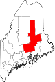
Towns Alton | Bradford | Bradley | Burlington | Carmel | Charleston | Chester | Clifton | Corinna | Corinth | Dexter | Dixmont | East Millinocket | Eddington | Edinburg | Enfield | Etna | Exeter | Garland | Glenburn | Greenbush | Hampden | Hermon | Holden | Howland | Hudson | Kenduskeag | Lagrange | Lakeville | Lee | Levant | Lincoln | Lowell | Mattawamkeag | Maxfield | Medway | Milford | Millinocket | Mount Chase | Newburgh | Newport | Orono | Orrington | Passadumkeag | Patten | Plymouth | Springfield | Stacyville | Stetson | Veazie | Winn | Woodville
Plantations Unorganized
territoriesArgyle | East Central Penobscot | Kingman | North Penobscot | Prentiss | Twombly | Whitney
CDPs Dexter | East Millinocket | Hampden | Howland | Lincoln | Milford | Millinocket | Newport | Orono
Indian
reservation State of Maine
Topics - Index
- Culture
- Geography
- Government
- Governors
- History
- Images
- People
- Visitor Attractions
- Congressional districts
Regions Counties Cities Largest towns Categories:- Populated places established in 1774
- Cities in Maine
- Populated places in Penobscot County, Maine
- Old Town, Maine
-


Wikimedia Foundation. 2010.