- West Melbourne, Victoria
-
West Melbourne
Melbourne, Victoria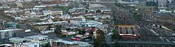
Aerial view of eastern commercial and residential section of West Melbourne looking south toward Melbourne CBD and Docklands. North Melbourne railway station and railyards are right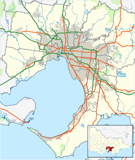
 West Melbourne
Population: 3,037 (2006) [1] Postcode: 3003 Area: 6.4 km² (2.5 sq mi) Location: 3 km (2 mi) from Melbourne LGA: City of Melbourne State District: Melbourne Federal Division: Melbourne Suburbs around West Melbourne: Footscray Kensington North Melbourne Yarraville West Melbourne Melbourne CBD Newport Port Melbourne Docklands West Melbourne is an inner city suburb of Melbourne, Victoria, Australia, 3 km north-west from Melbourne's central business district. Its Local Government Area is the City of Melbourne. At the 2006 Census, West Melbourne had a population of 3037.
West Melbourne is bounded by Victoria Street and the Footscray Rail line in the North, Footscray Road and the Moonee Ponds Creek and the Yarra River in the south. Peel Street and the Flagstaff Gardens help form the Eastern Boundary, with the Western Boundary defined by the Maribyrnong River and Coode Island, a locality of West Melbourne which is home to Victoria's largest toxic chemical storage facility.
Being largely an industrial area, a significant portion of West Melbourne is occupied by the Port of Melbourne, the Dynon railway yards and the Melbourne Markets. These include the Wholesale Fruit and Vegetable and Fish Markets as well as the National Flower Centre. It also contains a small pocket of residential and commercial properties, consisting of a mixture of Victorian single and double storey terrace houses and converted warehouses at the north-west corner of the Melbourne CBD. It is also home to the Queen Victoria Market located on corner of Victoria and Peel Streets.
Contents
History
West Melbourne Post Office opened on 1 March 1937 and was replaced by the Queen Vic Market Newsagency office in 1990 which closed in 1996.[2]
Transport
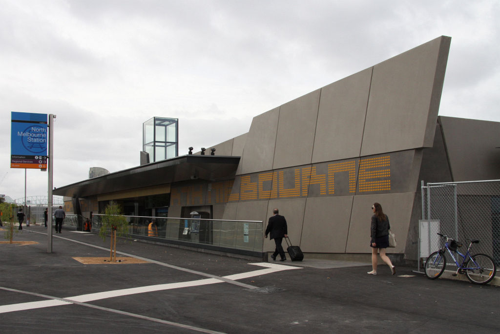
 North Melbourne railway station
The North Melbourne railway station is actually situated in West Melbourne, opposite the Railway Hotel on Ireland Street.
- 401 North Melbourne – University of Melbourne via Royal Melbourne Hospital, University of Melbourne (Monday to Friday). Operated by Sita Bus Lines.
A number of tram routes run along the periphery of the suburb, along Victoria Street, Peel/William Street and LaTrobe Street.
Culture
Churches
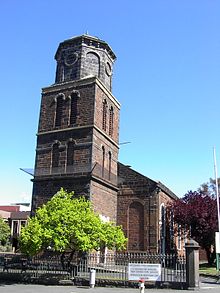 St James Old Cathedral
- West Melbourne Baptist
- St Mary Star of the Sea Catholic
- St James Old Cathedral (Melbourne's oldest cathedral, built in 1842)
- St Mary's Anglican
Hotels
- Carron Tavern, Spencer Street
- McMahons Hotel (Moomba Hotel, formerly North West Hotel), Spencer Street
- Railway Hotel, Ireland Street
- Royal Mail Hotel (formerly Maitz), Spencer Street
- Royal Standard Hotel, William Street
- Hotel Spencer, Spencer Street
- Three Crowns Hotel, Victoria Street
Restaurants
 One of the West Melbourne's restaurants
- Citrus Mint
- Kathmandu Cottage
- Warung Agus
- Le Taj
- Wild East
- Amiconi
- Fraus
- Tandoori Dhaba
Entertainment venues
- Festival Hall
- Witches in Britches
- The Looney Bin
Parks and gardens
- Flagstaff Gardens
- The Triangle Park (bounded by King St, Chetwynd St, Eades Place)
- The Pocket Park (bounded by William, Howard and Rosslyn Sts)
 Coode Island viewed from the west
Localities
North of the railway lines
The area bounded by Railway Parade and Spencer St has undergone significant change since 2000. While the region has always been mixed industry and residential, the industrial flavour of the area has diminished rapidly, as West Melbourne's population increases. In Dryburgh, Laurens, Ireland, Stanley and Adderley Streets, the majority of the warehouses have been converted to townhouse developments. The development nearby of the Docklands has had a significant impact on the perceived prestige of the area, and it is rapidly losing its status as one of the most affordable precincts with such proximity to the CBD.
Shopping
West Melbourne lays claim to the southern side of Victoria Street, meaning that a small range of restaurants and shops lie within its boundaries. Otherwise it has no shopping area of its own. However the Direct Factory Outlet development on Spencer St in the CBD, and Errol St North Melbourne sit just outside the boundary of West Melbourne.
Coode Island
Coode Island is a locality in West Melbourne's industrial zone. It is unusual in that although it is a locality of West Melbourne, with the creation of Melbourne Docklands and Bolte Bridge the area has become completely disonnected from the main area of the suburb.
It is the site of Victoria's major petrochemical storage facility. The area is named after engineer John Coode and retains the "Island" name despite no longer being an island.
References
- ^ Australian Bureau of Statistics (25 October 2007). "West Melbourne (State Suburb)". 2006 Census QuickStats. http://www.censusdata.abs.gov.au/ABSNavigation/prenav/LocationSearch?collection=Census&period=2006&areacode=SSC21729&producttype=QuickStats&breadcrumb=PL&action=401. Retrieved 2007-09-26.
- ^ Premier Postal History, Post Office List, https://www.premierpostal.com/cgi-bin/wsProd.sh/Viewpocdwrapper.p?SortBy=VIC&country=, retrieved 2008-04-11
External links
Coordinates: 37°48′40″S 144°56′02″E / 37.811°S 144.934°E
Suburbs of the City of Melbourne | Melbourne | Victoria Carlton · Carlton North · Docklands · East Melbourne · Flemington · Kensington · Melbourne CBD · North Melbourne · Port Melbourne · Parkville · Southbank · South Wharf · South Yarra · West Melbourne
Categories:- Suburbs of Melbourne


Wikimedia Foundation. 2010.