- List of districts of Lima
-
The province of Lima is divided into forty three districts of Lima (Spanish: distritos) which are administered by the Metropolitan Municipality of Lima[1] The city proper (urban area) of Lima is generally considered to be formed by thirty of these districts. The remaining thirteen districts consist of mostly rural and sparsely populated desert and mountainous areas. Of these peripheral districts, many of the coastal ones serve as beach resorts and their population —which is considerably smaller than that of the urban districts— increases during the summer months.
Districts of Lima
 Districts of the Lima province
 Urban districts of the Lima province
Area and population information on the following list has been retrieved from official data by the Peruvian National Institute of Statistics and Informatics (Spanish: Instituto Nacional de Estadística e Informática, INEI).[2] Demographic data is based on the 2005 Census carried out from 18 July through 20 August 2005. Population density is given to one decimal place in persons per square kilometer. UBIGEO numbers are codes used by INEI to identify national administrative subdivisions. Foundation dates have been retrieved from a compilation by the Peruvian Congress published in 2000.[3]
Districts UBIGEO Area
(km²)Population Population density
(/km²)Created Postal
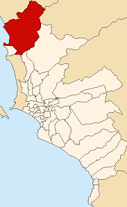
codeLocation Ancón 150102 299.22 29,419 98.3 29 October 1874 02 
Ate 150103 77.72 419,663 5,399.7 2 January 1857 03 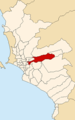
Barranco 150104 3.33 45,922 13,790.4 26 October 1874 04 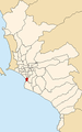
Breña 150105 3.22 94,808 29,443.5 15 July 1949 05 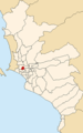
Carabayllo 150106 346.88 188,764 544.2 4 August 1821 06 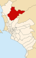
Chaclacayo 150107 39.5 39,686 1,004.7 24 April 1940 08 
Chorrillos 150108 38.94 262,595 6,743.6 2 January 1857 09 
Cieneguilla 150109 240.33 15,784 65.7 3 March 1970 40 
Comas 150110 48.75 464,745 9,533.2 12 December 1961 07 
El Agustino 150111 12.54 165,425 13,191.8 6 January 1965 10 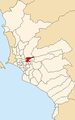
Independencia 150112 14.56 197,308 13,551.4 16 March 1964 28 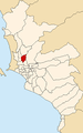
Jesús María 150113 4.57 58,588 12,820.1 13 December 1963 11 
La Molina 150114 65.75 124,468 1,893.0 6 February 1962 12 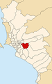
La Victoria 150115 8.74 190,218 21,764.1 16 August 1921 13 
Lima 150101 21.88 278,804 13,187.2 2 January 1857 01 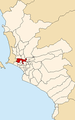
Lince 150116 3.03 52,123 17,202.3 20 May 1936 14 
Los Olivos 150117 18.25 286,549 15,701.3 7 April 1989 39 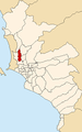
Lurigancho 150118 236.47 90,594 383.1 2 January 1857 15 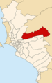
Lurín 150119 181.12 55,953 308.9 2 January 1857 16 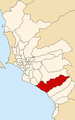
Magdalena del Mar 150120 3.61 48,445 13,419.7 10 May 1920 17 
Miraflores 150122 9.62 92,815 9,648.1 2 January 1857 18 
Pachacamac 150123 160.23 54,763 341.8 2 January 1857 19 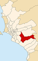
Pucusana 150124 37.83 9,231 244.0 22 January 1943 20 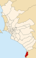
Pueblo Libre 150121 4.38 71,892 16,413.7 2 January 1857 21 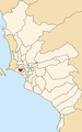
Puente Piedra 150125 71.18 203,473 2,858.6 14 February 1927 22 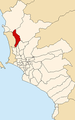
Punta Hermosa 150126 119.5 4,676 39.1 7 April 1954 24 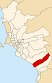
Punta Negra 150127 130.5 4,473 34.3 7 April 1954 23 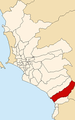
Rímac 150128 11.87 175,793 14,809.9 16 August 1921 25 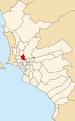
San Bartolo 150129 45.01 5,733 127.4 5 May 1946 26 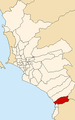
San Borja 150130 9.96 102,762 10,317.5 1 June 1983 41 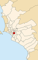
San Isidro 150131 11.1 55,309 6,165.6 24 April 1931 27 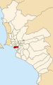
San Juan de Lurigancho 150132 131.25 812,656 6,191.7 13 January 1967 36 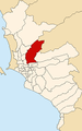
San Juan de Miraflores 150133 23.98 335,237 13,979.9 12 January 1965 29 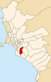
San Luis 150134 3.49 46,258 13,254.4 30 May 1968 30 
San Martín de Porres 150135 36.91 525,155 14,228.0 22 May 1950 31 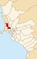
San Miguel 150136 10.72 124,904 11,651.5 10 May 1920 32 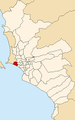
Santa Anita 150137 10.69 160,777 15,039.9 26 October 1989 43 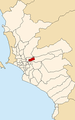
Santa María del Mar District 150138 9.81 88 9.0 16 January 1962 37 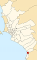
Santa Rosa 150139 21.5 9,379 436.2 7 February 1962 38 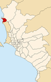
Santiago de Surco 150140 34.75 272,690 7,847.2 16 December 1929 33 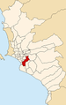
Surquillo 150141 3.46 84,202 24,335.8 15 July 1949 34 
Villa El Salvador 150142 35.46 367,436 10,362.0 1 June 1983 42 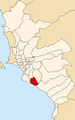
Villa María del Triunfo 150143 70.57 355,761 5,041.2 28 December 1961 35 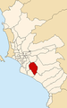
References
- ^ Municipalidad Lima. Municipalidad Lima. Retrieved 24 March 2008.
- ^ Instituto Nacional de Estadística e Informática. Banco de Información Distrital. Retrieved on 24 March 2008.
- ^ Carmen Lozada de Gamboa, Perú: demarcación territorial, vol. II, pp. 405–414.
See also
- Lima
- Lima Province
- Subdivisions of Peru
Lima and Callao Metropolitan Area Culture · History · Landmarks · Notable people · Mayors · Other elected officials · Transportation Districts Central Lima Breña · La Victoria · Lima · Rimac South Central Lima Barranco · Jesús María · La Molina · Lince · Magdalena · Miraflores · Pueblo Libre ·San Borja · San Isidro · San Miguel · Santiago de Surco · Surquillo Cono Este Ate · Cieneguilla · Chaclacayo · El Agustino · Lurigancho (Chosica) · San Juan de Lurigancho · San Luis · Santa Anita Cono Norte Ancón · Carabayllo · Comas · Independencia · Los Olivos · Puente Piedra · San Martin de Porres · Santa Rosa Cono Sur Chorrillos · Lurín · Pachacamac · Pucusana · Punta Hermosa · Punta Negra · San Bartolo · San Juan de Miraflores · Santa María del Mar · Villa el Salvador · Villa María del Triunfo Callao Bellavista · Callao District · Carmen de la Legua Reynoso· La Perla · La Punta · Ventanilla  Peru-related lists
People Geography Regions · Cities · Districts of Lima · Islands · Lakes · Mountains · Natural regions · Protected areas · Rivers · VolcanoesNature Politics Institutions Other See also PeruCategories:- Districts of Lima
- Peru-related lists


Wikimedia Foundation. 2010.