- Delhi, Louisiana
-
Town of Delhi D-Town Town  Delhi Municipal Building
Country United States State Louisiana Parish Richland Elevation 89 ft (27.1 m) Coordinates 32°27′21″N 91°29′36″W / 32.45583°N 91.49333°W Area 2.6 sq mi (6.7 km2) - land 2.5 sq mi (6 km2) - water 0.1 sq mi (0 km2), 3.85% Population 3,066 (2000) Density 1,215.2 / sq mi (469.2 / km2) Timezone CST (UTC-6) - summer (DST) CDT (UTC-5) Area code 318 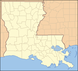
 Location of Delhi in Louisiana
 Location of Louisiana in the United States
 A look at part of downtown Delhi
 Abandoned theater in downtown Delhi
 First Baptist Church in Delhil; pastor Mickey Bounds (2010)
Delhi, originally called Deerfield, is a town in Richland Parish, Louisiana, in the United States. As of the 2000 census, the town population was 3,066.
Contents
History
During the American Civil War, Delhi and Monroe, the seat of Ouachita Parish, were both overcrowded with unwelcome refugees from rural areas to the east when the forces of General U.S. Grant moved into northeastern Louisiana and spent the winter of 1862-1863 at Winter Quarters south of Newellton in Tensas Parish in preparation for the siege of Vicksburg, Mississippi, not completed until July 4, 1863. Historian John D. Winters reported "strong Union sympathy" in both Delhi and Monroe.[1]
In the 1940s, Delhi was the center of a large natural gas boom, and several functioning gas fields still surround the town.
On February 21, 1971, Louisiana's only recorded F5 tornado struck Delhi. It took forty-six lives and was the deadliest F5 tornado to hit the United States since the Jackson, Mississippi, Candlestick Park Tornado five years earlier in 1966 and the earliest confirmed F5 tornado during a year. Later, on May 3, 1999, it lost its record as most destructive tornado in history to the Moore, Oklahoma Tornado.
Geography
Delhi is located at 32°27′21″N 91°29′36″W / 32.45583°N 91.49333°W (32.455948, -91.493345)[2]. The town lies at the confluence of US Highway 80 and Louisiana Highway 17, and near to Interstate Highway 20.
According to the United States Census Bureau, the town has a total area of 2.6 square miles (6.7 km2), of which, 2.5 square miles (6.5 km2) of it is land and 0.1 square miles (2.33%) of it is water.
The elevation of 89 ft (27 m) spared Delhi from the brunt of the Great Mississippi Flood of 1927 that destroyed most of the surrounding Mississippi River Delta area.
The newly constructed Poverty Point Reservoir, which hosts the acclaimed Black Bear Golf Club, is located just north of the town on Louisiana Highway 17 near Warden, Louisiana.
Demographics
As of the census[3] of 2000, there were 3,066 people, 1,129 households, and 788 families residing in the town. The population density was 1,215.2 people per square mile. There were 1,253 housing units at an average density of 496.6 per square mile. The racial makeup of the town was 42.24% White, 56.78% African American, 0.07% Native American, 0.10% Asian, 0.36% from other races, and 0.46% from two or more races. Hispanic or Latino of any race were 0.98% of the population.
There were 1,129 households out of which 32.4% had children under the age of 18 living with them, 41.5% were married couples living together, 24.5% had a female householder with no husband present, and 30.2% were non-families. 27.3% of all households were made up of individuals and 15.7% had someone living alone who was 65 years of age or older. The average household size was 2.54 and the average family size was 3.10.
In the town the population was spread out with 26.7% under the age of 18, 10.2% from 18 to 24, 25.9% from 25 to 44, 18.4% from 45 to 64, and 18.9% who were 65 years of age or older. The median age was 36 years. For every 100 females there were 80.8 males. For every 100 females age 18 and over, there were 76.0 males.
The median income for a household in the town was $21,763, and the median income for a family was $25,651. Males had a median income of $25,054 versus $12,837 for females. The per capita income for the town was $11,161. About 26.2% of families and 31.6% of the population were below the poverty line, including 45.7% of those under age 18 and 21.8% of those age 65 or over.
Education
Public schools in Richland Parish are operated by the Richland Parish School Board. Three campuses serve the town of Delhi - Delhi Elementary School (Grades PK-4), Delhi Middle School (Grades 5-8), Delhi High School (Grades 9-12), and Delhi Charter School (DCS) (K-12).
Notable natives and residents
- Lenny Fant, basketball coach at the University of Louisiana at Monroe from 1957–1979, coached at Delhi High School from 1950-1953.
- Earl Holliman, film and television actor.
- Arlene Howell, a.k.a. Eurlyne Howell, was an American television actress who held the Miss USA title in 1958.
- Tim McGraw, country musician.
- Pat "Gravy" Patterson, longtime baseball coach at Louisiana Tech University.
- Steve Pylant, sheriff of Franklin Parish and incoming Republican member of the Louisiana House of Representatives, resides in Franklin Parish near Delhi.
- Charles and Sam Wyly, businessmen who endowed Wyly Tower of Learning at Louisiana Tech
References
- ^ John D. Winters, The Civil War in Louisiana, Baton Rouge: Louisiana State University Press, 1963, ISBN 0-8071-0834-0, pp. 308-309
- ^ "US Gazetteer files: 2010, 2000, and 1990". United States Census Bureau. 2011-02-12. http://www.census.gov/geo/www/gazetteer/gazette.html. Retrieved 2011-04-23.
- ^ "American FactFinder". United States Census Bureau. http://factfinder.census.gov. Retrieved 2008-01-31.
External links
- Delhi Progress Community Progress Site for Delhi, LA
- Delhi Sweet Potato Plant Sweet Potato Plant Greeniest Biggest In The World!!(Coming Fall 2010)
Municipalities and communities of Richland Parish, Louisiana Towns Delhi | Rayville

Village Unincorporated
communityCategories:- Populated places in Richland Parish, Louisiana
- Towns in Louisiana
- Populated places in Louisiana with African American majority populations


Wikimedia Foundation. 2010.