- Mazingarbe
-
Mazingarbe
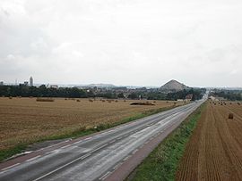
Road to Lens with a slag heap in the background 
 MazingarbeLocation within Nord-Pas-de-Calais region
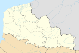 Mazingarbe
Administration Country France Region Nord-Pas-de-Calais Department Pas-de-Calais Arrondissement Lens Canton Bully-les-Mines Intercommunality Communaupole de Lens-Liévin Mayor Bernard Urbaniak
(2008–2014)Statistics Elevation 26–74 m (85–243 ft)
(avg. 33 m/108 ft)Land area1 10.27 km2 (3.97 sq mi) Population2 7,564 (2006) - Density 737 /km2 (1,910 /sq mi) INSEE/Postal code 62563/ 62670 1 French Land Register data, which excludes lakes, ponds, glaciers > 1 km² (0.386 sq mi or 247 acres) and river estuaries. 2 Population without double counting: residents of multiple communes (e.g., students and military personnel) only counted once. Coordinates: 50°28′26″N 2°43′09″E / 50.4738888889°N 2.71916666667°E
Mazingarbe is a commune in the Pas-de-Calais department in the Nord-Pas-de-Calais region of France.
Contents
History
The village was known as Masengarba in 1046, Masengarbe in 1232 and Mazengarbe in 1558.
Mazingarbe’s first inhabitants, as far as can be ascertained, were Neolithic farmers who grew grain and raised sheep, pigs and oxen. Many flint tools have been found dating from this period. Other archaeological excavations have unearthed pottery, clay tiles, tools, jewelry and bones, evidence of occupation of the site at the beginning of the first millennium of a Gallo-Roman villa at a place called Le Marais Bray.
In 1046 the village was mentioned as the villa Mazengarba confirmed as a possession of the abbey of Marchiennes. The estate and its lands remained the property of the church until the French Revolution. Under the Ancient Regime, the population was predominantly agricultural. Like most towns and villages of the Artois, Mazingarbe had suffered the ravages of invasions, wars and looting, epidemics of plague, fires and harsh winters. In 1790, there were 328 inhabitants. The records of Croÿ, dating from the early 17th century, show Mazingarbe at that time as a modest little village gathered around a church.
Mazingarbe was home to less than 800 people before the opening, in 1859, of the first coal mine, No. 2. Pits No. 6 (1876) and No. 7 (1877) followed later. The population grew at the same speed as industry, the city hosting several waves of immigrant workers, first Belgians and Italians and then later mostly Polish. The creation of a treatment plant and coal processing plant in 1896, which later became a large chemical complex, significantly enhanced the town.
Mazingarbe suffered heavy damage during the Great War. The battlefront was only two kilometres away at Vermelles.
The Second World War didn’t spare the town either. An Allied aerial bombardment of the factories and mines, in September 1943, claimed 27 civilian victims.Geography
Mazingarbe is located 3 miles (4.8 km) northwest of Lens, at the junction of the D176 and the D75 roads. The A26 motorway passes through the commune.
Population
Population history 1962 1968 1975 1982 1990 1999 2006 9300 10060 8992 8114 7829 7470 7564 Census count starting from 1962: Population without duplicates Places of interest
- The church of St.Rictrude, dating from the nineteenth century.
- A nineteenth century chateau, now the Hotel deVille (Town Hall).
- The war memorial.
- Two chapels.
- The Commonwealth War Graves Commission cemeteries.
See also
References
External links
- Official website of the commune (French)
- The CWGC cemetery
- The CWGC graves in the communal cemetery
- Mazingarbe on the Quid website (French)
Categories:- Communes of Pas-de-Calais
- Pas-de-Calais geography stubs


Wikimedia Foundation. 2010.