- Diagonal, Iowa
-
Diagonal, Iowa — City — Location of Diagonal, Iowa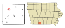
Coordinates: 40°48′32″N 94°20′29″W / 40.80889°N 94.34139°WCoordinates: 40°48′32″N 94°20′29″W / 40.80889°N 94.34139°W Country  United States
State  Iowa
IowaCounty Ringgold Area – Total 0.9 sq mi (2.4 km2) – Land 0.9 sq mi (2.4 km2) – Water 0.0 sq mi (0.0 km2) Elevation 1,148 ft (350 m) Population (2000) – Total 312 – Density 343.5/sq mi (132.6/km2) Time zone Central (CST) (UTC-6) – Summer (DST) CDT (UTC-5) ZIP code 50845 Area code(s) 641 FIPS code 19-21270 GNIS feature ID 0455904 Diagonal is a city in Ringgold County, Iowa, United States. The population was 312 at the 2000 census.
Contents
Geography
Diagonal is located at 40°48′32″N 94°20′29″W / 40.80889°N 94.34139°W (40.808819, -94.341510)[1] along the Grand River.
According to the United States Census Bureau, the city has a total area of 0.9 square miles (2.3 km2), all of it land.
Demographics
As of the census[2] of 2000, there were 312 people, 139 households, and 87 families residing in the city. The population density was 343.5 people per square mile (132.4/km²). There were 154 housing units at an average density of 169.6 per square mile (65.3/km²). The racial makeup of the city was 100.00% White.
There were 139 households out of which 23.0% had children under the age of 18 living with them, 54.0% were married couples living together, 5.8% had a female householder with no husband present, and 36.7% were non-families. 31.7% of all households were made up of individuals and 16.5% had someone living alone who was 65 years of age or older. The average household size was 2.24 and the average family size was 2.85.
In the city the population was spread out with 21.2% under the age of 18, 10.9% from 18 to 24, 25.3% from 25 to 44, 24.4% from 45 to 64, and 18.3% who were 65 years of age or older. The median age was 40 years. For every 100 females there were 92.6 males. For every 100 females age 18 and over, there were 87.8 males.
The median income for a household in the city was $24,063, and the median income for a family was $28,393. Males had a median income of $22,083 versus $18,958 for females. The per capita income for the city was $16,601. About 16.5% of families and 15.8% of the population were below the poverty line, including 23.7% of those under age 18 and 13.3% of those age 65 or over.
See also
- W.J. Buck Polygonal Barn, listed on the National Register of Historic Places
References
- ^ "US Gazetteer files: 2010, 2000, and 1990". United States Census Bureau. 2011-02-12. http://www.census.gov/geo/www/gazetteer/gazette.html. Retrieved 2011-04-23.
- ^ "American FactFinder". United States Census Bureau. http://factfinder.census.gov. Retrieved 2008-01-31.
Municipalities and communities of Ringgold County, Iowa Cities Beaconsfield | Benton | Clearfield‡ | Delphos | Diagonal | Kellerton | Maloy | Mount Ayr | Redding | Shannon City‡ | Tingley

Footnotes ‡This populated place also has portions in an adjacent county or counties
Categories:- Cities in Iowa
- Populated places in Ringgold County, Iowa

Wikimedia Foundation. 2010.