- Malvern, Iowa
-
Malvern, Iowa — City — Location of Malvern, Iowa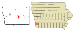
Coordinates: 41°0′17″N 95°35′4″W / 41.00472°N 95.58444°W Country  United States
State  Iowa
IowaCounty Mills Area – Total 1.2 sq mi (3.1 km2) – Land 1.2 sq mi (3.1 km2) – Water 0.0 sq mi (0.0 km2) Elevation 1,007 ft (307 m) Population (2000) – Total 1,256 – Density 1,053.1/sq mi (406.6/km2) Time zone Central (CST) (UTC-6) – Summer (DST) CDT (UTC-5) ZIP code 51551 Area code(s) 712 FIPS code 19-48720 GNIS feature ID 0458747 Malvern is a city in Mills County, Iowa, United States. The population was 1,256 at the 2000 census, estimated in 2008 at 1,323.[1] The Wabash Trace--a railroad converted to a bicycle trail—passes through Malvern. The Mills County Fair is held here, although Glenwood is the county seat. Malvern is the largest town in the eastern half of the county.
Contents
History
The pioneer village of Milton was established in the fall of 1869. It was later renamed Malvern when it was discovered that there was already another Milton, Iowa. It was one of four communities in the area that came into existence with the completion of the Burlington and Missouri River Railroad on November 18, 1869.
John D. Paddock and his bride were the first residents of Malvern. They arrived in September and put up a small 1 1⁄2-story building that served as their home and the community’s first store.
The completion of the railroad soon brought a flood of new residents and business enterprises. White Cloud, a town of perhaps 200 persons and a variety of businesses, was located about where the present Wabash Trace Nature Trail crosses the Nishnabotna River three miles southeast of Malvern. It soon closed down when the new railroad was built two miles north. Several business enterprises and White Cloud residents moved to Malvern.
Malvern grew almost explosively in its first two years. In its fifth year, Mr. Paddock reported in his Brief History of Malvern, it had a population of 800. It served a particularly productive farming area. It soon had a number of factories, including a hog packing plant, an electric generation plant (in 1892) which permitted a municipal water system, and in the early part of the twentieth century, developed a varied poultry industry that at one time furnished employment for up to 200 persons. Malvern started a school system in 1870, a county fair in 1873, a Chautauqua in 1905, built the town library in 1916 and the present Liberty Memorial Community Building in 1926
When the “good roads” movement came to Iowa, the town was omitted from Highway 34, causing some economic stress. At the time it also had the Wabash and Tabor & Northern Railroads, which were also having some economic stress. The town experienced additional stress in the 1950s when much of Iowa’s poultry industry moved to Arkansas.
The success of the Malvern community has always been linked to agriculture in many ways. When fewer family farms and farm workers, became the norm, in the 1960s, 1970’s, and especially the difficult 1980’s, the economy of Malvern suffered as well, losing many of the established businesses that had so long lined the streets in this community.
Today Malvern is a rural community with its own school system recently renamed as East Mills, a golf course, swimming pool, new library and Carnegie Conference Center, agricultural businesses and government offices, a bank, two residential care facilities, physician’s offices, Mills County Fair Grounds, the Wabash Trace Nature Trail, and numerous other small businesses. Population in Mills County is growing at one of the top ten rates across the state of Iowa. Malvern’s population is growing as well thanks to new housing developments in and around the community.
Geography
Malvern is located at 41°0′17″N 95°35′4″W / 41.00472°N 95.58444°WCoordinates: 41°0′17″N 95°35′4″W / 41.00472°N 95.58444°W [2].
According to the United States Census Bureau, the city has a total area of 1.2 square miles (3.1 km2), all of it land.
Demographics
As of the census[3] of 2000, there were 1,256 people, 474 households, and 320 families residing in the city. The population density was 1,053.1 people per square mile (407.5/km²). There were 503 housing units at an average density of 421.8 per square mile (163.2/km²). The racial makeup of the city was 98.73% White, 0.08% African American, 0.08% Native American, 0.08% Asian, and 1.04% from two or more races. Hispanic or Latino of any race were 0.40% of the population.
There were 474 households out of which 31.6% had children under the age of 18 living with them, 55.5% were married couples living together, 8.9% had a female householder with no husband present, and 32.3% were non-families. 28.9% of all households were made up of individuals and 16.9% had someone living alone who was 65 years of age or older. The average household size was 2.49 and the average family size was 3.08.
Population spread: 26.5% under the age of 18, 6.0% from 18 to 24, 24.1% from 25 to 44, 23.3% from 45 to 64, and 20.1% who were 65 years of age or older. The median age was 40 years. For every 100 females there were 90.6 males. For every 100 females age 18 and over, there were 88.8 males.
The median income for a household in the city was $33,182, and the median income for a family was $44,432. Males had a median income of $29,185 versus $22,266 for females. The per capita income for the city was $15,553. About 7.1% of families and 11.2% of the population were below the poverty line, including 9.0% of those under age 18 and 13.4% of those age 65 or over.
References
- ^ http://factfinder.census.gov/servlet/SAFFPopulation?_event=Search&geo_id=16000US1931350&_geoContext=01000US%7C04000US19%7C16000US1931350&_street=&_county=Malvern&_cityTown=Malvern&_state=04000US19&_zip=&_lang=en&_sse=on&ActiveGeoDiv=geoSelect&_useEV=&pctxt=fph&pgsl=160&_submenuId=population_0&ds_name=null&_ci_nbr=null&qr_name=null®=null%3Anull&_keyword=&_industry=
- ^ "US Gazetteer files: 2010, 2000, and 1990". United States Census Bureau. 2011-02-12. http://www.census.gov/geo/www/gazetteer/gazette.html. Retrieved 2011-04-23.
- ^ "American FactFinder". United States Census Bureau. http://factfinder.census.gov. Retrieved 2008-01-31.
External links
Metropolitan area of Omaha-Council Bluffs Primary Cities NebraskaIowa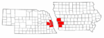
Cities over 10,000
(per 2000 Census)NebraskaCities of 5,000 to 10,000
(per 2000 Census)NebraskaIowaCities of 1,000 to 5,000
(per 2000 Census)NebraskaIowaCensus-designated places NebraskaCities and villages
of fewer than 1,000
(per 2000 Census)NebraskaAlvo · Avoca · Bennington · Boys Town · Cedar Bluffs · Cedar Creek · Ceresco · Colon · Elmwood · Fort Calhoun · Greenwood · Herman · Ithaca · Kennard · Leshara · Malmo · Manley · Mead · Memphis · Morse Bluff · Murdock · Murray · Nehawka · Prague · South Bend · Union · Valparaiso · Washington · Waterloo · WestonIowaCounties NebraskaIowaMunicipalities and communities of Mills County, Iowa Cities Emerson | Glenwood | Hastings | Henderson | Malvern | Pacific Junction | Silver City | Tabor‡

Unincorporated
communitiesHillside | Mineola
Footnotes ‡This populated place also has portions in an adjacent county or counties
Categories:- Cities in Iowa
- Populated places in Mills County, Iowa


Wikimedia Foundation. 2010.