Appenzell Alps

Appenzell Alps

Geobox|Range
name=Appenzell Alps
other_name= _fr. Alpes appenzelloises
other_name1= _de. Appenzeller Alpen


image_caption=Churfirsten group, with the Schibestoll, Zuestoll, Brisi, Frümsel and Selun (left to right)
country=Switzerland
region_type=Cantons
region=Appenzell Ausserrhoden| region1=Appenzell Innerrhoden
region2=St. Gallen
unit=Alps
border=Glarus Alps|border1=Rätikon
length_imperial=| length_orientation=
width_imperial= | width_orientation=
geology= | period= | orogeny=
highest=Säntis
highest_elevation=2502
highest_lat_d=46|highest_lat_m=38|highest_lat_s=28|highest_lat_NS=N
highest_long_d=8|highest_long_m=25|highest_long_s=6|highest_long_EW=E


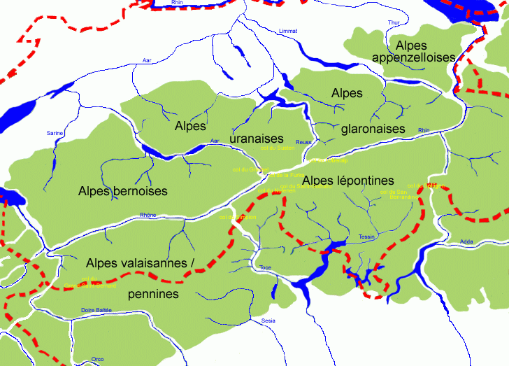
map_caption=Central Alps (Appenzell Alps marked as "Alpes appenzelloises")

The Appenzell Alps are a mountain range in Switzerland on the northern edge of the Alps. They extend into the cantons of Appenzell Ausserrhoden, Appenzell Innerrhoden and St. Gallen and are bordered by the Glarus Alps to the west and the Rätikon to the south-east.

The range is split up into six sub-ranges:
* Alpstein, central group, highest summit: Altmann, 2,435 m
* Alpstein, northern group, highest summit: Säntis, 2,502 m
* Alpstein, southern group, highest summit: Roslen- or Saxerfirst, 2,151 m
* Alviergruppe, highest summit: Gamsberg, 2,385 m
* Churfirsten, highest summit: Hinterrugg, 2,306 m
* Speer - Mattstock, highest summit: Speer, 1,950 m

Principal summits

The principal summits of the Appenzell Alps are:
* Säntis, 2,502 m
* Girenspitz, 2,448 m
* Altmann, 2,436 m
* Gamsberg, 2,385 m
* Fulfirst, 2,384 m
* Wildhuser Schafberg, 2,373 m
* Wisswand, 2,346 m
* Alvier, 2,343 m
* Hinterrugg, 2,306 m
* Brisi, 2,279 m
* Frümsel, 2,267 m
* Zuestoll, 2,235 m
* Margelchopf, 2,163 m
* Silberplatten, 2,158 m
* Schibestoll, 2,136 m
* Leistchamm, 2,101 m
* Gamser Rugg, 2,076 m
* Kreuzberge, 2,065 m
* Lütispitz, 1,987 m
* Speer, 1,950 m
* Mattstock, 1,936 m
* Schäfler, 1,924 m
* Federispitz, 1,865 m
* Gonzen, 1,830 m
* Hoher Kasten, 1,795 m
* Gulmen, 1,789 m
* Stockberg, 1,781 m
* Kronberg, 1,663 m
* Ebenalp, 1,640 m
* Hochalp, 1,521 m

Other interesting summits

* Tanzboden, 1443 m
* Chrüzegg, 1314 m
* Gäbris, 1247 m
* Hörnli, 1133 m
* Köbelisberg, 1131 m
* Bachtel, 1115 m

ee also

*Swiss Alps

External links

[http://www.summitpost.org/area/range/170869/appenzell-alps-alpstein-.html The Appenzell Alps on SummitPost]


Wikimedia Foundation. 2010.

Игры ⚽ Поможем написать реферат

Look at other dictionaries:

  • Appenzell Innerrhoden — Kanton Appenzell Innerrhoden   Canton of Switzerland   …   Wikipedia

  • Alps — Alpe redirects here. For the German river, see Alpe (river). For other uses, see Alps (disambiguation). Alps Range The …   Wikipedia

  • Swiss Alps — Satellite image of Switzerland in October 2002. On the north side of the Alps, the regions located above 2000 m are covered by snow. The canton of Ticino (on the south side) is almost snow free in early autumn. The Swiss Alps (German: Schweizer… …   Wikipedia

  • Glarus Alps — Geobox|Range name=Glarus Alps other name= fr. Alpes glaronaises other name1= de. Glarner Alpen image caption=Tödi country=Switzerland region type=Cantons region=Glarus| region1=Uri | region2=Graubünden region3=St Gallen unit=Alps border=Urner… …   Wikipedia

  • Geography of the Alps — The Alps cover a large area. This article describes the delimitation of the Alps as a whole and of subdivisions of the range, follows the course of the main chain of the Alps and discusses the lakes and glaciers found in the region.The Alps form… …   Wikipedia

  • History of the Alps — The valleys of the Alps have been inhabited since prehistoric times. Alpine culture centers around transhumance.Early historyThe Wildkirchli caves in the Appenzell Alps show traces of Neanderthal habitation. During the last glacial maximum, the… …   Wikipedia

  • Northern Alps — may be: the Alps north of the Periadriatic Seam the Alps north of the Main chain of the Alps Glarus Alps Appenzell Alps Northern Limestone Alps Hida Mountains, Japan See also Geography of the Alps Southern Alps (disambiguation) Eastern Alps… …   Wikipedia

  • North-Eastern Swiss Alps — This article focuses on the part of the Alps and Pré Alps that is located in North Eastern Switzerland. This region is bordered by: Lake Lucerne in the south west; the Klausen Pass, upper Linth valley and Lake Walen in the south; the Rhine valley …   Wikipedia

  • St. Gallen — Infobox Swiss town subject name = St. Gallen municipality name = St. Gallen municipality type = municipality imagepath coa = Coa St. Gallen.png languages = German canton = St. Gallen iso code region = CH SG district = St. Gallen lat d=47|lat… …   Wikipedia

  • Säntis — Infobox Mountain Name = Säntis Photo = Alt St. Johann.jpg Caption = Alt St. Johann with Säntis Elevation = convert|2502|m|ft|0|lk=on Location = Switzerland Range = Appenzell Alps Prominence = 2021 m (6630 ft) (#13 in the Alps) latd= 47|latm=14… …   Wikipedia

Share the article and excerpts

Direct link
Do a right-click on the link above
and select “Copy Link”