- Mainalo
-
For the village in Arcadia, Greece, see Mainalo, Arcadia.
Mainalo/Menalo 
Elevation 1,986 m (6,516 ft) Location Location northern Arcadia, Greece Range approx. 25 km, north to south
approx. from 5 to 10 km from east to westCoordinates 37°39′50″N 22°13′0″E / 37.66389°N 22.216667°E Climbing Easiest route climb The Mainalo (Greek, Modern: Μαίναλο, Ancient/Katharevousa: Μαίναλον; older form: Mainalon; Latin: Mænalus), is a mountain range that spans about 15 to 20 from north to south (southwest of Tripoli to NE of Vytina) and from east to west from 5 to 10 km. (from Zygovisti to Kapsas.
Much of the area used to be covered in old-growth forests but most were burnt in 2000 and especially in September 2011.
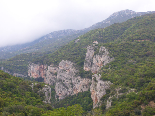
In the medieval times and until the late-20th century, the mountain was known as Apano Chrepa. It is also a village which is located in the mountain range and dates back to the ancient times. The mountain is home to the skiing resort which is located in the middle of a mountain 20 km NW of Tripoli and 9 km SW of GR-74/GR-33, northbound. The elevation of the skiing resort is at 1,550 m. The panorama of the northern part of Arcadia and the Lyrkian mountains. There is a communications tower which broadcasts television and radio stations to Tripoli. It is located about 140 km SW of Patras, about 75 km S of Kalavryta, about 20 km SW of E65 superhighway, about 85 km (old: about 120 km SW of Corinth, 80 km W of Argos and about 90 km W of Nafplio, about 90 km (old: 100 km) ENE of Kalamata and about 140 km E of Pyrgos. The name of the mountain comes from a figure in Greek mythology. The mountain range is entirely surrounded by roads, the GR-74 runs around the Mainalo to the north and the east and a road linking Tripoli and villages W of Tripoli and to Vytina with a low speed limit is to the south and west. The western part west of Mainalo does not have much roads. The mountaintop which is also known as Ostrakia elevates at 1,860 m is in the northwest central part. Mainalo is also the tallest mountain in Arcadia. The highest mountaintop is named Profiti Ilia. The entire area is also a parkland.Contents
Nearest places
- Thana, SE
- Tripoli, SE
- Chania, ESE
- Kapsas, E
- Levidi, N
- Vytina, NW
- Magouliana, NW
- Dimitsana, W
- Piana, W
- Zygovisti, SW
- Davia, SW
Source of name
Mythical Maenalus son of Lycaon, is the founder of Maenalus (at that time town in Arcadia).[1]
For yet another mythical person of the same name see also: www.mythindex.com: Maenalus.
Persons
There were also ancient Olympic gold medallists that were from Mainalos:
- Androsthenes of Maenalus, won gold in 420 and 416 BC.
- Euthymenes of Maenalus, won gold in 400 and 392 BC.
References
External links
Categories:- Arcadia
- Mountains of Greece
Wikimedia Foundation. 2010.