- Dudley Tunnel
-
Dudley Tunnel 
Overview Location Dudley, Birmingham, England Coordinates 52°31′03″N 2°05′12″W / 52.517544°N 2.086741°WCoordinates: 52°31′03″N 2°05′12″W / 52.517544°N 2.086741°W OS grid reference SO942910 Status Part-open Waterway Dudley Canal No 1 Line Start 52°31′18″N 2°04′42″W / 52.52173°N 2.07840°W End 52°30′04″N 2°06′03″W / 52.50110°N 2.10086°W Operation Opened 25 June 1791 Owner British Waterways Technical Construction 1775 - 1791 Length 3,172 yards (2,900.5 m) Towpath No Boat-passable No 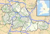
 Location of Dudley Tunnel in the West Midlands
Dudley Tunnel is a canal tunnel on the Dudley Canal Line No 1, England. At about 3,172 yards (2,900.5 m) long, it is now the second longest canal tunnel on the UK canal network today. (Standedge Tunnel is the longest, at 5,456 yards (4,989.0 m), and the 3,931 yards (3,594.5 m) Higham and Strood tunnel is now rail only). However, since the Dudley Tunnel is not continuous this status is sometimes questioned: (the main tunnel is 2,942 yards (2,690.2 m), Lord Ward's tunnel is 196 yards (179.2 m) and Castle Mill basin is 34 yards (31.1 m)).
In 1959 the British Transport Commission sought to close the tunnel but this led to an Inland Waterways Association-organised massed protest cruise in 1960. The tunnel was however closed in 1962; and was further threatened with permanent closure by British Railways who wished to replace a railway viaduct at the Tipton portal with an embankment and a culvert.[1] However, this never happened as the railway was closed in 1968 and the disused bridge demolished in the 1990s.[2]
The tunnel was reopened in 1973, as a result of restoration, which had been a collaboration between local volunteers (originally the Dudley Canal Tunnel Preservation Society, later the Dudley Canal Trust), and the local authority, Dudley Borough Council. The opening ceremony was advertised as "TRAD 1973 - Tunnel Reopening at Dudley".[1]
Contents
Construction of the tunnel(s)
Dudley Tunnel Legend

Dudley Canal 
Tipton portal 
Lord Ward's tunnel 
Shirts Mill basin 


Castle Mill basin 
Wrens Nest tunnel 1989 tunnel 

Cathedral arch 

Little Tess cavern Rock Tunnel 
Hurst cavern 1984 tunnel Singing Cavern East basin Dudley Canal Tunnel West basin 
Parkhead portal Dudley Canal A private Act of Parliament to construct the tunnel and associated canal, later to be known as the Dudley Canal Line No. 1, was passed in 1776. However Lord Dudley and Ward started building a canal and tunnel, in 1775, to link his Tipton Colliery and his lime works to the Birmingham Canal Navigations, at Tipton, on the 473 ft Wolverhampton Level. He later agreed to sell the canal and tunnel to the Dudley Canal Company. The Dudley Canal Line No. 1 and Dudley Tunnel were reported as finished on 25 June 1791.
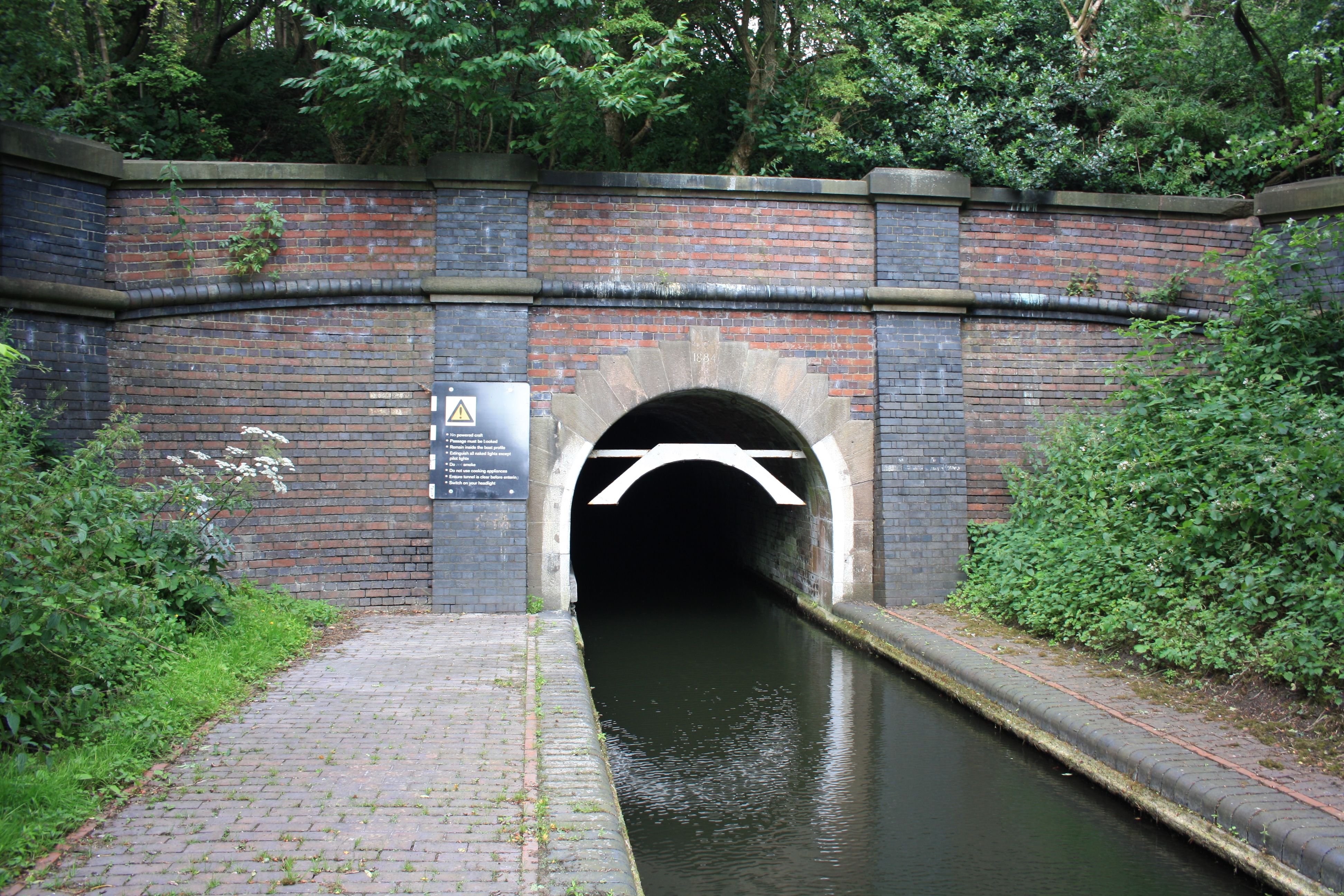
The earliest part of tunnel system was built to help with the transport of limestone extracted from the mines inside Castle Hill through which the tunnel runs. This was Lord Ward's tunnel, which leads to Castle Mill Basin. From there the main tunnel runs, via the Cathedral Arch, to Parkhead, near Netherton. At Cathedral Arch a branch canal lead into the Little Tess Cavern mine workings. This route is now blocked, but has been by-passed by two new tunnels (see below). The southern end, including the southern portal, of the tunnel had to be rebuilt in 1884 due to subsidence caused by adjacent coal mines. This section of the tunnel was built several feet wider than the original tunnel bore. The southern portal bears a brick date stone of 1884.
Another 1,227-yard (1,122 m) canal tunnel at Castle Mill Basin, now blocked off by a dam, leads under Wren's Nest to two under ground basins, east basin and west basin, and was used to transport limestone from the underground mine workings. Surface quarries were also opened; they outlasted the underground workings and were last used in the early 1920s. The land above the underground workings, together with the surface quarries, became a National Nature Reserve.
Dudley Tunnel today
In 1989 two completely new canal tunnels were made, linking Singer Cavern and the Rock Tunnel, via Little Tess Cavern, to Castle Mill Basin (the northern portal of the main tunnel).
The restrictive dimensions of the tunnel and the absence of a towpath mean that many boats are unable to pass through it. Those that can are not allowed to use diesel engines due to the lack of ventilation in the tunnel.
Visitors to the adjacent Black Country Living Museum, which opened in 1976, may take a battery-powered narrowboat trip either through the tunnel or partway through the tunnel and the adjacent mines; and, also, try legging the boat.
The rock on Castle Hill into which the tunnel is dug, Oolitic limestone, allows visitors to see Trilobite fossils preserved within it. Some fossils which were considered notable and were located close to the water line, have been removed to prevent them from being eroded and attacked by visitors. Other parts of the tunnel pass through a granite-type rock known locally as Rowley Rag; and through coal measures.
The Netherton Tunnel follows a parallel route 1½ miles to the south east; it is much larger and has twin towpaths running through it. It was built to ease congestion in the Dudley Tunnel.
Coordinates
(With links to map and aerial photo sources)
Point Coordinates OS Grid ref. Northern portal 52°31′18″N 2°04′42″W / 52.52173°N 2.07840°W SO947917 Southern portal 52°30′04″N 2°06′03″W / 52.50110°N 2.10086°W SO932892 See also
- Lapal Tunnel
- Legging (canals)
- List of canal tunnels in Great Britain
- Parkhead Viaduct
- Wren's Nest quarry
References
Further reading
- (N/A) (1973). Dudley Tunnel TRAD 1973: Dudley Canal Tunnel: A Guide Commemorating the Restoration of the Tunnel and the Official Reopening by Sir Frank Price, Chairman, British Waterways Board, and Alderman E. Morris, J.P., Mayor of Dudley. Dudley: Dudley Canal Trust.
External links
Categories:- Canal tunnels in England
- Transport in Dudley
- Birmingham Canal Navigations
- Canals in the West Midlands (county)
- Tunnels in the West Midlands (county)
- Tunnels completed in 1791

Wikimedia Foundation. 2010.