- Jerseyville, Illinois
-
For the small town of the same name in New South Wales, Australia, see Jerseyville, New South Wales.
Jerseyville City  The Jersey County Courthouse in Downtown Jerseyville, 1988
Country United States State Illinois County Jersey Township Jersey Elevation 659 ft (200.9 m) Coordinates 39°7′15″N 90°19′39″W / 39.12083°N 90.3275°W Area 4.4 sq mi (11.4 km2) - land 4.4 sq mi (11 km2) - water 0 sq mi (0 km2), 0% Population 8,465 (2010) Density 1,817.9 / sq mi (701.9 / km2) Founded 1827 - Incorporated Town July 21, 1837 - City Charter February 21, 1867 Government Mayor-Council Mayor Richard Perdun Timezone CST (UTC-6) - summer (DST) CDT (UTC-5) Postal code 62052 Area code 618 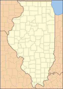
 Location of Jerseyville within Illinois
 Location of Illinois in the United States
Website: http://www.jerseyville-il.us/ Jerseyville is a city in Jersey County, Illinois, United States. As of the 2010 U.S. census, the city had a total population of 8,465. It is the county seat of Jersey County[1], and is also the largest city in the county. The city's current mayor is Richard Perdun.
Jerseyville is a part of Southern Illinois, the Metro-East region, and the St. Louis Metropolitan Statistical Area.
Contents
Geography
Jerseyville is located at 39°7′15″N 90°19′39″W / 39.12083°N 90.3275°W (39.120789, -90.327545).[2]
According to the United States Census Bureau, the city has a total area of 4.4 square miles (11 km2). None of it is covered by water.
Climate
Jerseyville, Illinois Climate chart (explanation) J F M A M J J A S O N D 1.93517241223.553324.16442474523.783613.588662.986633.279552.968433.853342.84023Average max. and min. temperatures in °F Precipitation totals in inches Source: The Weather Channel[3] Metric conversion J F M A M J J A S O N D 492-8515-68912010518610023119328168931197430178226137320696121724-5Average max. and min. temperatures in °C Precipitation totals in mm Typically, the city's climate reflects most Midwest cities, located in the transitional zone between the humid continental climate type and the humid subtropical climate type (Koppen Dfa and Cfa, respecively), with neither large mountains nor large bodies of water to moderate its temperature. Spring is the wettest season and produces severe weather ranging from tornadoes to snow or ice storms. Summers are hot and humid, and the humidity often makes the heat index rise to temperatures feeling well above 100 °F (38 °C). Fall is mild with lower humidity and can produce intermittent bouts of heavy rainfall with the first snow flurries usually forming in late November. Winters can be cold at times with periodic light snow and temperatures below freezing.
In recent years, average temperatures in Jerseyville have ranged from a low of 17 °F (−8 °C) in January to a high of 88 °F (31 °C) in July. The record low temperature of −25 °F (−32 °C) was recorded in January 1977 and the record high temperature of 112 °F (44 °C) was recorded in July 1954. Average monthly precipitation ranges from 1.92 inches (49 mm) in January to 4.14 inches (105 mm) in April.[3]
History
In 1827, James Faulkner, a Pennsylvania native, and his family built a small framed structure that was named the "Little Red House," in the area that is now known as Jerseyville. The "Little Red House" served as the first stagecoach station, first tavern, first school, and first bank in the immediate area. By 1834, the small settlement that grew up around Faulkner’s home, then known as Hickory Grove by its residents, was surveyed and platted by two immigrants from New Jersey, John Lott and Edward M. Daly. Lott and Daly’s involvement marked the beginning of a proportionally large number of merchants, businessmen and settlers from New Jersey. A meeting was called in that same year at the "Little Red House" to vote for a town name, so a post office could be established. The name of Jerseyville was chosen to honor the native state of many of its inhabitants.[4]
In 1839, Jersey County was formed out of Greene County and Jerseyville was named as its county seat. After the American Civil War ended, and the construction of the Alton & Chicago Railroad was completed, Jerseyville saw a period of commercial, industrial and urban growth. The first major period of growth in the city occurred from 1880 to 1916, and from that time to the present, Jerseyville's growth has since been steady and substantial. The majority of the commercial structures that are now located in the Downtown Historic District and Courthouse Square were built during this period. It was also during this time that the present Jersey County Courthouse was built. The two story, 124-foot-tall (38 m) Romanesque Revival building was completed in 1893, and is considered to be one of the most aesthetic courthouses in the area. Other nearby Victorian style buildings in the city include Queen Anne, Edwardian and Italianate architectural features, with several of these buildings having been recently renovated.[citation needed]
In recent decades, Jerseyville has been a testing ground in the agricultural biotechnology field. Monsanto owns and operates a facility located just south of the city, which in 1987, was the site of the world’s very first biotechnology field trial – first with tomatoes and later that year with soybeans. The facility was also home to the first triple stacked corn trial in 1998, which later became part one of Monsanto’s top-selling products. The facility was further expanded in 2008, and now consists of sixteen greenhouses and almost 300 acres of land for field testing.[5]
The Downtown Historic District is presently home to some antique stores and gift shops, a few clothing stores, two pharmacies, and several local restaurants and banks. Most of the growth that has occurred since the early 1990s has been in the southern and southwestern portions of the city, where new residential subdivisions and retail shopping centers have been built, and where numerous land annexations have been made by the city.[citation needed]
Demographics
Historical populations Census Pop. %± 1850 760 — 1860 2,610 243.4% 1870 2,576 −1.3% 1880 2,894 12.3% 1890 3,207 10.8% 1900 3,517 9.7% 1910 4,116 17.0% 1920 3,839 −6.7% 1930 4,309 12.2% 1940 4,809 11.6% 1950 5,792 20.4% 1960 7,420 28.1% 1970 7,446 0.4% 1980 7,506 0.8% 1990 7,382 −1.7% 2000 7,984 8.2% 2010 8,465 6.0% Decennial US Census 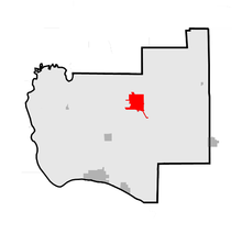 Location of Jerseyville within Jersey County
As of the census[6] of 2000, there were 7,984 people, 3,260 households, and 2,089 families residing in the city. The population density was 1,817.9 people per square mile (702.2/km²). There were 3,423 housing units at an average density of 779.4 per square mile (301.1/km²). The racial makeup of the city was 98.85% White, 0.09% African American, 0.18% Native American, 0.16% Asian, 0.10% from other races, and 0.63% from two or more races. Hispanic or Latino of any race were 0.54% of the population.
There were 3,260 households, out of which 31.5% had children under the age of 18 living with them, 49.1% were married couples living together, 12.1% had a female householder with no husband present, and 35.9% were non-families. 32.1% of all households were made up of individuals, and 17.7% had someone living alone who was 65 years of age or older. The average household size was 2.35, and the average family size was 2.97.
In the city, the population was spread out with 24.4% under the age of 18, 8.1% from 18 to 24, 27.2% from 25 to 44, 19.9% from 45 to 64, and 20.4% who were 65 years of age or older. The median age was 38 years. For every 100 females, there were 84.6 males. For every 100 females age 18 and over, there were 80.5 males.
The median income for a household in the city was $35,556, and the median income for a family was $46,832. Males had a median income of $37,312 versus $21,282 for females. The per capita income for the city was $20,178. About 5.8% of families and 7.3% of the population were below the poverty line, including 8.5% of those under age 18 and 4.7% of those age 65 or over.
Education
Jerseyville has a number of public and private schools. Public schools are part of Jersey Community Unit School District 100.
- Elementary schools
- East Elementary School (Grades 3 through 5)
- West Elementary School (Grades Pre-K through 2)
- Holy Ghost School (Grades Pre-K through 4)
- Middle schools
- Illini Middle School (Grades 6 through 8)
- St. Francis Xavier School (Grades 5 through 8)
- High school
Both Holy Ghost and St. Francis Xavier Schools are private Roman Catholic schools.
Schools in Jerseyville had a total combined enrollment of 2,720 students.[7]
Nearby colleges and universities include Principia College, in Elsah, and Lewis and Clark Community College, in Godfrey.
Transportation
Two major highways run through the city. US Highway 67 runs along a north-south route, while Illinois Route 16 runs along a west-east route. Also, Illinois Route 109 has its northern terminus in Jerseyville at US Highway 67.
A four-lane expansion of US Highway 67 in Jerseyville has been in the planning stages for years, and is currently in Illinois' five-year road construction plan. The plan includes the Jerseyville Bypass, which is expected to go around the eastern portion of the city when it is completed. Construction of the bypass has not started yet, but all of the work prior to actual road construction is scheduled to be completed by 2012. This is a part of the completion of the entire US Highway 67 four-lane project in Illinois between Godfrey and the Quad Cities area.
Community
Recreation
The Jerseyville Parks and Recreation Department maintains and operates six parks:
- Dolan Park - June and Spruce St.
- Easton Park - Lincoln and Easton Ave.
- Lions Club Park - Jefferson and Spruce St.
- Northmoor Park - Liberty St.
- Rotary Club Centennial Park - Liberty, Prairie, and Carpenter St. (Illinois Route 16)
- Wittman Park - Jefferson St.
Local media
Print / Online:
- Daily newspaper: The Telegraph - published out of Alton, but also covers the Jerseyville and Jersey County areas
- Weekly newspaper: The Jersey County Journal - distributed every Wednesday and online
- Weekly classifieds: The Jersey County Shopper - print only
- Online newspaper: The Jersey County Star - online only
Radio:
- WJBM 1480 kHz AM - has a talk radio format
- KXI70 162.450 mHz - NOAA Weather Radio
Utilities
Utility companies serving Jerseyville are AmerenCIPS (natural gas and electricity), Grafton Technologies and Frontier Communications (landline telephone service and internet), and Cass Communications (cable television). Water services are provided and maintained by the city.
Notable residents
- Russell Dunham - World War II veteran and recipient of the Medal of Honor award
- Brent Hawkins - professional football player for the Saskatchewan Roughriders of the CFL, and formerly for the Jacksonville Jaguars of the NFL
- Arthur Scott King (1876–1957) - noted physicist and astrophysicist
- Anthony L. Knapp (1828–1881) - U.S. Representative from Illinois
- Robert M. Knapp (1831–1889) - U.S. Representative from Illinois and former mayor of Jerseyville from 1871 to 1876
- Eric S. Pistorius - currently a circuit court Judge of the Seventh Circuit in Illinois
- Thomas J. Selby (1840–1917) - U.S. Representative from Illinois and former mayor of Jerseyville
- Jana Shortal - news reporter for KARE television in Minneapolis-St. Paul.
Interesting Notes
Both the Jersey County Courthouse and the Jerseyville Downtown Historic District were placed on the National Register of Historic Places in 1986. Also on the National Register, is the Col. William H. Fulkerson Farmstead (built in 1866), located just north of the city limits on US Highway 67. The farmstead was added to the Register in 1998.
Jerseyville was also a minor stopping point on the historic Underground Railroad. The “Little Red House” was utilized as a station for the Underground Railroad until the end of the Civil War and included a false cellar that was used to hide slaves searching for freedom.
See also
References
- ^ "Find a County". National Association of Counties. http://www.naco.org/Counties/Pages/FindACounty.aspx. Retrieved 2011-06-07.
- ^ "US Gazetteer files: 2010, 2000, and 1990". United States Census Bureau. 2011-02-12. http://www.census.gov/geo/www/gazetteer/gazette.html. Retrieved 2011-04-23.
- ^ a b "Monthly Averages for Jerseyville, Illinois". The Weather Channel. http://www.weather.com/weather/wxclimatology/monthly/graph/USIL0588. Retrieved 2011-01-27.
- ^ Jerseyville description & history, retrieved August 24, 2007
- ^ Monsanto Jerseyville description, retrieved April 1, 2011
- ^ "American FactFinder". United States Census Bureau. http://factfinder.census.gov. Retrieved 2008-01-31.
- ^ ILDCEO Community Profile, retrieved March 9, 2008
Further reading
- Marshall M. Cooper, History of Jerseyville, Illinois, Brookhaven Press, 2001. ISBN 1581039425
- Robbi Courtaway, Spirits of St. Louis II: Further Hauntings in the Mound City, Virginia Publishing, 2002. ISBN 189144218X
- National Academy of Sciences Staff, Biographical Memoirs, National Academies Press, 1996. ISBN 0309052386
External links
- City of Jerseyville
- Jerseyville Public Library
- Jersey Community Unit School District No. 100
- Jersey Community Hospital
- Jersey County Health Department
- Jersey County Historical Society
- Jersey County Journal
Municipalities and communities of Jersey County, Illinois County seat: Jerseyville Cities Grafton | Jerseyville

Town Villages Townships Elsah | English | Fidelity | Jersey | Mississippi | Otter Creek | Piasa | Quarry | Richwood | Rosedale | Ruyle
Unincorporated
communitiesBeltrees | Chautauqua | Delhi | Democrat Spring | Dow | East Newbern | Kemper | Lake Piasa | Lockhaven | McClusky | New Delhi | Newbern | Nutwood | Reardon | Reddish | Rosedale | Spankey
Footnotes ‡ This populated place also has portions in an adjacent county or counties
Illinois Metro-East region Counties 
Major Cities (10,000+) Alton | Belleville | Cahokia | Centralia | Collinsville | East St. Louis | Edwardsville | Fairview Heights | Glen Carbon | Godfrey | Granite City | O'Fallon | Swansea | Wood RiverCities (5,000-10,000) Bethalto | Centreville | Columbia | East Alton | Highland | Jerseyville | Maryville | Mascoutah | Pontoon Beach | Shiloh | Staunton | Troy | Washington Park | WaterlooCities (1,000-5,000) Alorton | Aviston | Beckemeyer | Breese | Brighton | Carlyle | Caseyville | Dupo | Fairmont City | Freeburg | Germantown | Hartford | Lebanon | Madison | Marissa | Millstadt | New Athens | New Baden | Rosewood Heights | Roxana | Smithton | South Roxana | Trenton | Valmeyer | Venice | WamacInterstates in the Metro-East Airports/Military Bases List of Colleges in the Metro-East Sports teams based in the Metro East Gateway Grizzlies (baseball: Frontier League)Categories:- Metro-East
- Cities in Illinois
- Populated places in Jersey County, Illinois
- Jerseyville, Illinois
- County seats in Illinois
- Populated places established in 1827


Wikimedia Foundation. 2010.