- Cookstown District Council
-
Coordinates: 54°38′46″N 6°44′42″W / 54.646°N 6.745°W
Cookstown District Geography 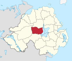
Area
- TotalRanked 9th of 26
622 km²Admin HQ Cookstown ISO 3166-2 GB-CKT ONS code 95I Demographics Population
- Total (2010)
- DensityRanked 22nd
36,700
59 / km²Community Catholic: 64.1%
Protestant: 34.8%Politics Control No overall control
Sinn Féin: 6
SDLP: 4
DUP: 3
UUP: 3MLAs Mid Ulster
Sinn Féin: 3
DUP: 1
SDLP: 1
UUP: 1MPs Martin McGuinness (Sinn Féin) Meeting place Website http://www.cookstown.gov.uk Cookstown District Council (Irish: Comhairle Cheantar na Coirre Críochaí; Ulster Scots: Districk Cooncil o Cookestoun)[1] is a district council covering an area largely in County Tyrone and partly in County Londonderry. Council headquarters are in Cookstown. Small towns in the council area include Pomeroy, Moneymore, Coagh and Stewartstown and in the east the area is bounded by Lough Neagh. It covers an area of 235 square miles (610 km2) and has a current population of over 35,500.
The council has 16 elected representatives. Local elections are held every four years using the single transferable vote system. The chairman and vice-chairman of the council are elected at the annual general meeting each June. The next election was due to take place in May 2009, but on April 25, 2008, Shaun Woodward, Secretary of State for Northern Ireland announced that the scheduled 2009 district council elections were to be postponed until the introduction of the eleven new councils in 2011.[2] The proposed reforms were abandoned in 2010, and the next district council elections will take place in 2011[3]
The Cookstown District Council area consists of 3 electoral areas: Drum Manor, Ballinderry and Cookstown Central. At the last elections in 2005, members were elected from the following political parties: 5 Sinn Féin, 5 Social Democratic and Labour Party (SDLP), 3 Ulster Unionist Party (UUP) and 3 Democratic Unionist Party (DUP). In 2008-09, the council chairman is Councillor Walter Greer of the Ulster Unionist Party and the vice-chairman is Councillor Tony Quinn of the Social Democratic Labour Party.
In elections for the Westminster Parliament it is part of Mid Ulster.
See also
References
Local authorities of Northern Ireland Antrim · Ards · Armagh · Ballymena · Ballymoney · Banbridge · Belfast · Carrickfergus · Castlereagh · Coleraine · Cookstown · Craigavon · Derry · Down · Dungannon and South Tyrone · Fermanagh · Larne · Limavady · Lisburn · Magherafelt · Moyle · Newry and Mourne · Newtownabbey · North Down · Omagh · Strabane
Categories:- Politics of County Tyrone
- Politics of County Londonderry
- Local authorities of Northern Ireland

Wikimedia Foundation. 2010.