- Poulan, Georgia
Infobox Settlement
official_name = Poulan, Georgia
other_name =
native_name =
nickname =
settlement_type =City
motto =
imagesize =
image_caption =
flag_size =
image_
seal_size =
image_shield =
shield_size =
image_blank_emblem =
blank_emblem_type =
blank_emblem_size =
imagesize =
image_caption =
flag_size =
image_
seal_size =
image_shield =
shield_size =
image_blank_emblem =
blank_emblem_type =
blank_emblem_size =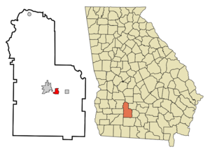
mapsize = 250px
map_caption = Location in Worth County and the state of Georgia
mapsize1 =
map_caption1 =
image_dot_
dot_mapsize =
dot_map_caption =
dot_x =
dot_y =
pushpin_
pushpin_label_position =
pushpin_map_caption =
pushpin_mapsize =
subdivision_type = Country
subdivision_name =United States
subdivision_type1 = State
subdivision_name1 = Georgia
subdivision_type2 = County
subdivision_name2 = Worth
subdivision_type3 =
subdivision_name3 =
subdivision_type4 =
subdivision_name4 =
government_footnotes =
government_type =
leader_title =
leader_name =
leader_title1 =
leader_name1 =
leader_title2 =
leader_name2 =
leader_title3 =
leader_name3 =
leader_title4 =
leader_name4 =
established_title =
established_date =
established_title2 =
established_date2 =
established_title3 =
established_date3 =
area_magnitude =
unit_pref = Imperial
area_footnotes =
area_total_km2 = 4.3
area_land_km2 = 4.3
area_water_km2 = 0
area_total_sq_mi = 1.7
area_land_sq_mi = 1.7
area_water_sq_mi = 0
area_water_percent =
area_urban_km2 =
area_urban_sq_mi =
area_metro_km2 =
area_metro_sq_mi =
area_blank1_title =
area_blank1_km2 =
area_blank1_sq_mi =
population_as_of = 2000
population_footnotes =
population_note =
population_total = 946
population_density_km2 = 220
population_density_sq_mi = 556.5
population_metro =
population_density_metro_km2 =
population_density_metro_sq_mi =
population_urban =
population_density_urban_km2 =
population_density_urban_sq_mi =
population_blank1_title =
population_blank1 =
population_density_blank1_km2 =
population_density_blank1_sq_mi =
timezone = Eastern (EST)
utc_offset = -5
timezone_DST = EDT
utc_offset_DST = -4
latd = 31 |latm = 30 |lats = 49 |latNS = N
longd = 83 |longm = 47 |longs = 28 |longEW = W
elevation_footnotes =
elevation_m = 116
elevation_ft = 381
postal_code_type =ZIP code
postal_code = 31781
area_code = 229
blank_name = FIPS code
blank_info = 13-62496GR|2
blank1_name = GNIS feature ID
blank1_info = 0321100GR|3
website =
footnotes =Poulan is a city in Worth County, Georgia,
United States . The population was 946 at the 2000 census. It was settled about 1877, was also located along the Brunswick and Albany railroad. The city was named for Judge W.A. Poulan.Poulan is part of the
Albany, Georgia Metropolitan Statistical Area.Geography
Poulan is located at coor dms|31|30|49|N|83|47|28|W|city (31.513739, -83.791041)GR|1.
According to the
United States Census Bureau , the city has a total area of 1.7square mile s (4.3km² ), all of it land.Demographics
As of the
census GR|2 of 2000, there were 946 people, 365 households, and 273 families residing in the city. Thepopulation density was 571.2 people per square mile (220.0/km²). There were 399 housing units at an average density of 240.9/sq mi (92.8/km²). The racial makeup of the city was 76.22% White, 21.99% African American, 0.42% Native American, 0.11% Asian, 0.53% from other races, and 0.74% from two or more races. Hispanic or Latino of any race were 0.74% of the population.There were 365 households out of which 35.9% had children under the age of 18 living with them, 52.3% were married couples living together, 15.3% had a female householder with no husband present, and 25.2% were non-families. 23.6% of all households were made up of individuals and 9.9% had someone living alone who was 65 years of age or older. The average household size was 2.59 and the average family size was 3.00.
In the city the population was spread out with 26.5% under the age of 18, 9.0% from 18 to 24, 28.0% from 25 to 44, 24.6% from 45 to 64, and 11.8% who were 65 years of age or older. The median age was 37 years. For every 100 females there were 97.5 males. For every 100 females age 18 and over, there were 87.3 males.
The median income for a household in the city was $27,708, and the median income for a family was $35,208. Males had a median income of $30,000 versus $21,250 for females. The
per capita income for the city was $13,439. About 16.8% of families and 20.9% of the population were below thepoverty line , including 21.8% of those under age 18 and 16.9% of those age 65 or over.Notable people
*
Howell T. Heflin , who became aU.S. Senator fromAlabama , was born in Poulan in 1921. At that time Heflin's father was serving as a Methodist minister in Poulan. The Heflin family remained there for only a short time before returning to their native Alabama.*
Chase Osborn , wasGovernor of Michigan from 1911-1913. He resided at Possum Poke in Poulan. He died there in 1949.References
External links
* [http://www.worthcounty.com/communities.html Worth County, Georgia]
* [http://www.msu.edu/~dowj/osborn/pp_pics2.htm Possum Poke]
Wikimedia Foundation. 2010.