- Chewacla State Park
-
Chewacla State Park 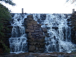
Chewacla Falls in late autumnType State Park Location 124 Shell Toomer Parkway
Auburn, Alabama, United StatesCoordinates 32°33′15″N 85°28′51″W / 32.55409°N 85.48085°W Area 696 acres (2.82 km2) Operated by Alabama Department of Conservation and Natural Resources Chewacla State Park is a 696-acre (2.82 km2) state park in Auburn, Alabama. It is located just south of Interstate 85 in Lee County, Alabama.
Contents
Trails
Chewacla State Park has eight hiking trails in varying degrees of difficulty, a mountain bike trail, and a tree identification trail.[1]
The Sweet Shrub Trail features some interpretative displays and begins at the Lower Shelter, makes a loop and returns to the Lower Shelter. The Boy Scout Trail begins on the west side of the stone bridge and runs into the Sweet Shrub Trail. The Troop 30 Boy Scout Trail begins on the north side of the stone bridge on Murphy Drive. This trail follows Moore’s Mill Creek to the boundary of the park. It may be followed to the park boundary or the creek may be crossed on one of the rock dams to follow the trail back to Murphy Drive. The Eagle Scout Trail branches off from the Troop 30 Boy Scout Trail on the east side of Chewacla Lake and terminates on the logging road across from the Walnut Shelter. The Deer Rub Trail features steep terrain and begins at the Upper Pavilion and follows Chewacla Creek to the Walnut Shelter. The Loop Road Trail leads to Chewacla Falls and is a paved trail. The Mountain Laurel Trail begins at the Upper Pavilion area, goes down to Chewacla Falls and then follows Chewacla Lake. The Mountain Bike Trail loops around the upper portion of Murphy Drive.[1]
Lodging
The park has six renovated Civilian Conservation Corps-era stone cabins featuring hardwood floors, stone fireplaces, bathrooms, and modern kitchens. Cabins have central heating and cooling systems. The cabins are available year around and require reservations.[2]
References
- ^ a b "Chewacla State Park Trails". "AlaPark.com". http://www.alapark.com/parks/feature.cfm?parkid=14&featureid=15. Retrieved 2008-01-25.
- ^ "Chewacla State Park Cabins". "AlaPark.com". http://www.alapark.com/parks/feature.cfm?parkid=14&featureid=5. Retrieved 2008-01-25.
External links
Protected Areas of Alabama Federal Bon Secour • Cahaba River • Choctaw • Eufaula • Fern Cave • Key Cave • Mountain Longleaf • Santa Cave • Watercress Darter • Wheeler
Wilderness AreasState Bladon Springs • Blue Springs • Buck's Pocket • Cathedral Caverns • Chattahoochee • Cheaha • Chewacla • Chickasaw • DeSoto • Florala • Frank Jackson • Gulf • Joe Wheeler • Lake Guntersville • Lake Lurleen • Lakepoint • Meaher • Monte Sano • Oak Mountain • Paul M. Grist • Rickwood Caverns • Roland Cooper • Wind Creek
Fayette • Geneva • Little River • Saint Stephens • Weogufka
Alabama Department of Conservation and Natural Resources (web) Categories:- Alabama state parks
- Civilian Conservation Corps in Alabama
- Protected areas of Lee County, Alabama

Wikimedia Foundation. 2010.