- Neak Leung
-
Neak Leung
អ្នកលឿង— Town — A Mekong ferry takes vehicles and passengers across the Mekong to Neak Loeung town Location of Neak Lung in Cambodia
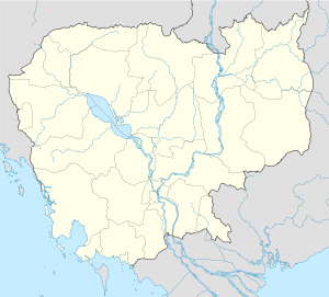
 Neak Leung
Coordinates: 11°15′42″N 105°17′10″E / 11.26167°N 105.28611°E Country  Cambodia
Province Prey Veng Province District Peam Ror District Population (1998)[1] – Total 7,109 Neak Leung (Khmer: អ្នកលឿង) is a busy commercial town in Prey Veng Province, Cambodia. Located on the Mekong and astride National Highway number 1, it is the commune centre for Neak Leung commune and the capital of Peam Ror District. The town can be reached by car ferry from Kampong Phnum in Kandal Province or by boat along the Mekong river.
Due to its strategic location, the town and port of Neak Leung has been a significant battleground at various times in Cambodia's history. In August 1973, during the Cambodian Civil War, Neak Leung was propelled to the centre of international attention when an American B-52 Stratofortress mistakenly dropped its 20 ton load on the town centre.[2]
Contents
Location
 Market at Mekong ferry landing. Nak Loeung, Prey Veng, Cambodia
Neak Leung has grown up at the intersection of several important trade and transport routes. It is located 61 kilometres south east of Phnom Penh on the east bank of the Mekong River. The town straddles National Highway 1, which runs from the capital Phnom Penh to the town of Bavet on the border with Vietnam. National Road 11 begins in Neak Leung and connects the provincial capital at Prey Veng 30 kilometres to the north. This road continues to join National Highway 7 at Thnal Totoung near Kampong Cham town.[3]
A busy market has grown up around the ferry port. There is an abundance of fresh produce available, which includes the products of local farmers and fruits imported from Vietnam by road and river.
Characteristics
Prey Veng province lies on the lower part of the Mekong flood plain. During the rainy season, much of it is severely flooded and is only accessible by boat. Neak Loeung is on slightly higher land and is near the geographic centre of the province. Because of these geographic peculiarities, a number of aid and development agencies have opened offices in Neak Leung, rather than in the provincial capital Prey Veng, as a base for work elsewhere in the province.
The car ferries that cross the Mekong at Neak Leung are an essential part of Cambodia's transport infrastructure. The current vessels were purchased in 1997, as part of a $20 million USD grant from the Mekong River Commission to upgrade ferry facilities in Cambodia.[4] Despite the upgrade, there are sometimes significant delays while waiting to cross. If one of the ferries is not operational or traffic is particularly heavy, there may be queues of hundreds of vehicles and a wait of several hours to cross the river.[5]
 Sellers converge on a heavily laden vehicle waiting for the ferry crossing to Neak Loeung
The first Cambodian bridge across the Mekong was built in Kampong Cham town with Japanese assistance and opened in 2001.[6] For many years the Royal Government of Cambodia (RGC) has been searching for capital to build a second bridge across the Mekong at Neak Leung Since 2002, the RGC made at least 4 proposals to the government of Japan for funding to build a second bridge over the Mekong at Neak Leung.[7] In June 2007, Prime Minister Hun Sen made an official visit to Japan where he appealed directly for aid from the Japanese government to build the bridge.[8] The Japanese government granted the appeal and the construction plan and environmental impact study are estimated to be complete by the end of 2007. Construction is scheduled to begin 12 February 2011 and cost $131 million.[9]
The bombing
On August 6, 1973,[10] during the Cambodian Civil War Neak Leung was propelled to the centre of international attention when an American B-52 Stratofortress mistakenly dropped its 20 ton load on the town centre.[11] At least 137 Cambodians were killed and another 268 were wounded. More than 30 craters stretched for a mile down the main street and a third of the town was completely destroyed while another third was heavily damaged. Neak Leung market and a large army barracks in the town were also destroyed.[12] This incident was reproduced fairly accurately by director Roland Joffé in his 1984 film The Killing Fields.
References
- ^ General Population Census of Cambodia, 1998: Village Gazetteer. National Institute of Statistics. February, 2000. pp. 228.
- ^ Desperate Days for Besieged Phnom Penh, TIME Magazine, August 20, 1973
- ^ Total Road Atlas of Cambodia 2006, 3rd edition, Total Cambodge, Phnom Penh, Cambodia
- ^ The People's Highway: Past, Present and Future Transport on the Mekong River System, Mekong River Commission, April 2004, Phnom Penh, Cambodia [1]
- ^ Escaping New Year, Bayon Pearnik, Issue 117, May 2006
- ^ First bridge over Mekong in Cambodia opens amid celebrations, Associated Press, December 4, 2001 [2]
- ^ Selected Comments by Hun Sen at the Groundbreaking Ceremony of Two Bridges on the National Road 1 between Phnom Penh and Nak Loeung, 6 December 2005 [3]
- ^ Hun Sen Begins Japan Visit, Chun Sakada, VOA Khmer, Phnom Penh, Cambodia 13 June 2007 [4]
- ^ http://www.phnompenhpost.com/index.php/2011012046237/National-news/mekong-bridge-to-break-ground.html
- ^ Flighglobal Archive
- ^ into a dialogue of The Killing Fields the reason is briefly mentioned: one of the B-52 on bombarding mission didn't offset the target from a reference beacon that was just set up in the middle of the town
- ^ Desperate Days for Besieged Phnom Penh, TIME Magazine, August 20, 1973
 Prey Veng Province
Capital city Prey Veng
Districts Ba Phnum • Kamchay Mear • Kampong Trabaek • Kanhchriech • Me Sang • Peam Chor • Peam Ro • Pea Reang • Preah Sdach • Prey Veaeng • Kampong Leav • Sithor KandalPlaces Neak Leung • Chok CheyCategories:- Populated places in Cambodia
- Prey Veng Province


Wikimedia Foundation. 2010.