- Myitkyina
-
Myitkyina
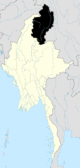
မြစ်ကြီးနားမြို့ Location in Burma
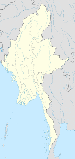
 Myitkyina
Coordinates: 25°23′0″N 97°24′0″E / 25.383333°N 97.4°E Country  Burma
BurmaDivision Kachin State District Myitkyina District Township Myitkyina Township Population (2005) – Total 146,544 – Ethnicities Kachin, Shan, Bamar, Chinese, Gorkha – Religions Buddhism, Christianity Time zone MST (UTC+6.30) Area code(s) 74 [1] Myitkyina (Burmese: မြစ်ကြီးနားမြို့; MLCTS: mrac kri: na: mrui., pronounced [mjɪʔtɕíná]) is the capital city of Kachin State in Myanmar (Burma), located 1,480 kilometers (920 mi) from Yangon, and 785 kilometers (488 mi) from Mandalay. In Burmese it means "near the big river", and in fact "Myitkyina" lies on the west bank of the Ayeyarwady River, just below 40 kilometers (25 mi) from Myit-son (Burmese for confluence) of its two headstreams (the Mali and N'mai rivers).[2] It is the northernmost river port and railway terminus in Myanmar.[3]
Contents
History
Myitkyina has been a important trading town between China and Burma since ancient times.
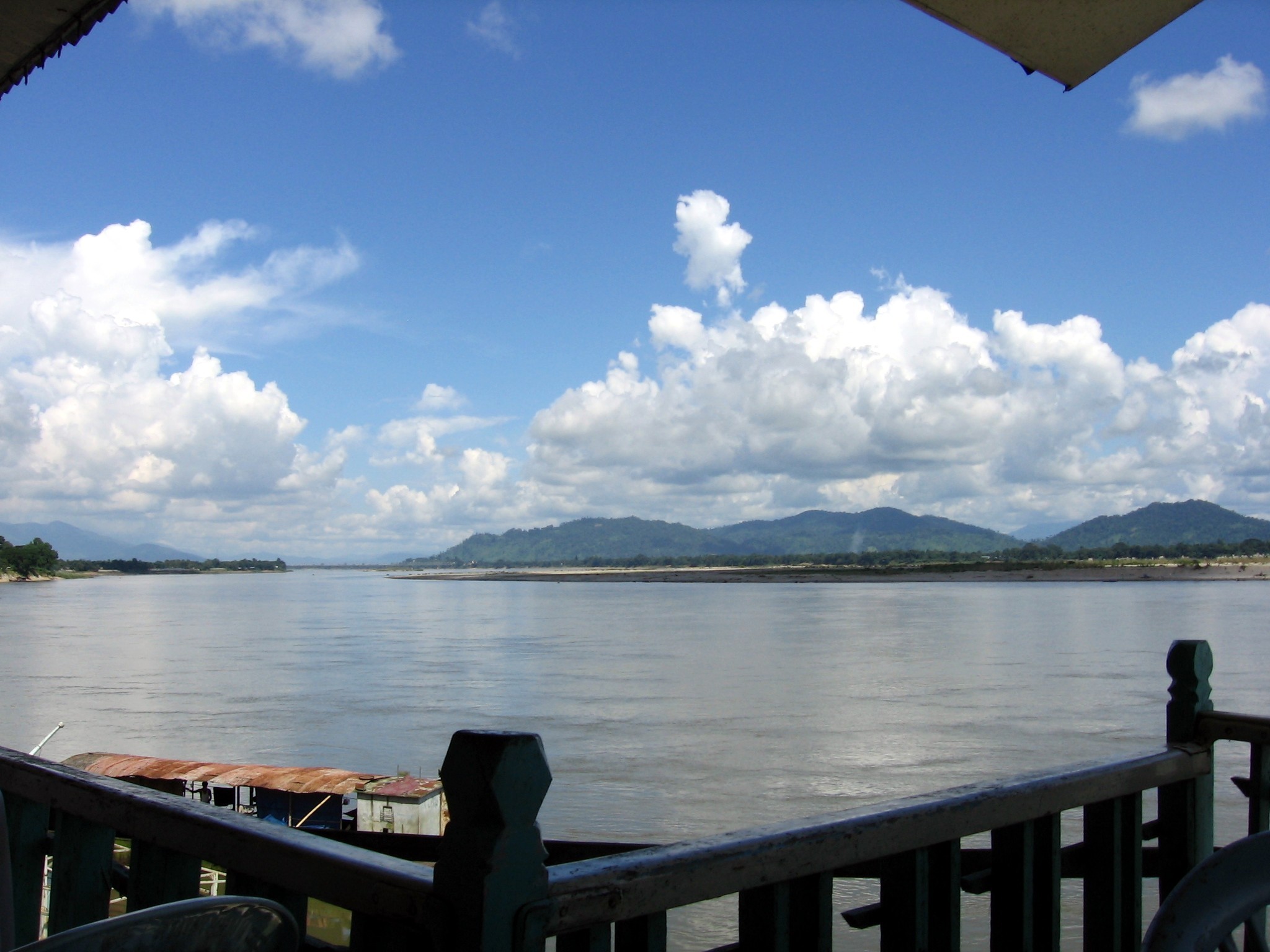
 Blamindin Bridge at Myitkyina
American Baptist missionary George J. Geis and his wife arrived in Myitkyina in the late 1890s and in 1900 requested permission to build a misison there.[4]
In August 1944 during World War II, Myitkyina fell to the Allied forces under General Joseph Stilwell after a prolonged siege and heavy fighting between Nationalist Chinese divisions, the Chindits, and Merrill's Marauders of the Northern Combat Area Command and the besieged elements of the 33rd Imperial Japanese Army under General Masaki Honda. The town was strategically important not only because of its rail and water links to the rest of Burma, but also because it was on the planned route of the Ledo Road.[2][5]
As the capital of the state, it has government offices, and a greater population than other cities in the state. The city has a population of approximately 150,000, with a mix of Kachin, Shan, Bamar peoples and some Chinese and Indians.[6] Fragrant rice produced near Myitkyina, called khat cho, is considered the best in Myanmar.[citation needed]
The Kachin language is the common language among the Kachin, but Burmese is the national language and everyone can speak Burmese. It has two big markets. The city is home to Myitkyina University, a teachers college, a nurses training school, and a computer college, and various Christian theological seminaries and colleges affiliated with several seminaries in the U.S. and Asia, notably Kachin Theological College-Nawng Nan.
Major religions are Theravada Buddhism and Baptist Christianity, but other religions such as animism, Hinduism and Islam are also practised. Foreigners are now free to visit Myitkyina without prior government permission.
Climate data for Myitkyina Month Jan Feb Mar Apr May Jun Jul Aug Sep Oct Nov Dec Year Average high °C (°F) 24.2
(75.6)26.7
(80.1)30.0
(86.0)33.3
(91.9)32.7
(90.9)30.6
(87.1)30.0
(86.0)30.6
(87.1)31.2
(88.2)30.3
(86.5)27.4
(81.3)24.6
(76.3)29.30
(84.74)Average low °C (°F) 10.3
(50.5)12.7
(54.9)16.4
(61.5)19.5
(67.1)22.3
(72.1)24.1
(75.4)24.2
(75.6)24.3
(75.7)23.4
(74.1)21.2
(70.2)16.0
(60.8)11.6
(52.9)18.83
(65.90)Rainfall mm (inches) 8
(0.31)18
(0.71)26
(1.02)46
(1.81)159
(6.26)535
(21.06)513
(20.2)411
(16.18)285
(11.22)158
(6.22)28
(1.1)9
(0.35)2,196
(86.46)Sunshine hours 248 224 248 210 186 120 124 155 150 186 210 248 2,309 Source no. 1: Climate Charts Source no. 2: World Climate Guide Education
- Technological University, Myitkyina
- Computer University, Myitkyina
- Myitkyina University
- Myitkyina Education College
Airport
Military
- Northern SOC (HQ at Myitkyina)
- Nanpong Air Base headquarters (former 503 Air Base)
Notes
- ^ "National Telephone Area Codes". Myanmar Yellow Pages. http://www.myanmar-yellowpages.com/information/page_14.asp.
- ^ a b "Myitkyina, Myanmar". Encyclopaedia Britannica Online. http://www.britannica.com/EBchecked/topic/400392/Myitkyina. Retrieved 2009-03-29.
- ^ "Train travel in Myanmar(Burma)". seat61.com. http://www.seat61.com/Burma.htm#Mandalay%20-%20Myityina. Retrieved 2009-03-29.
- ^ Baptist missionary magazine, Volume 80. American Baptist Foreign Mission Society, American Baptist Missionary Union,. 1900. p. 196. http://books.google.co.uk/books?id=nAMPAAAAIAAJ&q=George+J.+Geis&dq=George+J.+Geis&hl=en&ei=JhPYTMTkC4mLhQeB5tShBQ&sa=X&oi=book_result&ct=result&resnum=3&ved=0CDMQ6AEwAjgK.
- ^ Gardner, Major John J. "Battle of Myitkyina". http://www.gardnerworld.com/cbi/myitkyina.htm. Retrieved 2006-10-15.
- ^ "MYITKYINA". my-myitkyina.com. http://www.my-myitkyina.com/mh_html/mka.htm. Retrieved 2006-08-24.
External links
- Satellite Map of Myitkyina from Google Map
- Kachin State map Asterism
- http://www.kachinstate.com
- http://www.infoplease.com/ce6/world/A0834638.html
Coordinates: 25°23′N 97°24′E / 25.383°N 97.4°E
Kachin State Capital: MyitkyinaMyitkyina District 
Bhamo District Putao District Mohnyin District Main cities and towns Categories:- Township capitals of Burma
- Populated places in Kachin State
- Irrawaddy River


Wikimedia Foundation. 2010.