- Cheshire, Connecticut
-
Cheshire, Connecticut — Town — 
SealLocation in New Haven County, Connecticut
Coordinates: 41°30′44″N 72°54′13″W / 41.51222°N 72.90361°WCoordinates: 41°30′44″N 72°54′13″W / 41.51222°N 72.90361°W Country United States State Connecticut NECTA New Haven Region Central Naugatuck Valley Incorporated 1780 Government - Type Council-manager - Town manager Michael A. Milone - Council Tim Slocum, R-at large, chairman and honorary mayor
David Schrumm, R-1
Thomas Ruocco, R-2
Andy Falvey, R-3
Steve Carroll, R-4
James Sima, R-at large
Patti Flynn Harris, D-at large
Sylvia Nichols R-at large
Michael Ecke, D-at large[1]Area - Total 33.4 sq mi (86.5 km2) - Land 32.9 sq mi (85.2 km2) - Water 0.5 sq mi (1.3 km2) Elevation 230 ft (70 m) Population (2005) - Total 29,097 - Density 884/sq mi (341/km2) Time zone EST (UTC-5) - Summer (DST) EDT (UTC-4) ZIP code 06410 Area code(s) 203 FIPS code 09-14160 GNIS feature ID 0213406 Website http://www.cheshirect.org/ Cheshire is a town in New Haven County, Connecticut, United States. The population was 28,543 at the 2000 census. The center of population of Connecticut is located in Cheshire.[2] In 2009 Cheshire was ranked 72 in Money Magazine's 100 Best Places to Live.[3] Likewise, in 2011 Cheshire was ranked 73 in Money Magazine's 100 Best Places to Live. [4]
Contents
History
When Cheshire was originally settled in 1694[citation needed] by Europeans, it was part of the town of Wallingford and known locally as "Northfarms". In 1780, Cheshire separated from Wallingford to become its own town, and remained a small but prosperous agrarian society until the 1950s.
In the post-war period, Cheshire began to urbanize as residents of New Haven began moving outwards from the urban core. Several industrial plants also located themselves in one of the town's many planned industrial parks. Despite significant residential development, Cheshire has remained a highly agricultural town that has found an economic niche in producing bedding plants for local and national consumers. The town's slogan is "The Bedding Plant Capital of Connecticut".
Connecticut's 2nd worst air disaster took place over Cheshire on January 18, 1946, when an Eastern Airlines DC-3 crashed in town. The crash occurred near Wolf Hill Road and Copper Valley Court, on land that was occupied by a country club. All seventeen people aboard the aircraft lost their lives.[5]
Home invasion case
Main article: Cheshire, Connecticut, home invasion murdersOn January 6, 2008, over 130,000 luminary candles were lit in front of thousands of homes and along streets across Cheshire and Southington, Connecticut in "Cheshire Lights of Hope", a fundraiser for multiple sclerosis and a tribute to the Petit family. The Petits were victims of the highly publicized July 23, 2007, home invasion, during which mother Jennifer and daughters Hayley and Michaela Petit were murdered, leaving behind sole survivor Dr. William Petit. Founded by local couple, Don and Jenifer Walsh, the event raised over $100,000 for Hayley's Hope and Michaela's Miracle Memorial funds.[6] The murder and the aftermath was featured in a segment that aired on the NBC-TV newsmagazine show Dateline NBC on October 5, 2010. The segment was titled "The Family on Sorghum Mill Drive".[7] In 2010, Steven Hayes was convicted of the murders and other crimes during the home invasion and was sentenced to death;[8] his accomplice Joshua Komisarjevsky was convicted of the murders and other crimes in October 2011, and currently awaits sentencing.
Geography
According to the United States Census Bureau, the town has a total area of 33.4 square miles (87 km2), of which, 32.9 square miles (85 km2) of it is land and 0.5 square miles (1.3 km2) of it (1.50%) is water.
Cheshire is situated in the midst of several major cities of Connecticut. It lies 14 miles (21 km) north of New Haven, twenty-five miles south of the capital Hartford, thirty miles northeast of Bridgeport, and Waterbury is adjacent to Cheshire. Cheshire shares borders with Southington on the north and northeast, Meriden on the northeast, Wallingford on the east, Hamden on the south, Bethany for a short distance on the southwest, Prospect on the west, Waterbury on the northwest, and Wolcott on the northwest.
Demographics
As of the census[9] of 2000, there were 28,543 people, 9,349 households, and 7,254 families residing in the town. The population density was 867.4 people per square mile (334.9/km²). There were 9,588 housing units at an average density of 291.4 per square mile (112.5/km²). The racial makeup of the town was 89.40% White, 4.67% African American, 0.22% Native American, 2.63% Asian, 0.02% Pacific Islander, 1.91% from other races, and 1.15% from two or more races. Hispanic or Latino of any race were 3.84% of the population. The largest ethnic groups in the town are Italian Americans and Irish Americans.
There were 9,349 households out of which 39.1% had children under the age of 18 living with them, 68.5% were married couples living together, 6.9% had a female householder with no husband present, and 22.4% were non-families. 19.4% of all households were made up of individuals and 9.6% had someone living alone who was 65 years of age or older. The average household size was 2.71 and the average family size was 3.14.
In the town the population was spread out with 25.2% under the age of 18, 7.7% from 18 to 24, 29.4% from 25 to 44, 25.0% from 45 to 64, and 12.6% who were 65 years of age or older. The median age was 38 years. For every 100 females there were 113.9 males. For every 100 females age 18 and over, there were 114.4 males.
As of 2000 census, the median income for a household in the town was $80,466, and the median income for a family was $90,774. As of 2007, these figures had risen to $100,835 and $113,587 respectively.[10] In 2000, males had a median income of $60,078 versus $38,471 for females. The per capita income for the town was $33,903. About 1.6% of families and 3.0% of the population were below the poverty line, including 3.1% of those under age 18 and 4.3% of those age 65 or over.
Cheshire's voters have split tickets frequently in recent statewide elections. In 2004, President Bush won a narrow plurality over John Kerry. Bush had lost the town in his 2000 bid. In 2006 Cheshire voters gave strong support to Republican Governor M. Jodi Rell, independent U.S. Senate candidate Joe Lieberman and local Democratic House candidate Chris Murphy who defeated incumbent Nancy Johnson.[11] In the 2008 Presidential election, the town's voters supported Democrat Barack Obama with 8,177 votes over Republican John McCain with 6,839 votes. Cheshire voted for Republican majorities to its Board of Selectmen every election from 1915 to 1971, and then to its Town Council every year from 1973 to 2001, when voters elected a Democratic majority (6-3) for the first time. In 2003, a Republican majority (5-4) was elected. A Democratic majority (5-4) was elected in 2005, then reelected (5-4) in 2007. In the 2009 local elections, Cheshire voters ousted the Democratic majority on the Town Council and elected 8 Republicans and 1 Democrat (though due to local minority representation rules, only 7 Republicans were seated).[12]
Education
Cheshire is home to one public high school, Cheshire High School and one public middle school, Dodd Middle School.[13]
There are four public elementary schools: Chapman, Doolittle, Highland, and Norton Elementary. Cheshire is also home to one public kindergarten, Darcey School.
There are also several private and alternative schools in the town, including Cheshire Academy (originally The Episcopal Academy of Connecticut), which was founded in Cheshire in 1794 and currently educates students in the Middle School (grades 7–8) and the Upper School (grades 9-12/Post-Graduate Year). St. Bridgets is a Catholic school in Cheshire for grades preschool to 8th grade. Humiston is an alternative high school in Cheshire.
The Legion of Christ, a Roman Catholic congregation, run a novitiate and college of humanities on a 200-acre (0.81 km2), complex on Oak Avenue. About 160 seminarians undergo two to four years of training for the priesthood there, including religious formation and classical humanities.
Culture and notable features
Cheshire is home to two large state prison facilities located in the northern section of town. The largest of these facilities is the Cheshire Correctional Institution, which opened in 1910. In 1982, the Manson Youth Institution opened adjacent to the CCI. These prisons explain the skewed male/female ratios. The larger of these prisons is located across the street from Chapman Elementary School, separated by Route 10.[14]
Transportation
Transportation within Cheshire is largely by car. Interstate 691 skirts the northern edge of the town. Interstate 84 passes through the northwest part of the town. The main north-south artery is Route 10, a difficult passage that is busy, sometimes congested, and includes many stoplights. There are two east-west routes: Route 42 and Route 68/Route 70. Route 10 is by far the busiest road in Cheshire, with the worst Route 10 traffic occurring between Routes 68/70 and Route 42 every weekday during the morning commute, evening commute, and after the high school gets out at 2 pm. West Main Street and Main Street, Route 68/70 between Route 10 and Waterbury Road, is the next busiest road in town. The intersection of Route 10 and Route 68/70 is the busiest intersection in town. The second busiest intersection is the Cheshire High School and Route 10 intersection right before school starts and right after school ends.[15][citation needed]
The J line of Connecticut Transit New Haven which runs from Waterbury to New Haven travels through Cheshire on Routes 70 and 10. A commuter express bus also runs from the commuter lot near Interstate 84 to Hartford.
Points of interest
The Barker Character, Comic and Cartoon Museum, located in the northern section of Cheshire, holds a large collection of memorabilia, novelties and ephemera such as lunch boxes and Pez dispensers bearing the likenesses of characters from television, cartoons and comics.[16]
Farmington Canal, a popular non-motorized recreational trail, goes through Cheshire. The Hitchcock-Phillips House, a historic home, is located in town.
Roaring Brook Falls along the Quinnipiac Trail in the southwest corner of town is Connecticut's tallest single drop waterfall, and is owned by the Cheshire Land Trust.
National Register of Historic Places
- Cheshire Historic District — Roughly bounded by Main Street, Highland Avenue, Wallingford Road, South Main, Cornwall, and Spring streets (added September 29, 1986)
- Farmington Canal Lock (Lock 12) — 487 N. Brooksvale Road (added March 16, 1973)
- First Congregational Church of Cheshire — 111 Church Drive (added March 16, 1973)
- Marion Historic District (added December 21, 1988)
Notable people, past and present
- Syed Mansoor Alam, director, The Enough Foundation and Enough Advocacy
- Amos Bronson Alcott (1799–1888), schoolmaster
- Amos Doolittle (1754–1832), engraver of Battle of Concord scenes
- Brad Ausmus, professional baseball player
- Henry Washington Benham (1813–1884), Union army general
- Chris Berman, ESPN sportscaster
- Jay Bontatibus, actor
- John Chamberlain, (1903–1995), journalist
- Samuel A. Foot (1780–1846), politician
- Seabury Ford (1801–1855), politician
- James J. Greco, businessman
- Sunil Gulati, President of the United States Soccer Federation
- Peter Hitchcock (1781–1854) judge
- John Holmstrom, cartoonist, writer.
- John Frederick Kensett (1816–1872), artist
- Brian Leetch, International Hockey Hall of Fame inductee
- Legs McNeil, journalist, rock music historian
- J.P. Morgan, businessman
- Chris Murphy, politician
- Anjul Nigam, actor
- Ron Palillo, actor
- Paul Pasqualoni, athletic coach
- Lonnie Quinn, meteorologist
- Edward Tufte, professor
- Justin Tussing, novelist
- Vijay Vaitheeswaran, journalist
- James Van Der Beek, actor
See also
References
- ^ http://www.cheshirect.org/agendas-and-minutes/town-council
- ^ "Population and Population Centers by State". United States Census Bureau: 2000 Census. http://www.census.gov/geo/www/cenpop/statecenters.txt. Retrieved August 18, 2007.
- ^ "Best Places to Live 2009". CNN. http://money.cnn.com/magazines/moneymag/bplive/2009/snapshots/CS0914160.html.
- ^ Cite error: Invalid
<ref>tag; no text was provided for refs namedMoney_Magazine_2011; see Help:Cite errors/Cite error references no text - ^ "Cheshire, CT Airliner Plunges In Flames, Jan 1946 | GenDisasters ... Genealogy in Tragedy, Disasters, Fires, Floods". .gendisasters.com. http://www3.gendisasters.com/connecticut/5399/cheshire,-ct-airliner-plunges-flames,-jan-1946. Retrieved January 30, 2011.
- ^ "Connecticut Local News, US & World, Business, Entertainment | NBC Connecticut". Nbc30.com. http://www.nbc30.com/news/14988462/detail.html. Retrieved January 30, 2011.
- ^ "Inside Dateline – Oct. 8: 'The Mystery of Horseshoe Drive' and revisiting 'The Family on Sorghum Mill Drive'". Insidedateline.msnbc.msn.com. http://insidedateline.msnbc.msn.com/_news/2010/10/07/5251978-oct-8-the-mystery-of-horseshoe-drive-and-revisiting-the-family-on-sorghum-mill-drive. Retrieved January 30, 2011.
- ^ Jurors in Cheshire Case United on Death Penalty
- ^ "American FactFinder". United States Census Bureau. http://factfinder.census.gov. Retrieved 2008-01-31.
- ^ American FactFinder, United States Census Bureau. "Cheshire town, New Haven County, Connecticut – Selected Economic Characteristics: 2005–2007". Factfinder.census.gov. http://factfinder.census.gov/servlet/ADPTable?_bm=y&-context=adp&-qr_name=ACS_2007_3YR_G00_DP3YR3&-ds_name=ACS_2007_3YR_G00_&-tree_id=3307&-redoLog=false&-_caller=geoselect&-geo_id=06000US0900914160&-format=&-_lang=en. Retrieved January 30, 2011.
- ^ Enter your Company or Top-Level Office. "SOTS: Election Results and Related Data". Sots.ct.gov. http://www.sots.ct.gov/sots/cwp/view.asp?a=3179&Q=392194&SOTSNav_GID=1846. Retrieved January 30, 2011.
- ^ "GOP Wins In Landslide Fashion". The Cheshire Herald. November 5, 2009. http://www.cheshireherald.com/node/1606. Retrieved January 30, 2011.
- ^ "Cheshire Public Schools homepage". Cheshire.k12.ct.us. http://www.cheshire.k12.ct.us/. Retrieved January 30, 2011.
- ^ "chapman elementary school, cheshire, CT – Google Maps". Maps.google.com. January 1, 1970. http://maps.google.com/maps?f=q&hl=en&geocode=&q=chapman+elementary+school,+cheshire,+CT&ie=UTF8&ll=41.520523,-72.897688&spn=0.003334,0.00662&t=h&z=17. Retrieved January 30, 2011.
- ^ http://www.ct.gov/dot/lib/dot/documents/dpolicy/policymaps/adt/dgn/025adt04.zip
- ^ "TRAVEL ADVISORY; The Golden Days Of Lunch Boxes and Pez". New York Times. December 7, 1997. http://query.nytimes.com/gst/fullpage.html?sec=travel&res=990DEED8143DF934A35751C1A961958260. Retrieved March 23, 2007.
External links
- Town of Cheshire official Web site
- Cheshire Public Library – The Library has a Cheshire/Connecticut history section and will answer genealogical and historical questions about Cheshire and environs.
- First Congregational Church – Host of the Annual Strawberry Festival and "mother church" to other congregations in the area and along the Eastern Seaboard. The church steeple is an official symbol of the town, as it is depicted on the town seal.
- Barker Character, Comic and Cartoon Museum
- Saint Peter's Church
- Money Magazine 2011
 State of Connecticut
Hartford (capital) Topics Index · Culture · Constitution · Delegations · Elections · Geography · Government · History · Images · People · Visitor Attractions
Regions Counties Fairfield · Hartford · Litchfield · Middlesex · New Haven · New London · Tolland · Windham
Cities Ansonia · Bridgeport · Bristol · Danbury · Derby · Groton · Hartford · Meriden · Middletown · Milford · New Britain · New Haven · New London · Norwalk · Norwich · Shelton · Stamford · Torrington · Waterbury · West Haven
Places Municipalities and communities of New Haven County, Connecticut Cities 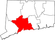
Towns Beacon Falls | Bethany | Branford | Cheshire | East Haven | Guilford | Hamden | Madison | Middlebury | Naugatuck* | North Branford | North Haven | Orange | Oxford | Prospect | Seymour | Southbury | Wallingford | Wolcott | Woodbridge
*Consolidated borough and town
Borough Unincorporated
communitiesDevon | Fair Haven | Heritage Village | Northford | Quaker Farms | Short Beach | South Britain | Stony Creek | Waterville | Westville | Yalesville
Categories:- Cheshire, Connecticut
- Towns in New Haven County, Connecticut


Wikimedia Foundation. 2010.