- Boyes Hot Springs, California
Infobox Settlement
official_name = Boyes Hot Springs, California
other_name =
native_name =
nickname =
settlement_type = CDP
motto =
imagesize =
image_caption =
flag_size =
image_
seal_size =
image_shield =
shield_size =
image_blank_emblem =
blank_emblem_type =
blank_emblem_size =
imagesize =
image_caption =
flag_size =
image_
seal_size =
image_shield =
shield_size =
image_blank_emblem =
blank_emblem_type =
blank_emblem_size =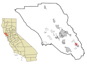
mapsize = 250x200px
map_caption = Location in Sonoma County and the state ofCalifornia
mapsize1 =
map_caption1 =
image_dot_
dot_mapsize =
dot_map_caption =
dot_x =
dot_y =
pushpin_
pushpin_label_position =
pushpin_map_caption =
pushpin_mapsize =
subdivision_type = Country
subdivision_name =United States
subdivision_type1 = State
subdivision_name1 =California
subdivision_type2 = County
subdivision_name2 = Sonoma
subdivision_type3 =
subdivision_name3 =
subdivision_type4 =
subdivision_name4 =
government_footnotes =
government_type =
leader_title =
leader_name =
leader_title1 =
leader_name1 =
leader_title2 =
leader_name2 =
leader_title3 =
leader_name3 =
leader_title4 =
leader_name4 =
established_title =
established_date =
established_title2 =
established_date2 =
established_title3 =
established_date3 =
area_magnitude =
unit_pref =
area_footnotes = GR|2
area_total_sq_mi = 1.05
area_land_sq_mi = 1.05
area_water_sq_mi = 0
area_water_percent = 0
area_urban_sq_mi =
area_metro_sq_mi =
area_blank1_title =
area_blank1_sq_mi =
population_as_of = 2000
population_footnotes = GR|2
population_note =
population_total = 6665
population_density_sq_mi = 6329.9
population_metro =
population_density_metro_sq_mi =
population_urban =
population_density_urban_sq_mi =
population_blank1_title =
population_blank1 =
population_density_blank1_sq_mi =
timezone = PST
utc_offset = -8
timezone_DST = PDT
utc_offset_DST = -7
latd = 38 |latm = 18 |lats = 40 |latNS = N
longd = 122 |longm = 29 |longs = 2 |longEW = W
elevation_footnotes =
elevation_m = 41
elevation_ft = 135
postal_code_type =ZIP code
postal_code = 95416
area_code = 707
blank_name = FIPS code
blank_info = 06-07848
blank1_name = GNIS feature ID
blank1_info = 1658122
website =
footnotes =Boyes Hot Springs is a
census-designated place (CDP) inSonoma Valley ,Sonoma County, California ,United States . The population was 6,665 people at the 2000 census. Resorts in Boyes Hot Springs, El Verano, Fetters Hot Springs, and Agua Caliente were popular health retreats for tourists fromSan Francisco and points beyond until the middle of the 20th century because of thegeothermic hot springs that still well up from deep within the earth. Today the Sonoma Mission Inn in Boyes Hot Springs remains as a main destination resort, and the surrounding valley's wineries, historic sites, and natural beauty are popular tourist attractions.Geography
Boyes Hot Springs is located at coor dms|38|18|40|N|122|29|2|W|city (38.311068, -122.483973)GR|1.
According to the
United States Census Bureau , the CDP has a total area of 1.05square mile s (2.7km² ), all of it land.Demographics
As of the
census GR|2 of 2000, there were 6,665 people, 2,256 households, and 1,495 families residing in the CDP. Thepopulation density was 6,329.9 people per square mile (2,450.8/km²). There were 2,395 housing units at an average density of 2,274.6/sq mi (880.7/km²). The racial makeup of the CDP was 74.99% White, 0.42% African American, 0.72% Native American, 0.92% Asian, 0.09% Pacific Islander, 18.24% from other races, and 4.62% from two or more races. Hispanic or Latino of any race were 41.67% of the population.There were 2,256 households out of which 37.7% had children under the age of 18 living with them, 49.5% were married couples living together, 11.0% had a female householder with no husband present, and 33.7% were non-families. 25.0% of all households were made up of individuals and 6.4% had someone living alone who was 65 years of age or older. The average household size was 2.95 and the average family size was 3.53.
In the CDP the population was spread out with 28.5% under the age of 18, 10.7% from 18 to 24, 32.8% from 25 to 44, 20.2% from 45 to 64, and 7.8% who were 65 years of age or older. The median age was 32 years. For every 100 females there were 104.4 males. For every 100 females age 18 and over, there were 105.7 males.
The median income for a household in the CDP was $50,668, and the median income for a family was $54,469. Males had a median income of $35,085 versus $28,951 for females. The
per capita income for the CDP was $20,115. About 8.6% of families and 12.0% of the population were below thepoverty line , including 16.0% of those under age 18 and 9.9% of those age 65 or over.Politics
In the state legislature Boyes Hot Springs is located in the 2nd Senate District, represented by Democrat
Pat Wiggins , and in the 6th Assembly District, represented by DemocratJared Huffman . Federally, Boyes Hot Springs is located inCalifornia's 6th congressional district .External links
Wikimedia Foundation. 2010.