- Banning, California
-
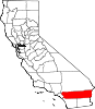
City of Banning — City — Location in Riverside County and the state of California
Coordinates: 33°55′54″N 116°53′51″W / 33.93167°N 116.8975°WCoordinates: 33°55′54″N 116°53′51″W / 33.93167°N 116.8975°W Country  United States
State  California
County Riverside Incorporated (city) February 6, 1913 [1] Area[2] – Total 23.099 sq mi (59.826 km2) – Land 23.099 sq mi (59.826 km2) – Water 0 sq mi (0 km2) 0% Elevation 2,349 ft (716 m) Population (2010) – Total 29,603 – Density 1,281.6/sq mi (494.8/km2) Time zone PST (UTC-8) – Summer (DST) PDT (UTC-7) ZIP code 92220 Area code(s) 951 FIPS code 06-03820 GNIS feature ID 1660306 Website www.ci.banning.ca.us Banning is a city in Riverside County, California, United States in the Greater Los Angeles area. The population was 29,603 at the 2010 census, up from 23,562 at the 2000 census. It is situated in the San Gorgonio Pass, also known as Banning Pass. It is named for Phineas Banning, stagecoach line owner and the "Father of the Port of Los Angeles."
Banning has a western neighbor, the city of Beaumont, which shares geographic and regional features. Banning and Beaumont have been rapidly growing in size and population since the 1990s. Both cities are about 80 miles east of downtown Los Angeles and 30 miles west of Palm Springs, each connected by freeway and railroad.
Contents
History
The area, up to the mid-19th century, was inhabited by the Cahuilla people, though the region around Banning was originally Maringayam (Serrano), and the Cahuilla expanded into the pass only in historic times. In 1824 it became part of the Mission San Gabriel Arcangel, and then the Rancho San Gorgonio. The first Anglo to settle in the area was Dr. Isaac Smith in 1853. In 1863 a smallpox epidemic further diminished the Cahuilla. The government created Indian reservations for the Cahuilla in 1877.
The first stagecoach line came through in 1862, and the railroad followed in 1876. U.S. Route 99 was built in 1923, followed by U.S. Route 60/70 in 1936, and subsequently Interstate 10. The Southern Pacific (later purchased by Union Pacific) railroad, laid down in 1881, was a major contributor to the area's growth.
Banning borders the Morongo Indian Reservation, home to the Morongo Band of Cahuilla (Mission) Indians. Relations with reservation residents have been stressed by such actions as disputes over water rights. See Dorothy Ramon's book (published 2000) "Always Believe" for a Maringayam's views on Banning and reservation life.
Prior to the name Banning, the settlement was called "Moore City". Ransom B. Moore operated a large cattle ranch and was a member of the Los Angeles County Board of Supervisors, settling in the area and nearby San Gorgonio mountains from the late 1850s until the early 1880s. The town was incorporated on February 6, 1913. Between the years 1880 and 1980, it was the largest city in year-round population between Redlands and the Colorado River.[citation needed]
The early western poet and author Henry Herbert Knibbs lived his last years in Banning.
 City of Banning, public art
 City of Banning Ring of Honor
Geography
Banning is located at 33°55′54″N 116°53′51″W / 33.93167°N 116.8975°W (33.931729, -116.897557).[3]
According to the United States Census Bureau, the city has a total area of 23.1 square miles (60 km2), all of it land.
Including Beaumont, Banning's elevation is approximately 2,300 feet (700 m) above sea level, which gives it a cooler climate in contrast to the county seat Riverside at 800 feet (240 m) above sea level and the Coachella Valley of the Colorado Desert to the east.
Demographics
Historical populations Census Pop. %± 1870 520 — 1920 1,810 — 1930 2,752 52.0% 1940 3,874 40.8% 1950 7,034 81.6% 1960 10,250 45.7% 1970 12,034 17.4% 1980 14,020 16.5% 1990 20,570 46.7% 2000 23,562 14.5% 2010 29,603 25.6% 2010
The 2010 United States Census[4] reported that Banning had a population of 29,603. The population density was 1,281.6 people per square mile (494.8/km²). The racial makeup of Banning was 19,164 (64.7%) White, 2,165 (7.3%) African American, 641 (2.2%) Native American, 1,549 (5.2%) Asian, 39 (0.1%) Pacific Islander, 4,604 (15.6%) from other races, and 1,441 (4.9%) from two or more races. Hispanic or Latino of any race were 12,181 persons (41.1%).
The Census reported that 28,238 people (95.4% of the population) lived in households, 254 (0.9%) lived in non-institutionalized group quarters, and 1,111 (3.8%) were institutionalized.
There were 10,838 households, out of which 3,083 (28.4%) had children under the age of 18 living in them, 5,106 (47.1%) were opposite-sex married couples living together, 1,488 (13.7%) had a female householder with no husband present, 592 (5.5%) had a male householder with no wife present. There were 700 (6.5%) unmarried opposite-sex partnerships, and 75 (0.7%) same-sex married couples or partnerships. 3,092 households (28.5%) were made up of individuals and 2,085 (19.2%) had someone living alone who was 65 years of age or older. The average household size was 2.61. There were 7,186 families (66.3% of all households); the average family size was 3.19.
The population was spread out with 6,777 people (22.9%) under the age of 18, 2,730 people (9.2%) aged 18 to 24, 6,048 people (20.4%) aged 25 to 44, 6,387 people (21.6%) aged 45 to 64, and 7,661 people (25.9%) who were 65 years of age or older. The median age was 42.3 years. For every 100 females there were 93.4 males. For every 100 females age 18 and over, there were 90.7 males.
There were 12,144 housing units at an average density of 525.7 per square mile (203.0/km²), of which 7,412 (68.4%) were owner-occupied, and 3,426 (31.6%) were occupied by renters. The homeowner vacancy rate was 4.1%; the rental vacancy rate was 10.9%. 17,552 people (59.3% of the population) lived in owner-occupied housing units and 10,686 people (36.1%) lived in rental housing units.
2000
As of the census[5] of 2000, there were 23,562 people, 8,923 households, and 6,237 families residing in the city. The population density was 1,022 people per square mile (395/km²). There were 9,761 housing units at an average density of 423/sq mi (164/km²). The racial makeup of the city was 64.2% White, 8.6% Black or African American, 2.5% Native American, 5.4% Asian, 0.1% Pacific Islander, 14.9% from other races, and 4.9% from two or more races. 30.2% of the population were Hispanic or Latino of any race.
There were 8,923 households out of which 26.3% had children under the age of 18 living with them, 53.2% were married couples living together, 12.5% had a female householder with no husband present, and 30.1% were non-families. 25.8% of all households were made up of individuals and 16.1% had someone living alone who was 65 years of age or older. The average household size was 2.60 and the average family size was 3.11.
In the city the population was spread out with 26.4% under the age of 18, 7.4% from 18 to 24, 20.9% from 25 to 44, 18.4% from 45 to 64, and 26.8% who were 65 years of age or older. The median age was 41 years. For every 100 females there were 90.9 males. For every 100 females age 18 and over, there were 86.7 males.
The median income for a household in the city was $32,076, and the median income for a family was $38,995. Males had a median income of $31,300 versus $20,794 for females. The per capita income for the city was $16,231. About 14.8% of families and 19.9% of the population were below the poverty line, including 31.8% of those under age 18 and 6.5% of those age 65 or over.
Politics
In the state legislature Banning is located in the 37th Senate District, represented by Republican Bill Emmerson, and in the 65th Assembly District, represented by Republican Paul Cook. Federally, Banning is located in California's 41st congressional district, which has a Cook PVI of R +9[6] and is represented by Republican Jerry Lewis.
City of Banning is proposing[7] to raise funds to offset the deficit. Measure L would double the Transient Occupancy Tax from 6% to 12%.
Public services
Safety
Banning has had its own police force since shortly after its 1913 incorporation, and for many years also had a regional station of the Riverside County Sheriff's Department (which has moved eastward to neighboring Cabazon). The Beaumont, Palm Springs, Cathedral City, and Desert Hot Springs Police Departments also provide assistance in a major emergency, as well as the California Highway Patrol out of the Beaumont regional station.
Like its western neighbor, Beaumont, Banning disbanded its fire department in 2000 and now contracts for fire protection and emergency medical services (EMS) with the Riverside County Fire Department through a cooperative agreement with the California Department of Forestry and Fire Protection (Cal Fire).
Education
The city is served by the Banning Unified School District and nearby Beaumont has the Beaumont Unified School District, both districts serve the area. Schools in the Banning USD:
- Banning High School
- Cabazon Elementary
- Central Elementary
- Coombs Intermediate
- Hemmerling Elementary
- Hoffer Elementary
- New Horizons High (Independent Studies)
- Nicolet Middle
Transportation
City-owned Banning Municipal Airport, (FAA designator: BNG), has a 5,200-foot (1,600 m) runway.
Health care
San Gorgonio Memorial Hospital is a General Acute Care Hospital in Banning with Basic Emergency Services as of 2005.[8]
Cemetery
The Summit Cemetery District[9] operates the San Gorgonio Memorial Park, which was established in 1931 as the Banning-Cabazon Cemetery District.[10]
In popular culture
- The protagonist in the 1950 film noir D.O.A., played by Edmond O'Brien, is an accountant and notary from Banning.[11]
- Location shooting for the films Buckshot John (1915), Fatherhood (1915), El ministro de Hacienda en Córdoba (1975), Sky Below, Crowd Above: The Art Scholl Story (1984), How to Make an American Quilt (1995), Follow Me Home (1996) and Evil on Queen Street (2002) took place in Banning.[12]
References
- ^ http://www.aaroads.com/california/i-010ee_ca.html
- ^ U.S. Census
- ^ "US Gazetteer files: 2010, 2000, and 1990". United States Census Bureau. 2011-02-12. http://www.census.gov/geo/www/gazetteer/gazette.html. Retrieved 2011-04-23.
- ^ All data are derived from the United States Census Bureau reports from the 2010 United States Census, and are accessible on-line here. The data on unmarried partnerships and same-sex married couples are from the Census report DEC_10_SF1_PCT15. All other housing and population data are from Census report DEC_10_DP_DPDP1. Both reports are viewable online or downloadable in a zip file containing a comma-delimited data file. The area data, from which densities are calculated, are available on-line here. Percentage totals may not add to 100% due to rounding. The Census Bureau defines families as a household containing one or more people related to the householder by birth, opposite-sex marriage, or adoption. People living in group quarters are tabulated by the Census Bureau as neither owners nor renters. For further details, see the text files accompanying the data files containing the Census reports mentioned above.
- ^ "American FactFinder". United States Census Bureau. http://factfinder.census.gov. Retrieved 2008-01-31.
- ^ "Will Gerrymandered Districts Stem the Wave of Voter Unrest?". Campaign Legal Center Blog. http://www.clcblog.org/blog_item-85.html. Retrieved 2008-02-10.
- ^ http://www.ci.banning.ca.us/index.aspx?nid=369 ci.banning.ca.us
- ^ California Department of Health Services
- ^ Summit Cemetery District, San Gorgonio Memorial Park
- ^ Find A Grave, photos
- ^ D.O.A. plot summary on AllMovieGuide
- ^ "Most Popular Titles With Location Matching 'Banning, California, USA'" on the Internet Movie Database
External links
- City of Banning official website
- Banning Police Department website
- Banning Library District website
- Banning Unified School District website
- Banning Chamber of Commerce website
Municipalities and communities of Riverside County, California Cities Banning | Beaumont | Blythe | Calimesa | Canyon Lake | Cathedral City | Coachella | Corona | Desert Hot Springs | Eastvale | Hemet | Indian Wells | Indio | Jurupa Valley | La Quinta | Lake Elsinore | Menifee | Moreno Valley | Murrieta | Norco | Palm Desert | Palm Springs | Perris | Rancho Mirage | Riverside | San Jacinto | Temecula | Wildomar
CDPs Aguanga | Anza | Bermuda Dunes | Cabazon | Cherry Valley | Coronita | Crestmore Heights | Desert Center | Desert Edge | Desert Palms | East Hemet | El Cerrito | El Sobrante | French Valley | Garnet | Glen Avon | Good Hope | Green Acres | Highgrove | Home Gardens | Homeland | Idyllwild-Pine Cove | Indio Hills | Lake Mathews | Lake Riverside | Lakeland Village | Lakeview | March ARB | Mead Valley | Meadowbrook | Mecca | Mesa Verde | Mira Loma | Mountain Center | North Shore | Nuevo | Oasis | Pedley | Ripley | Romoland | Rubidoux | Sky Valley | Sunnyslope | Temescal Valley | Thermal | Thousand Palms | Valle Vista | Vista Santa Rosa | Warm Springs | Whitewater | Winchester | Woodcrest
Unincorporated
communitiesAlberhill | Alessandro | Arcilla | Arnold Heights | Belltown | Biskra Palms | Bly | Bonnie Bell | Box Springs | Cactus City | Cahuilla | Cahuilla Hills | Chiriaco Summit | East Blythe | Edgemont | El Cariso | Gilman Hot Springs | La Cresta | Lost Lake | Mortmar | Murrieta Hot Springs | River Bend Lodge | Sun City Palm Desert
Indian
reservationsAgua Caliente Indian Reservation | Cabazon Indian Reservation | Cahuilla Reservation | Colorado River Indian Reservation | Los Coyotes Reservation | Morongo Reservation | Ramona Indian Reservation | Santa Rosa Indian Reservation | Soboba Reservation | Torres-Martinez Indian Reservation
Ghost towns Alamo Bonito | Auld | Bergman | Caleb | Eagle Mountain | Hell | La Placita | Midland | Pinacate | Saahatpa | Terra Cotta
Categories:- Banning, California
- Cities in Riverside County, California
- Incorporated cities and towns in California


Wikimedia Foundation. 2010.