- Costa Mesa, California
-
Costa Mesa, California — City — Aerial view of Costa Mesa

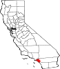
SealLocation of Costa Mesa within Orange County, California
Coordinates: 33°39′54″N 117°54′44″W / 33.665°N 117.91222°WCoordinates: 33°39′54″N 117°54′44″W / 33.665°N 117.91222°W Country  United States
State  California
County Orange Government - Type Council-Manager - City Council Mayor Gary Monahan
Jim Righeimer
Eric Bever
Wendy Leece
Stephen Mensinger[1]-
City Manager
Tom Hatch-
City Treasurer / Finance Director
Marc Puckett, CCMTArea[2] - Total 15.700 sq mi (40.662 km2) - Land 15.654 sq mi (40.543 km2) - Water 0.046 sq mi (0.119 km2) 0.29% Elevation 98 ft (30 m) Population (2010) - Total 109,960 - Rank 8th in Orange County
54th in California
236th in the United States- Density 7,004/sq mi (2,704.2/km2) Time zone PST (UTC-8) - Summer (DST) PDT (UTC-7) ZIP codes 92626-92628 Area code(s) 714/949 FIPS code 06-16532 GNIS feature ID 1652692 Website http://ci.costa-mesa.ca.us Costa Mesa is a city in Orange County, California. The population was 109,960 at the 2010 census. Since its incorporation in 1953, the city has grown from a semi-rural farming community of 16,840 to a primarily suburban and "edge" city with an economy based on retail, commerce, and light manufacturing.
Contents
History
Members of the Gabrieleño/Tongva and Juaneño/Luiseño nations long inhabited the area. After the 1769 expedition of Gaspar de Portolà, a Spanish expedition led by Father Junípero Serra named the area Vallejo de Santa Ana (Valley of Saint Anne). On November 1, 1776, Mission San Juan Capistrano became the area's first permanent European settlement in Alta California, New Spain.
In 1801, the Spanish Empire granted 62,500 acres (253 km2) to Jose Antonio Yorba, which he named Rancho San Antonio. Yorba's great rancho included the lands where the communities of Olive, Orange, Villa Park, Santa Ana, Tustin, Costa Mesa and Newport Beach stand today.
After the Mexican-American war, California became part of the United States and American settlers arrived in this area and formed the town of Fairview in the 1880s near the modern intersection of Harbor Boulevard and Adams Avenue. An 1889 flood wiped out the railroad serving the community, however, and it shriveled.
To the south, meanwhile, the community of Harper had arisen on a siding of the Santa Ana and Newport Railroad, named after a local rancher. This town prospered on its agricultural goods. On May 11, 1920, Harper changed its name to Costa Mesa, which literally means "coast table(land)" in Spanish. This is a reference to the city's geography as being a plateau by the coast.
Costa Mesa surged in population during and after World War II, as many thousands trained at Santa Ana Army Air Base and returned after the war with their families. Within three decades of incorporation, the city's population had nearly quintupled.
Commerce and culture
Costa Mesa's local economy relies heavily on retail and services. The single largest center of commercial activity is South Coast Plaza, a shopping center noted for its architecture and size. The volume of sales generated by South Coast Plaza, on the strength of 322 stores, places it among the highest volume regional shopping centers in the nation. It generates more than one billion dollars per year. Some manufacturing activity also takes place in the city, mostly in the industrial, southwestern quarter, which is home to a number of electronics, pharmaceuticals and plastics firms.
The commercial district surrounding South Coast Plaza, which contains parts of northern Costa Mesa and southern Santa Ana, is sometimes called South Coast Metro.
The Orange County Performing Arts Center and South Coast Repertory Theater are based in the city. A local newspaper, the Daily Pilot, is owned, operated, and printed by the Los Angeles Times. Ceradyne, El Pollo Loco, Emulex, Hurley, RVCA, L-R-G, and Volcom are among the businesses headquartered in Costa Mesa.
The commercial district within the triangle that is formed by Highways 405, 55 & 73 is sometimes called SoBeCa, which stands for "South On Bristol, Entertainment, Culture & Arts".[3]
Costa Mesa offers 26 parks, a municipal golf course, 26 public schools and 2 libraries. It is also home to the Orange County Fairgrounds, which hosts one of the largest fairs in California, the Orange County Fair, each July. The Fair receives more than one million visitors each year. Adjacent to the Fairgrounds is the Pacific Amphitheater, which has hosted acts such as Madonna, Bill Cosby, Jessica Simpson, Steppenwolf, Kelly Clarkson and many more.
Top employers
According to the City's 2010 Comprehensive Annual Financial Report,[4] the top employers in the city are:
# Employer # of employees 1 Experian 3,700 2 Coast Community College District Foundation 3,044 3 Orange Coast College 2,500 4 Coast Community College District 2,500 5 White Cap Construction Supply 2,200 6 Fairview Developmental Center 1,500 7 Automobile Club of Southern California 1,200 8 First Team Real Estate 1,025 9 Los Angeles Times 1,000 10 Commercial Cleaning Systems 850 Government
Local
A general law city, Costa Mesa has a council-manager form of government. Voters elect a five-member City Council, all at-large seats, who in turn select a mayor who acts as its chairperson and head of the government. Day to day, the city is run by a professional city manager and staff of approximately 600 full-time employees.
Management of the city and coordination of city services are provided by:[5]
Office Officeholder City CEO Thomas R. Hatch City Attorney Kimberly Hall Barlow Director of Administrative Services Steven N. Mandoki Director of Development Services Donald D. Lamm Director of Finance Vacant Director of Public Works Peter Naghavi Fire Chief Kirk Dominic Police Chief Vacant The 9.5 acre (38,000 m²) Costa Mesa Civic Center is located at 77 Fair Drive. City Hall is a five-story building where the primary administrative functions of the City are conducted. Also contained in the Civic Center complex are Council Chambers, the Police facility, Communications building and Fire Station No. 5.
Emergency services
Fire protection is provided by the Costa Mesa Fire Department. Law enforcement is the responsibility of the Costa Mesa Police Department. Emergency Medical Services are provided by the Costa Mesa Fire Department and Care Ambulance Service.
State and federal
In the state legislature Costa Mesa is located in the 35th Senate District, represented by Republican Tom Harman, and in the 68th Assembly District, represented by Republican Allan Mansoor. Federally, Costa Mesa is located in California's 46th congressional district, which has a Cook PVI of R +6[6] and is represented by Republican Dana Rohrabacher.
Transportation
Costa Mesa is served by several bus lines of the Orange County Transportation Authority (OCTA), but most transportation is by automobile. Two freeways terminate here, State Route 73 and State Route 55 (also known as the Costa Mesa Freeway). The San Diego Freeway, Interstate 405, also runs through the city.
Geography
Costa Mesa is located 37 miles (60 km) southeast of Los Angeles, 88 miles (142 km) north of San Diego and 425 miles (684 km) south of San Francisco, Costa Mesa encompasses a total of 16 square miles (41 km2) with its southernmost border only 1-mile (1.6 km) from the Pacific Ocean. According to the United States Census Bureau, the city has a total area of 15.7 square miles (41 km2). 15.7 square miles (41 km2) of it is land and 0.05 square miles (0.13 km2) of it (0.29%) is water.
Climate
Costa Mesa has a Mediterranean climate (Köppen climate classification Csb).
Climate data for Costa Mesa Month Jan Feb Mar Apr May Jun Jul Aug Sep Oct Nov Dec Year Average high °F (°C) 64
(18)64
(18)64
(18)66
(19)79
(26)82
(28)85
(29)90
(32)86
(30)86
(30)68
(20)64
(18)68 Average low °F (°C) 44
(7)50
(10)51
(11)54
(12)57
(14)60
(16)63
(17)64
(18)63
(17)54
(12)42
(6)38
(3)56 Precipitation inches (mm) 2.60
(66)2.54
(64.5)2.25
(57.2).70
(18).18
(4.6).08
(2).02
(0.5).09
(2.3).30
(8).28
(7.1)1.02
(25.9)1.59
(40.4)11.65
(295.9)Source: Weather Channel [7] Demographics
2010
The 2010 United States Census[8] reported that Costa Mesa had a population of 109,960. The population density was 7,004.0 people per square mile (2,704.3/km²). The racial makeup of Costa Mesa was 75,335 (68.5%) White, 1,640 (1.5%) African American, 686 (0.6%) Native American, 8,654 (7.9%) Asian, 527 (0.5%) Pacific Islander, 17,992 (16.4%) from other races, and 5,126 (4.7%) from two or more races. Hispanic or Latino of any race were 39,403 persons (35.8%).
The Census reported that 106,990 people (97.3% of the population) lived in households, 2,232 (2.0%) lived in non-institutionalized group quarters, and 738 (0.7%) were institutionalized.
There were 39,946 households, out of which 12,298 (30.8%) had children under the age of 18 living in them, 16,478 (41.3%) were opposite-sex married couples living together, 4,369 (10.9%) had a female householder with no husband present, 2,392 (6.0%) had a male householder with no wife present. There were 3,013 (7.5%) unmarried opposite-sex partnerships, and 281 (0.7%) same-sex married couples or partnerships. 10,963 households (27.4%) were made up of individuals and 2,775 (6.9%) had someone living alone who was 65 years of age or older. The average household size was 2.68. There were 23,239 families (58.2% of all households); the average family size was 3.30.
The population was spread out with 23,682 people (21.5%) under the age of 18, 12,847 people (11.7%) aged 18 to 24, 38,211 people (34.7%) aged 25 to 44, 25,106 people (22.8%) aged 45 to 64, and 10,114 people (9.2%) who were 65 years of age or older. The median age was 33.6 years. For every 100 females there were 103.7 males. For every 100 females age 18 and over, there were 102.7 males.
There were 42,120 housing units at an average density of 2,682.9 per square mile (1,035.9/km²), of which 15,799 (39.6%) were owner-occupied, and 24,147 (60.4%) were occupied by renters. The homeowner vacancy rate was 1.2%; the rental vacancy rate was 5.9%. 42,517 people (38.7% of the population) lived in owner-occupied housing units and 64,473 people (58.6%) lived in rental housing units.
2000
As of the census[9] of 2000, there were 108,724 people, 39,206 households, and 22,778 families residing in the city. The population density was 6,956.3 inhabitants per square mile (2,685.8/km²). There were 40,406 housing units at an average density of 2,585.2 per square mile (998.1/km²). The racial makeup of the city was 69.48% White, 1.40% Black or African American, 0.78% Native American, 6.90% Asian, 0.60% Pacific Islander, 16.57% from other races, and 4.27% from two or more races. 31.75% of the population were Hispanic or Latino of any race.
There were 39,206 households out of which 29.2% had children under the age of 18 living with them, 42.8% were married couples living together, 10.3% had a female householder with no husband present, and 41.9% were non-families. 28.1% of all households were made up of individuals and 6.3% had someone living alone who was 65 years of age or older. The average household size was 2.69 and the average family size was 3.34.
In the city the population was spread out with 23.2% under the age of 18, 11.2% from 18 to 24, 39.0% from 25 to 44, 18.1% from 45 to 64, and 8.4% who were 65 years of age or older. The median age was 32 years. For every 100 females there were 105.0 males. For every 100 females age 18 and over, there were 103.9 males.
The median income for a household in the city was $50,732, and the median income for a family was $55,456. Males had a median income of $38,670 versus $32,365 for females. The per capita income for the city was $23,342. About 8.2% of families and 12.6% of the population were below the poverty line, including 16.0% of those under age 18 and 6.2% of those age 65 or over.
Education
Institutions of higher learning located in Costa Mesa include Orange Coast College, Vanguard University (affiliated with the Assemblies of God), Whittier Law School (a satellite of Whittier College) and National University (a private university based in La Jolla, California).
Costa Mesa has two high schools, Costa Mesa High School and Estancia High School. Costa Mesa has two public middle schools; Tewinkle Middle School, which was named after Costa Mesa's first mayor, and Costa Mesa Middle School which shares the same campus as Costa Mesa High School. Costa Mesa also has two alternative high schools that share the same campus, Back Bay High School and Monte Vista High School and another, Coastline Early College High School which is on its own facility. Olympic high jumper, Sharon Day, graduated from Costa Mesa High School in 2003.[10]
Sister city
Notable natives and residents
- Mike Barrowman, Olympic swimmer
- Jake Gibb, beach volleyball Olympian[11]
- Mitchell Hurwitz[citation needed]
- Bill Madden, singer-songwriter and musician is a former resident.
- Misty May-Treanor, two-time Olympic gold-medalist in beach volleyball
- Mike Ness, singer and guitarist of the punk band Social Distortion is a former resident.
- Jason Thornberry, author is a former resident.
- Kyla Ross, USA Gymnastics Junior National Team Member; 2009 U.S. Junior National Champion and 2009 Junior Pan American Games Champion; trains at Gym-Max
See also
References
- ^ http://www.ci.costa-mesa.ca.us/
- ^ U.S. Census
- ^ http://www.sobeca.net/
- ^ City of Costa Mesa CAFR
- ^ City of Costa Mesa Website retrieved 2009-06-04
- ^ "Will Gerrymandered Districts Stem the Wave of Voter Unrest?". Campaign Legal Center Blog. http://www.clcblog.org/blog_item-85.html. Retrieved 2008-02-10.
- ^ Average weather for Costa Mesa Weather Channel Retrieved 2008-03-29
- ^ All data are derived from the United States Census Bureau reports from the 2010 United States Census, and are accessible on-line here. The data on unmarried partnerships and same-sex married couples are from the Census report DEC_10_SF1_PCT15. All other housing and population data are from Census report DEC_10_DP_DPDP1. Both reports are viewable online or downloadable in a zip file containing a comma-delimited data file. The area data, from which densities are calculated, are available on-line here. Percentage totals may not add to 100% due to rounding. The Census Bureau defines families as a household containing one or more people related to the householder by birth, opposite-sex marriage, or adoption. People living in group quarters are tabulated by the Census Bureau as neither owners nor renters. For further details, see the text files accompanying the data files containing the Census reports mentioned above.
- ^ "American FactFinder". United States Census Bureau. http://factfinder.census.gov. Retrieved 2008-01-31.
- ^ http://www.usatf.org/athletes/bios/Day_Sharon.asp
- ^ Aimee Berg (2008-07-24). "The Perfect Mismatch". U.S. Olympic Committee web site. http://teamusa.org/news/article/2742. Retrieved 2008-07-24.
Service Organizations
- Costa Mesa Rotary Club
- Costa Mesa Kiwanis
- Oddfellows
- Cub Scout Pack 711
- Boy Scout Troop 339
- Boy Scout Troop 106
External links
- City of Costa Mesa official website
- City of Costa Mesa Chamber of Commerce
- City of Costa Mesa official Conference & Visitor Bureau
- Costa Mesa Library Foundation
- Costa Mesa Historical Society
- Vanguard University of Southern California
- National University
- [2]
Municipalities and communities of Orange County, California County seat: Santa Ana Cities Aliso Viejo | Anaheim | Brea | Buena Park | Costa Mesa | Cypress | Dana Point | Fountain Valley | Fullerton | Garden Grove | Huntington Beach | Irvine | La Habra | La Palma | Laguna Beach | Laguna Hills | Laguna Niguel | Laguna Woods | Lake Forest | Los Alamitos | Mission Viejo | Newport Beach | Orange | Placentia | Rancho Santa Margarita | San Clemente | San Juan Capistrano | Santa Ana | Seal Beach | Stanton | Tustin | Villa Park | Westminster | Yorba Linda
CDPs Unincorporated
communitiesAnaheim Island | Modjeska Canyon | Orange Park Acres | Santa Ana Heights | Santiago Canyon | Silverado | Trabuco Canyon
Mayors of cities with populations exceeding 100,000 in California - Antonio Villaraigosa
(Los Angeles) - Jerry Sanders
(San Diego) - Chuck Reed
(San Jose) - Edwin M. Lee
(San Francisco) - Ashley Swearengin
(Fresno) - Kevin Johnson
(Sacramento) - Bob Foster
(Long Beach) - Jean Quan
(Oakland) - Harvey Hall
(Bakersfield) - Tom Tait
(Anaheim) - Miguel A. Pulido
(Santa Ana)
- Ronald O. Loveridge
(Riverside) - Ann Johnston
(Stockton) - Cheryl Cox
(Chula Vista) - Bob Wasserman
(Fremont) - Sukhee Kang
(Irvine) - Pat Morris
(San Bernardino) - Jim Ridenour
(Modesto) - Thomas E. Holden
(Oxnard) - Acquanetta Warren
(Fontana) - William H. Batey II
(Moreno Valley)^ - John Drayman
(Glendale)
- Cathy Green
(Huntington Beach)^ - Bob Kellar
(Santa Clarita)^ - William Dalton
(Garden Grove) - Susan Gorin
(Santa Rosa)^ - Jim Wood
(Oceanside) - Donald Kurth
(Rancho Cucamonga) - Paul S. Leon
(Ontario) - R. Rex Parris
(Lancaster) - Pat Hume
(Elk Grove) - James C. Ledford Jr.
(Palmdale) - Stan Skipworth
(Corona)^
- Dennis Donohue
(Salinas) - Elliot Rothman
(Pomona) - Frank Scotto
(Torrance) - Michael Sweeney
(Hayward) - Sam Abed
(Escondido) - Tony Spitaleri
(Sunnyvale) - Bill Bogaard
(Pasadena) - Carolyn Cavecche
(Orange) - F. Richard Jones
(Fullerton)^ - Jacqui Irwin
(Thousand Oaks)^ - Jesus Gamboa
(Visalia)
- Paul Miller
(Simi Valley) - William D. Shinn
(Concord)^ - Gina Garbolino
(Roseville) - Jamie L. Matthews
(Santa Clara) - Osby Davis
(Vallejo) - Rudy Cabriales
(Victorville) - Ernest Gutierrez
(El Monte) - Tom Bates
(Berkeley) - Rick Trejo
(Downey)^ - Eric R. Bever
(Costa Mesa)^ - James T. Butts, Jr.
(Inglewood)

^Mayor selected from city council
Other states: AL • AK • AZ • AR • CA • CO • CT • DE • FL • GA • HI • ID • IL • IN • IA • KS • KY • LA • ME • MD • MA • MI • MN • MS • MO • MT • NE • NV • NH • NJ • NM • NY • NC • ND • OH • OK • OR • PA • RI • SC • SD • TN • TX • UT • VT • VA • WA • WV • WI • WYCategories:- Cities in Southern California
- Costa Mesa, California
- Cities in Orange County, California
- Populated places on the Santa Ana River
- Populated places established in 1920
- Incorporated cities and towns in California


Wikimedia Foundation. 2010.