- Nevada City, California
-
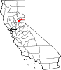
Nevada City — City — Broad Street, Downtown Nevada City Location in Nevada County and the state of California
 Location in Nevada County and the state of California
 Nevada City
Coordinates: 39°15′41″N 121°1′7″W / 39.26139°N 121.01861°WCoordinates: 39°15′41″N 121°1′7″W / 39.26139°N 121.01861°W Country  United States
State  California
County Nevada Area[1] – Total 2.192 sq mi (5.677 km2) – Land 2.188 sq mi (5.667 km2) – Water 0.004 sq mi (0.010 km2) 0.17% Elevation 2,477 ft (755 m) Population (2010) – Total 3,068 – Density 1,399.6/sq mi (540.4/km2) Time zone Pacific (PST) (UTC-8) – Summer (DST) PDT (UTC-7) ZIP code 95959 Area code(s) 530 FIPS code 06-50874 GNIS feature ID 1659211 Website nevadacityca.gov Nevada City (originally, Ustumah, a Nisenan Maidu village;[2] later, Nevada, Deer Creek Dry Diggins, and Caldwell's Upper Store)[3] is the county seat of Nevada County, California, USA, located 60 miles (97 km) northeast of Sacramento and 28 miles north of Auburn. In 1900, 3,250 people lived in Nevada City; in 1910, 2,689 lived there; at the 2000 census, the population was 3,001, and at the 2010 census it was 3,068.
Contents
History
It was first settled in 1849, during the California Gold Rush, under the name Nevada (meaning "snow-covered", a reference to the snow-topped mountains in the area). In 1850-51, it was the most important mining town in the state, Nevada County being the leading gold-mining county in the state. The town of Nevada was incorporated on April 19, 1856. In 1864, “City” was added to the name to avoid confusion with the State of Nevada, and since that time, the town has been legally, “Nevada City.” The former town of Coyoteville, California, later became Nevada City's northwestern section.[3][4]
Several historical buildings have received National Register of Historic Places and/or California Historical Landmark status, and have been preserved. Some of these include:
- Court house and city hall Art deco facades are attributable to Works Progress Administration projects.[3]
- Doris Foley Library for Historical Research (NRHP No. 90001809), 211 North Pine Street, is a Carnegie library.
- Miners Foundry (CHL No. 1012), 325 Spring Street, was the first manufacturing location of the Pelton wheel.
- National Hotel (CHL No. 899), 211 Broad Street, is one of the oldest continuously operating hotels west of the Rocky Mountains.
- Nevada City Firehouse No. 2
- Nevada Brewery (NRHP No. 85002303), 107 Sacramento Street, was used for brewing and serving lager beer to the mining community.
- Nevada Theatre (CHL No. 863), 401 Broad Street, is California's oldest original-use theatre.
- South Yuba Canal Office (CHL No. 832), 134 Main Street, was used during the period of 1857 to 1880.
Geography
Nevada City is located at 39°15′41″N 121°01′07″W / 39.261435°N 121.018602°W.[5]
According to the United States Census Bureau, the city has a total area of 2.2 square miles (5.7 km2), 99.83% of it land and 0.17% of it water.
Nevada, Missouri is named after Nevada City.
Demographics
Historical populations Census Pop. %± 1850 2,683 — 1880 4,022 — 1890 2,524 −37.2% 1900 3,250 28.8% 1910 2,689 −17.3% 1920 1,782 −33.7% 1930 1,701 −4.5% 1940 2,445 43.7% 1950 2,505 2.5% 1960 2,353 −6.1% 1970 2,314 −1.7% 1980 2,431 5.1% 1990 2,855 17.4% 2000 3,001 5.1% 2010 3,068 2.2% 2010
The 2010 United States Census[6] reported that Nevada City had a population of 3,068. The population density was 1,399.7 people per square mile (540.4/km²). The racial makeup of Nevada City was 2,837 (92.5%) White, 26 (0.8%) African American, 28 (0.9%) Native American, 46 (1.5%) Asian, 0 (0.0%) Pacific Islander, 40 (1.3%) from other races, and 91 (3.0%) from two or more races. Hispanic or Latino of any race were 205 persons (6.7%).
The Census reported that 2,829 people (92.2% of the population) lived in households, 56 (1.8%) lived in non-institutionalized group quarters, and 183 (6.0%) were institutionalized.
There were 1,356 households, out of which 317 (23.4%) had children under the age of 18 living in them, 510 (37.6%) were opposite-sex married couples living together, 155 (11.4%) had a female householder with no husband present, 79 (5.8%) had a male householder with no wife present. There were 97 (7.2%) unmarried opposite-sex partnerships, and 15 (1.1%) same-sex married couples or partnerships. 488 households (36.0%) were made up of individuals and 168 (12.4%) had someone living alone who was 65 years of age or older. The average household size was 2.09. There were 744 families (54.9% of all households); the average family size was 2.67.
The population was spread out with 517 people (16.9%) under the age of 18, 199 people (6.5%) aged 18 to 24, 720 people (23.5%) aged 25 to 44, 1,075 people (35.0%) aged 45 to 64, and 557 people (18.2%) who were 65 years of age or older. The median age was 47.5 years. For every 100 females there were 100.4 males. For every 100 females age 18 and over, there were 101.8 males.
There were 1,510 housing units at an average density of 688.9 per square mile (266.0/km²), of which 786 (58.0%) were owner-occupied, and 570 (42.0%) were occupied by renters. The homeowner vacancy rate was 3.8%; the rental vacancy rate was 4.8%. 1,678 people (54.7% of the population) lived in owner-occupied housing units and 1,151 people (37.5%) lived in rental housing units.
2000
As of the census[7] of 2000, there were 3,001 people, 1,313 households, and 740 families residing in the city. The population density was 1,425.0 people per square mile (549.1/km²). There were 1,415 housing units at an average density of 671.9 per square mile (258.9/km²). The racial makeup of the city was 94.3% White, 0.4% African American, 1.4% Native American, 0.7% Asian, <0.1% Pacific Islander, 0.7% from other races, and 2.4% from two or more races. Hispanic or Latino of any race were 3.5% of the population.
There were 1,313 households out of which 25.4% had children under the age of 18 living with them, 38.1% were married couples living together, 13.3% had a female householder with no husband present, and 43.6% were non-families. 35.0% of all households were made up of individuals and 10.4% had someone living alone who was 65 years of age or older. The average household size was 2.14 and the average family size was 2.71.
In the city, the population was spread out with 19.7% under the age of 18, 7.4% from 18 to 24, 25.9% from 25 to 44, 32.2% from 45 to 64, and 14.9% who were 65 years of age or older. The median age was 44 years. For every 100 females, there were 97.2 males. For every 100 females age 18 and over, there were 95.4 males.
The median income for a household in the city was $36,667, and the median income for a family was $46,149. Males had a median income of $32,070 versus $29,183 for females. The per capita income for the city was $22,399. About 1.7% of families and 7.9% of the population were below the poverty line, including 2.5% of those under age 18 and 3.8% of those age 65 or over.
Politics
In the state legislature, Nevada City is located in the 4th Senate District, represented by Republican Doug LaMalfa, and in the 3rd Assembly District, represented by Republican Dan Louge. Federally, Nevada City is located in California's 4th congressional district, which has a Cook PVI of R +11[8] and is represented by Republican Tom McClintock.
Economy
Tourism
Tourists visit Nevada City not only for its historic appeal, but for special events as well.
- Beginning in 1960, the Nevada City Classic[9] has been a challenging professional cycling race, commonly held on Father's Day, that brings in thousands of visitors. In June 2009, Lance Armstrong was the winner.[10]
- Beginning in 1967, the Constitution Day Parade includes the Ophir Prison Marching Kazoo Band[11] and, since 1987, the Famous Marching Presidents (and their First Ladies).[12] Held the second Sunday of September, it is one of the oldest and largest Constitution observances in the western United States.[13]
Town twinning/Sister City
Nevada City is twinned with Penzance, a seaside town in Cornwall, UK and the nearby tin and copper mining town of St Just in Penwith, Cornwall, UK.[citation needed] The twinning is a result of Cornish migration during the Californian gold rush in which Cornish mining expertise was exported to the area. In the City Hall of Nevada City there is a room dedicated to the twinning and houses Cornish memorabilia and items donated on various exchanges. Penzance Youth Wind Band under the direction of Paul Carter have joined forces with Nevada Union High School instrumental music department on two occasions.
Film and the arts
Beginning in 1985, the Sierra Storytelling Festival has brought together storytellers. The event takes place each July in a pine-shaded amphitheater built specifically for storytelling.[14]
Beginning in 2003, the Wild & Scenic Film Festival has showcased films on a full range of environmental issues and includes many films emphasizing outdoor adventure and extreme sports. The event takes place in January and occupies multiple venues in downtown Nevada City. It has become one of the largest film festivals of its kind in the United States.[15]
Modern day Nevada City was the setting for the 2006 Hallmark Channel original movie, The Christmas Card.
Education
Higher education
- California College of Ayurveda
Notable residents
- Tina Basich (resident), professional snowboarder
- Donald J. Butz, U.S. Air Force Major General
- Joseph Cornell resident, naturalist and author
- Alela Diane (resident), singer/songwriter
- Alasdair Fraser, Scottish fiddler and owner of Culburnie Records
- Noah Georgeson, musician, producer
- Mary K. Greer internationally renowned tarot scholar and practitioner
- Roger Hodgson (resident), singer/songwriter and ex-Supertramp member
- Dan Kemp, actor who died in Nevada City in 2000
- Rob Kieswetter, aka Bobby Birdman, musician
- Stephen McNallen an influential Germanic Neopagan leader and writer
- Joanna Newsom, harpist and singer/songwriter
- John Olmsted, California Naturalist, and co-creator of The Independence Trail State Park
- Utah Phillips (deceased), folk singer
- Ed Reimers, actor and television announcer
- Terry Riley, renowned minimalist composer
- Alexander Rossi, professional race car driver
- Aaron Augustus Sargent, U.S. Senator from California
- Niles Searls, Chief Justice of the Supreme Court of California
- Mariee Sioux, folk singer
- Gary Snyder (resident), poet associated with the Beat generation
- Heinrich Sylvester Theodor Tiling former resident, physician and botanist
Gallery of Downtown Nevada City 


Commercial Street Old Fire House on Broad Street The Chamber of Commerce on Union Alley See also
References
- ^ U.S. Census
- ^ Middleton, Elisabeth Rose; University of California, Berkeley (2008). "We were here, we are here, we will always be here": A political ecology of healing in Mountain Maidu country. ProQuest. pp. 387–. ISBN 978-1-109-10064-8. http://books.google.com/books?id=gfE6T0cREt8C&pg=PA387. Retrieved 13 November 2011.
- ^ a b c "Nevada City, Queen City of the Northern Hills". ncgold.com. http://www.ncgold.com/History/NCityHis.html. Retrieved 2008-07-21.
- ^ Hoover, Mildred Brooke; Douglas E. Kyle, Hero Rensch (2002). Historic spots in California. 5. Stanford University Press. pp. 258. ISBN 0804744823. http://books.google.com/books?id=AYMPR6xAj50C&pg=PA258&lpg=PA258&dq=%22coyoteville%22+%22nevada+county%22+town.
- ^ "US Gazetteer files: 2010, 2000, and 1990". United States Census Bureau. 2011-02-12. http://www.census.gov/geo/www/gazetteer/gazette.html. Retrieved 2011-04-23.
- ^ All data are derived from the United States Census Bureau reports from the 2010 United States Census, and are accessible on-line here. The data on unmarried partnerships and same-sex married couples are from the Census report DEC_10_SF1_PCT15. All other housing and population data are from Census report DEC_10_DP_DPDP1. Both reports are viewable online or downloadable in a zip file containing a comma-delimited data file. The area data, from which densities are calculated, are available on-line here. Percentage totals may not add to 100% due to rounding. The Census Bureau defines families as a household containing one or more people related to the householder by birth, opposite-sex marriage, or adoption. People living in group quarters are tabulated by the Census Bureau as neither owners nor renters. For further details, see the text files accompanying the data files containing the Census reports mentioned above.
- ^ "American FactFinder". United States Census Bureau. http://factfinder.census.gov. Retrieved 2008-01-31.
- ^ "Will Gerrymandered Districts Stem the Wave of Voter Unrest?". Campaign Legal Center Blog. http://www.clcblog.org/blog_item-85.html. Retrieved 2007-10-20.
- ^ "Nevada City Classic Bicycle Race". ncclassic.com. http://www.ncclassic.com/. Retrieved 2009-06-22.
- ^ Valentinsen, Thomas (June 22, 2009). "Lance Armstrong Wins 2009 Nevada City Classic". roadcycling.com. http://www.roadcycling.com/articles/Lance_Armstrong_Wins_2009_Nevada_City_Classic_002822.shtml. Retrieved 2009-06-22.
- ^ "Welcome to Ophir". ophirprison.com. http://www.ophirprison.com/. Retrieved 2009-06-22.
- ^ "The Famous Marching Presidents". marchingpresidents.org. http://marchingpresidents.org/. Retrieved 2009-06-22.
- ^ "43rd Annual Constitution Day Parade & Celebration Sept. 12-13 in Historic Nevada City". nevadacitychamber.com. http://www.nevadacitychamber.com/events/constitution.cfm. Retrieved 2009-06-22.
- ^ "Queen of storytelling festivals celebrates its 24th year". sierrastorytellingfestival.org. http://www.sierrastorytellingfestival.org/. Retrieved 2009-06-22.
- ^ "Wild and Scenic Film Festival". wildandscenicfilmfestival.org. http://www.wildandscenicfilmfestival.org/. Retrieved 2010-12-06.
Further reading
- Davis, H. P. (1940). National hotel and coffee shop, Nevada City, California.
- Hagaman, W. R. (2001). A short history of the Chinese cemetery at Nevada City, California: and Chinese burial customs during the Gold Rush. Nevada City, CA: Cowboy Press.
- Hattich, L. (1969). Feasibility study on Nevada City Theater, Nevada City, California. Boulder, Colo: Economic Development Internship Program, Western Interstate Commission for Higher Education.
- Hidden Nugget Placer Mining Co. (1910). Hidden Nugget Placer Mining Company, Nevada City, California. Nevada City, CAlif: The Company.
- Mann, R. (1982). After the Gold Rush: society in Grass Valley and Nevada City, California, 1849-1870. Stanford, Calif: Stanford University Press.
- Marsh, Martin Keith (2001). The Yellowjackets: A History of Nevada City High School Football (1901-1951). Grass Valley, CA: Cottage Hill. ISBN 0965824020.
- Nevada City Chamber of Commerce. (1932). Homes among the hills: Nevada City, California : gold, health, happiness. Nevada City, Calif.?: Nevada City Chamber of Commerce?.
External links
- Nevada City, California at the Open Directory Project
- Official City of Nevada City Website
- Nevada City Chamber of Commerce
- Nevada City Visitors Info
- Nevada City Live Weather Station and Webcam
- A History of Chinese Americans in California: Nevada City Chinese American Cemetery
- Nevada City History and Photos
- [1]

French Corral Camptonville Englebright Lake 
Scotts Flat Reservoir  Nevada City

Grass Valley Cedar Ridge Foresthill Municipalities and communities of Nevada County, California County seat: Nevada CityCities and towns Grass Valley | Nevada City | Truckee
CDPs Alta Sierra | Floriston | Graniteville | Kingvale‡ | Lake of the Pines | Lake Wildwood | North San Juan | Penn Valley | Rough and Ready | Soda Springs | Washington
Unincorporated
communitiesAlta Hill | Bitney Corner | Carpenter Valley | Casey Corner | Cedar Ridge | Chicago Park | Coleman | Crystal Lake | Dew Drop | French Corral | Forest Knolls | Gaston | Gateway | Gold Flat | Higgins Corner | Hills Flat | Hinton | Hirschdale | Junction House | Kres | Lake City | Marsh Mill | Mooney Flat | Mystic | Newtown | Norden | North Bloomfield | North Columbia | Peardale | Pinecrest | Polaris | Relief | Scotts Flat | Sebastopol | Spring Hill | The Oaks | Town Talk | Union Mills | Willow Valley | Wolf | You Bet | Yuba Pass
Ghost towns Alpha | Badger Hill | Balaklava | Bald Eagle | Baltimore Town | Bear River Pines | Bear Valley | Beckmans Flat | Birchville | Blue Tent | Boca | Boston Ravine | Brass Wire Bar | Bridgeport | Brighton House | Bronco | Buena Vista | Burckhalter | Burks Bar | Camp Spaulding | Cascade Diggings | Cedar Kress | Chalk Bluff | Champion | Cherokee | Coyoteville | Crystal Springs | Democrat | Diamond Creek | Diggers Bar | Dillon | Drum | Eagle Bird | Elida | Eureka | Excelsior | Farad | Fernley | Flood | Forest Spring | French Lake | Frenchmans Bar | Gelatt | Glenbrook | Gold Hill | Hacketville | Hobart Mills | Hunt's Hill | Iceland | Indian Springs | Jericho | Jones Bar | La Barr Meadows | Lafayette Hill | Langs | Little York | Louisa | Lowell Hill | Malakoff | Maybert | Meadow Lake | Melburn Hill | Missouri Flat | Moores Flat | Mount Zion | Mountain Well | Mountain View | Negro Flat | Ohm | Omega | Orleans Flat | Pittsburg | Pleasant Flat | Prosser | Prosser Creek | Providence | Randolph House | Rays Flat | Red Diamond | Red Dog | Remington Hill | Rose's Corral | Shands | Shelby Flat | Shellback | Six Mile House | Snow Point | Snow Tent | Spenceville | Spiritsville | Stockings Flat | Sunset View | Sweetland | Tsekankan | Union Hill | Ustoma | Virginia House | Waloupa | White Cloud | Wickes | Wilsonville | Wokodot | Woolsey Flat | Yamako | Zinc House
Footnotes ‡This CDP also has portions in an adjacent county or counties
Greater Sacramento Counties Douglas (NV) · El Dorado · Nevada · Placer · Sacramento · Sutter · Yolo · Yuba
Major City Cities
and
towns100k–200k25k–100kArden Arcade · Auburn · Carmichael · Citrus Heights · Davis · Folsom · Florin · Laguna · Lincoln · North Highlands · Orangevale · Parkway-South Sacramento · Rancho Cordova · Rocklin · West Sacramento · Woodland · Yuba City
10k–25kCameron Park · El Dorado Hills · Fair Oaks · Foothill Farms · Galt · Gardnerville Ranchos (NV) · Granite Bay · Grass Valley · La Riviera · Linda · Marysville · North Auburn · Olivehurst · Placerville · Rosemont · Rio Linda · South Lake Tahoe · South Yuba City · Truckee · Vineyard
Sub-regions Gold Country · Lake Tahoe · Sacramento Valley · Sierra Nevada · Yuba-Sutter Area
California county seats Consolidated city-county Municipalities Alturas | Auburn | Bakersfield | Colusa | Crescent City | El Centro | Eureka | Fairfield | Fresno | Hanford | Hollister | Jackson | Lakeport | Los Angeles | Madera | Martinez | Marysville | Merced | Modesto | Napa | Nevada City | Oakland | Oroville | Placerville | Red Bluff | Redding | Redwood City | Riverside | Sacramento | Salinas | San Bernardino | San Diego | San Jose | San Luis Obispo | San Rafael | Santa Ana | Santa Barbara | Santa Cruz | Santa Rosa | Sonora | Stockton | Susanville | Ukiah | Ventura | Visalia | Willows | Woodland | Yreka | Yuba City
CDPs Bridgeport | Downieville | Independence | Mariposa | Markleeville | Quincy | San Andreas | Weaverville
Categories:- Incorporated cities and towns in California
- Cities in Nevada County, California
- Sacramento metropolitan area
- County seats in California


Wikimedia Foundation. 2010.