- Mendota, California
-
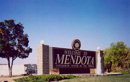
City of Mendota — City — Welcome sign at south end of Mendota along SR180. Location in Fresno County and the state of California
Coordinates: 36°45′13″N 120°22′54″W / 36.75361°N 120.38167°WCoordinates: 36°45′13″N 120°22′54″W / 36.75361°N 120.38167°W Country  United States
State  California
County Fresno Government – Mayor Robert Silva – Mayor Pro Tem Joseph Amador – Senate Dean Florez (D) – Assembly Juan Arambula (D) – U. S. Congress Jim Costa (D) Area[1] – Total 3.281 sq mi (8.499 km2) – Land 3.278 sq mi (8.491 km2) – Water 0.003 sq mi (0.008 km2) 0.10% Elevation 174 ft (53 m) Population (2010) – Total 11,014 – Density 3,356.9/sq mi (1,295.9/km2) Time zone Pacific (PST) (UTC-8) – Summer (DST) PDT (UTC-7) ZIP code 93640 Area code(s) 559 FIPS code 06-46828 GNIS feature ID 1656159 Website http://www.cityofmendota.com Slogan: The Cantaloupe Center of the World Mendota is a city in Fresno County, California, United States. The population was 11,014 at the 2010 census. The State Routes 180 and 33 run through the agricultural city. Mendota is located 8.5 miles (14 km) south-southeast of Firebaugh,[2] at an elevation of 174 feet (53 m).[3]
Contents
Geography
According to the United States Census Bureau, the city has a total area of 3.3 square miles (8.5 km2), over 99% of it land. At the 2000 census, according to the United States Census Bureau, the city had a total area of 1.9 square miles (4.9 km2), all of it land. It is located next to the San Joaquin River, near where the Delta-Mendota Canal intercepts it to bring extra water to the dry riverbed.
History
Beginning in 1891, Mendota thrived as a Southern Pacific Railroad storage and switching facility site. Southern Pacific management borrowed the name from Mendota, Illinois.[2] The first post office opened in 1892.[2] The city incorporated in 1942,[2] and is mostly recognized for its immense production of cantaloupes. Appropriately, the city of Mendota is identified as The Cantaloupe Center of the World. State water projects brought irrigation to the region, setting the stage for the tremendous growth of agriculture.
In 2007 a new Mendota Branch Library opened, part of the San Joaquin Valley Library System.
The city suffers from chronic unemployment averaging 20%. In 2009 a drought combined with a recession caused unemployment to surge above 40%.[4] The unemployment was quted at 45% in May 2011.[5]
Demographics
2010
The 2010 United States Census[6] reported that Mendota had a population of 11,014. The population density was 3,356.3 people per square mile (1,295.9/km²). The racial makeup of Mendota was 5,823 (52.9%) White, 107 (1.0%) African American, 153 (1.4%) Native American, 82 (0.7%) Asian, 5 (0.0%) Pacific Islander, 4,465 (40.5%) from other races, and 379 (3.4%) from two or more races. Hispanic or Latino of any race were 10,643 persons (96.6%).
The Census reported that 11,014 people (100% of the population) lived in households, 0 (0%) lived in non-institutionalized group quarters, and 0 (0%) were institutionalized.
There were 2,424 households, out of which 1,583 (65.3%) had children under the age of 18 living in them, 1,309 (54.0%) were opposite-sex married couples living together, 457 (18.9%) had a female householder with no husband present, 319 (13.2%) had a male householder with no wife present. There were 303 (12.5%) unmarried opposite-sex partnerships, and 11 (0.5%) same-sex married couples or partnerships. 197 households (8.1%) were made up of individuals and 78 (3.2%) had someone living alone who was 65 years of age or older. The average household size was 4.54. There were 2,085 families (86.0% of all households); the average family size was 4.49.
The population was spread out with 3,731 people (33.9%) under the age of 18, 1,500 people (13.6%) aged 18 to 24, 3,432 people (31.2%) aged 25 to 44, 1,832 people (16.6%) aged 45 to 64, and 519 people (4.7%) who were 65 years of age or older. The median age was 26.2 years. For every 100 females there were 123.6 males. For every 100 females age 18 and over, there were 134.3 males.
There were 2,556 housing units at an average density of 778.9 per square mile (300.7/km²), of which 1,056 (43.6%) were owner-occupied, and 1,368 (56.4%) were occupied by renters. The homeowner vacancy rate was 1.9%; the rental vacancy rate was 4.1%. 5,075 people (46.1% of the population) lived in owner-occupied housing units and 5,939 people (53.9%) lived in rental housing units.
2000
As of the census[7] of 2000, there were 7,890 people, 1,825 households, and 1,545 families residing in the city. The population density was 1,629.1/km² (4,229.4/mi²). There were 1,878 housing units at an average density of 387.8/km² (1,006.7/mi²). The racial makeup of the city was 27.33% White, 0.66% Black or African American, 1.31% Native American, 0.72% Asian, 0.16% Pacific Islander, 63.12% from other races, and 6.70% from two or more races. 94.65% of the population were Hispanic or Latino of any race.
There were 1,825 households out of which 53.4% had children under the age of 18 living with them, 56.8% were married couples living together, 16.9% had a female householder with no husband present, and 15.3% were non-families. 9.1% of all households were made up of individuals and 3.9% had someone living alone who was 65 years of age or older. The average household size was 4.32 and the average family size was 4.38.
In the city the population was spread out with 33.9% under the age of 18, 15.3% from 18 to 24, 30.9% from 25 to 44, 14.7% from 45 to 64, and 5.2% who were 65 years of age or older. The median age was 25 years. For every 100 females there were 130.2 males. For every 100 females age 18 and over, there were 142.0 males.
The median income for a household in the city was $23,705, and the median income for a family was $22,984. Males had a median income of $17,500 versus $21,319 for females. The per capita income for the city was $6,967. About 35.2% of families and 41.9% of the population were below the poverty line, including 49.4% of those under age 18 and 16.6% of those age 65 or over.
Politics
Mendota has 1,827 registered voters, and has the lowest percentage of "decline to state" voters in California. 7.6% of voters are "decline to state" while 69.1% are registered Democrats and 17.9% are registered Republican.[8]
Education
Federal Correctional Institution, Mendota
As of September 2006, Mendota Federal Correctional Institution, a federal prison, is under construction about 1-mile (1.6 km) south of downtown. A prominent water tower marks the location. The facility is built on 960 acres (3.9 km2) of land at a cost of over US$110 million. Completion is scheduled for 2010. The facility will include a medium security section which will house 1,152 adults and a minimum camp with a capacity of 128. The facility will have 300-350 full-time staff.[9]
References
- ^ U.S. Census
- ^ a b c d Durham, David L. (1998). California's Geographic Names: A Gazetteer of Historic and Modern Names of the State. Quill Driver Books. p. 1070. ISBN 9781884995149.
- ^ U.S. Geological Survey Geographic Names Information System: Mendota, California
- ^ McKinley, Jesse (22 February 2009). "Drought Adds to Hardships in California". The New York Times. http://www.nytimes.com/2009/02/22/us/22mendota.html?_r=1&pagewanted=2.
- ^ Marcum, Diana (19 May 2011). "Chess takes root in Central Valley farm town, blossoms into a state title for Latino high school team". Los Angeles Times. http://www.latimes.com/news/local/la-me-mendota-chess-20110519,0,4978581,full.story. Retrieved 20 May 2011.
- ^ All data are derived from the United States Census Bureau reports from the 2010 United States Census, and are accessible on-line here. The data on unmarried partnerships and same-sex married couples are from the Census report DEC_10_SF1_PCT15. All other housing and population data are from Census report DEC_10_DP_DPDP1. Both reports are viewable online or downloadable in a zip file containing a comma-delimited data file. The area data, from which densities are calculated, are available on-line here. Percentage totals may not add to 100% due to rounding. The Census Bureau defines families as a household containing one or more people related to the householder by birth, opposite-sex marriage, or adoption. People living in group quarters are tabulated by the Census Bureau as neither owners nor renters. For further details, see the text files accompanying the data files containing the Census reports mentioned above.
- ^ "American FactFinder". United States Census Bureau. http://factfinder.census.gov. Retrieved 2008-01-31.
- ^ http://www.sos.ca.gov/elections/ror/ror-pages/15day-stwdsp-09/politicalsub.pdf
- ^ Spaulding, M., Federal Correctional Institution, Mendota, California: Project Description and Employment and Business Opportunities, (Washington, D.C.: U.S. Department of Justice, Federal Bureau of Prisons, 2005).
External links
Municipalities and communities of Fresno County, California Cities 
CDPs Auberry | Big Creek | Biola | Bowles | Calwa | Cantua Creek | Caruthers | Centerville | Del Rey | Easton | Fort Washington | Friant | Lanare | Laton | Malaga | Mayfair | Minkler | Monmouth | Old Fig Garden | Raisin City | Riverdale | Shaver Lake | Squaw Valley | Sunnyside | Tarpey Village | Three Rocks | Tranquillity | West Park
Unincorporated
communitiesAlder Springs | Arbios | Avocado | Balch Camp | Barstow | Benito | Big Bunch | Biola Junction | Bretz Mill | Broadview Farms | Burness | Burrel | Calflax | Camden | Cameo | Camp Sierra | Cecile | Cedar Crest | Cedar Grove | Cedarbrook | Cella | Chaney Ranch | Cincotta | Clint | Clotho | Conejo | Crabtree | Cromir | Deer Crossing | Dinkey Creek | Dora Belle | Dunlap | Edmiston | Elk | Elm View | Etheda Springs | Figarden | Five Points | Floyd | Giffen Cantua Ranch | Glorietta | Goldleaf | Goodmill | Gordon | Gravesboro | Helm | Herndon | Highway City | Hoffman Point | Hub | Hume | Hume Station | Humphreys Station | Huntington Lake | Ingle | Ivesta | Jamesan | Kanawyers | La Jolla Ranch | Lacjac | Lakeshore | Lerona | Levis | Locans | Lone Star | Marshall Junction | Mathews Mill | Mattei | Meadow Lakes | Mercey Hot Springs | Miley | Miramonte | Mono Hot Springs | Murietta Farm | Muscatel | Navelencia | New Auberry | Ockenden | Old Bretz Mill | Oleander | Ora | Oro Loma | Oxalis | Panoche Junction | Parkfield Junction | Piedra | Pilibos Ranch | Pinehurst | Pineridge | Prather | Pratton | Raco | Riverbend | Rock Haven | Rodgers Crossing | Rolinda | Sawmill Flat | Schilling | Shaver Lake Heights | Sierra Cedars | Sierra Sky Park | Snow Bend | Tarpey | Tollhouse | Trimmer | Turk | Uva | Vanguard | Wahtoke | Westhaven | Westside | Wildflower | Wineland | Wolf | Wood Ranch | Zediker
Indian
reservationsBig Sandy Rancheria | Cold Springs Rancheria | Table Mountain Rancheria
Ghost towns Andrews | Barton | Bender | Bridge | Bronge | Butler | Cadogan | Caldwell | Carlile | Carmelita | Coalinga Mineral Springs | Collins | Darwin | Dathol | Deseret | Dickerson | El Prado | Elkhorn Station | Eshel | Everts | Fargo | Fort Camp | Fresno Beach | Fresno City | Fruitvale | Garfield | Granz | Hawthorne's Station | Hayes | Kelso | Kingriver | Kingston | La Libertad | Last | Leroy | Letcher | Lillis | Marshall Station | McKenzie Spring | McMullin | Mendota Station | Millerton | Mountain Rest | Nares | Nevills | Oakhurst | Oleander | Peteras Mill | Pinedale | Pool's Ferry | Pool's Fort | Poso de Chane | Portal | Pueblo de las Juntas | Rancho de los Californios | Reka | Riverview | Robinson | Rogers | Rugg | Sanders | Sentinel | Sharpville | Shaver | Shipp | Smith's Ferry | Sparkville | Tarn | Temperance | Thermal | Tisechu | Vanris | Vino | Warsaw
Categories:- Incorporated cities and towns in California
- Cities in Fresno County, California
- Populated places in California with Hispanic majority populations
- Populated places established in 1891
- San Joaquin Valley


Wikimedia Foundation. 2010.