- Cruden Bay
-
Coordinates: 57°25′02″N 1°51′09″W / 57.417254°N 1.852485°W
Cruden Bay Scottish Gaelic: Inbhir Chruidein 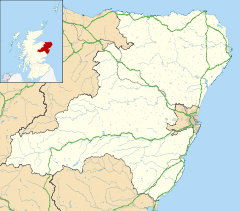
 Cruden Bay
Cruden Bay shown within AberdeenshirePopulation 1,608 [1] (2001 census)
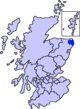
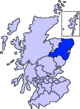
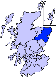
est. 1,760[2] (2006)OS grid reference NK089363 Council area Aberdeenshire Lieutenancy area Aberdeenshire Country Scotland Sovereign state United Kingdom Post town PETERHEAD Postcode district AB42 Dialling code 01779 81 Police Grampian Fire Grampian Ambulance Scottish EU Parliament Scotland List of places: UK • Scotland • Cruden Bay is a small village in Scotland, on the north coast of the Bay of Cruden in Aberdeenshire, 26 miles north of Aberdeen.
Just south of Slains Castle, Cruden Bay was the site of a battle between Danes and Scots under King Malcolm II in 1012. Traditionally, the name was derived from the Gaelic Croch Dain (Slaughter of Danes).[3]
Today, Cruden Bay attracts tourists with its hotels and well-known golf course. It has a long, unspoiled, beach made famous by Norwegian aviator Tryggve Gran who made the first solo flight across the North Sea.[4]
Contents
Literary associations
The village has associations with various figures in literature.
Dr Samuel Johnson and James Boswell were guests at Slains Castle in 1773. Johnson said that "no man can see with indifference" the sea chasm known as the Bullers of Buchan, which is near the village.
Dun Bay, or Yellow Rock is also near the Bullers of Buchan, and is associated with Walter Scott's The Antiquary.
Bram Stoker holidayed first at the Kilmarnock Arms Hotel[5] and then at nearby Whinnyfold from 1894. Some believe Slains Castle inspired Dracula, since Stoker was a regular guest at the Kilmarnock Arms, and Stoker’s novel The Mystery of the Sea and some short stories have Cruden Bay as their setting.
James Macpherson's poem The Highlander (1758) takes the battle of Cruden as its model.
Early area history
Earliest nearby human traces are evident in nearby Catto Long Barrow,[6] a massive stone structure now surrounded by agricultural fields.
The nearby clifftop Slains Castle was begun in 1597 and abandoned and unroofed for tax purposes in the 1920s. Bishop's Bridge spans Cruden Water and dates from 1697.
William Hay, 18th Earl of Erroll, established the fishing community of Port Erroll in the 1840s and 1850s. A functional harbour at the mouth of the Water of Cruden was added in the 1870s. Before that a tiny, now long-abandoned hamlet of rudimentary fisher cottages, simply known as Ward, stood exposed on top of Ward Hill, just above the harbour site. There was also a parish school since 1606, housed in the elegant two-storey Erroll Schoolhouse[7] (now a B & B) from 1834; the Presbyterian Church dedicated to Saint Olaf or commonly called the Old Kirk - built in 1776, with distinctive conical towers added in 1833; and Saint James[disambiguation needed
 ] Episcopal Church, notably the first structure designed by architect William Hay[8] on top of Chapel Hill in 1842.
Fishing community and seaside resort
 Harbour Street, Cruden Bay
Port Erroll developed as a fishing community to some extent, but the tidal nature of the harbour restricted the size of craft which could operate from it and the village missed out on the herring boom. However, tourism provided another source of income for the village. Even before the coming of the railway, the long pink curve of the Bay of Cruden sands and scenic cliffscapes to the north were attracting visitors and a small seaside resort was grafting itself onto the fishing community. The Cruden Bay Golfing Society, founded in 1791, played on the open links.
The coming and going of the railway
The railway brought grandeur, but not lasting prosperity, to Cruden Bay. The branch line from Ellon to Boddam near Peterhead was opened in 1897, along with the golf course[9] and the 55-bedroom Cruden Bay Hotel two years later. A tramway was added linking the station and hotel. The Great North of Scotland Railway Company promoted Cruden Bay as a Brighton of the North, only twelve hours from London and an ideal escape for gentry and nouveau riche. However, despite initial enthusiasm, neither railway nor hotel prospered. The railway was closed to passengers in 1932, and in 1939 the hotel was requisitioned as an army hospital, and never re-opened after the war. However, Cruden Bay remains a golfing destination, and the village still sustains three smaller hotels. Additionally, although both the harbour area and the local primary school[10] are still styled "Port Errol", the railway adventure put the name Cruden Bay firmly on the map.
Cruden Bay today
The 1950s and 1960s was a period of rapid population decline for Cruden Bay, but the coming of North Sea oil to northeast Scotland, with its attendant jobs and families looking for places to settle, reinvigorated the village; thereafter, the population rose again with new housing added near the now-closed brickworks, the site of the demolished Cruden Bay Hotel and along the water of Cruden at Morrison Place. These days Cruden Bay serves mainly as a dormitory village for the important settlements of Peterhead to the north and Aberdeen to the south. However, the eighteenth century timbered salmon station still operates, and some seasonal commercial fishing continues.
Cruden Bay is a nice place to live, with a medium sized primary school. Secondary pupils are bussed to nearby Peterhead Academy. There are a few small shops - a chemist/newsagent, a post office/hardware, a craft shop and a general store. There is also a Chinese takeaway, a medical surgery and a library. There are also many sports facilities - tennis courts, and two football pitches. The school and public hall house a number of youth groups such as Girlguiding UK. There is a Congregational Church in the village centre, and just outside of the village there is a Scottish Episcopalian Church and a Church of Scotland parish. Cruden Bay is not far from the towns of Ellon and Peterhead, and is approx 30 minutes drive from Aberdeen City.
Holiday makers are served by a number of hotels and bed and breakfasts.
The beach is extremely popular with visitors, as is the world famous golf course and Slains Castle.
Oil pipeline
Although there is little evidence of its presence other than a small complex a few miles south of the village, the sands at Cruden Bay is the place where the 110-mile long pipeline operated by British Petroleum, in use from 1975, finds landfall.[11] It pumps crude oil from the Forties oilfield to Port Errol, then onward by overland pipeline to Grangemouth.
Amenities
- Primary school with pre-school nursery
- Library
- Post office / General store
- Newsagent / General store
- Medical Practise
- Pharmacy
- Golf course
- Three hotels
- Public house
- Chinese take-away
- Gift shop
See also
- Bogbrae
- Laeca Burn
- Catto Long Barrow
References
- ^ "Comparative Population Profile: Cruden Bay Locality". Scotland's Census Results Online. 2001-04-29. http://www.scrol.gov.uk/scrol/browser/profile.jsp?profile=Population&mainArea=cruden+bay&mainLevel=Locality. Retrieved 2008-09-01.
- ^ http://www.gro-scotland.gov.uk/statistics/publications-and-data
- ^ A Brief History of Cruden Parish Church crudenchurch.org.uk, accessed 14 October 2008
- ^ Tryggve Gran
- ^ Welcome to the Kilmarnock Arms Hotel
- ^ C. Michael Hogan (2008) Catto Long Barrow fieldnotes, The Modern Antiquarian
- ^ Cruden Bay B&B accommodation - Erroll Schoolhouse Bed and Breakfast Cruden Bay Scotland
- ^ Clergy and Office Bearers The Services Parish History The Rector writes
- ^ Cruden Bay Golf Club
- ^ Port Erroll Primary School
- ^ Encyclopædia Britannica (2007)
External links
- Official Tourist Web Site
- Cruden Bay Community web site
- Cruden Bay Tramway page at the LNER Encyclopedia
- Peterhead Area Business Directory
Settlements and places of interest in Buchan, Aberdeenshire Primary settlements Boddam · Crimond · Cruden Bay · Fetterangus · Hatton · Longside · Maud · Mintlaw · New Deer · New Pitsligo · Peterhead · St Combs · St Fergus · Strichen · Stuartfield
Other settlements Auchnagatt · Buchanhaven · Clola · Inverugie · Lonmay · New Leeds · Old Deer · Rora · Whinnyfold
Places of interest Areas and primary settlements in Aberdeenshire
(see also: Aberdeen City)in Banff and Buchan Aberchirder · Banff · Fraserburgh · Gardenstown · Inverallochy and Cairnbulg · Macduff · Portsoy · Rosehearty · Sandhaven · Whitehills
in Buchan Boddam · Crimond · Cruden Bay · Fetterangus · Hatton · Longside · Maud · Mintlaw · New Deer · New Pitsligo · Peterhead · St Combs · St Fergus · Strichen · Stuartfield
in Formartine Balmedie · Cuminestown · Ellon · Fyvie · Newburgh · Oldmeldrum · Pitmedden · Potterton · Rothienorman · Tarves · Turriff
in Garioch in Kincardine and Mearns Drumoak · Fettercairn · Gourdon · Inverbervie · Johnshaven · Laurencekirk · Newtonhill · Portlethen · St Cyrus · Stonehaven
in Marr Categories:- Seaside resorts in Scotland
- Villages in Aberdeenshire


Wikimedia Foundation. 2010.