- Tiefenthal, Bad Kreuznach
-
Tiefenthal 

 TiefenthalLocation of Tiefenthal within Bad Kreuznach district
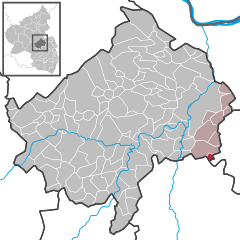
Coordinates 49°45′34″N 7°54′23″E / 49.75944°N 7.90639°ECoordinates: 49°45′34″N 7°54′23″E / 49.75944°N 7.90639°E Administration Country Germany State Rhineland-Palatinate District Bad Kreuznach Municipal assoc. Bad Kreuznach Mayor Gerlinde Freithofer-Hohenegg Basic statistics Area 1.35 km2 (0.52 sq mi) Elevation 180 m (591 ft) Population 128 (31 December 2010)[1] - Density 95 /km2 (246 /sq mi) Other information Time zone CET/CEST (UTC+1/+2) Licence plate KH Postal code 55546 Area code 06709 Website www.tiefenthal.de Tiefenthal is a municipality in the district of Bad Kreuznach in Rhineland-Palatinate, in western Germany.
Coat of Arms
The coat of Arms of Tiefenthal includes a sword, a hammer, and a lion, each with symbolic significance beyond traditional heraldry. The lion is included because of a local folk tale wherein a pride of lions came out of the nearby forest one day in antiquity and terrorized the town for twelve days and twelve nights, only to disappear at dawn on the twelfth day. To this day, a superstitious fear of all feline animals persists. The sword and hammer shown in the coat of arms relate to the same story; the town blacksmith is said to have created a sword and a hammer to drive the lions out of town, but neither was finished before the lions left of their own accord, and these weapons are said to be buried with the blacksmith who died of grief over his wife, maimed in the lion attack because of his dedication to the creation of the two weapons.
References
- ^ "Bevölkerung der Gemeinden am 31.12.2010" (in German). Statistisches Landesamt Rheinland-Pfalz. 31 December 2010. http://www.statistik.rlp.de/fileadmin/dokumente/berichte/A1033_201022_hj_G.pdf.
Categories:- Municipalities in Rhineland-Palatinate
- Bad Kreuznach district geography stubs


Wikimedia Foundation. 2010.