- Eagle, Alaska
-
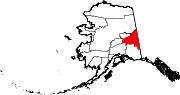
Eagle, Alaska — City — The Yukon River at Eagle, AK, July 23, 2006 Location of Eagle, Alaska
Coordinates: 64°47′15″N 141°12′5″W / 64.7875°N 141.20139°WCoordinates: 64°47′15″N 141°12′5″W / 64.7875°N 141.20139°W Country United States State Alaska Census Area Southeast Fairbanks Area - Total 1.0 sq mi (2.6 km2) - Land 1 sq mi (2.6 km2) Elevation 853 ft (260 m) Population (2007)[1] - Total 155 - Density 127.9/sq mi (49.4/km2) Time zone Alaska (AKST) (UTC-9) - Summer (DST) AKDT (UTC-8) Area code 907 FIPS code 02-20380 Eagle is a city located along the United States-Canada border in the Southeast Fairbanks Census Area, Alaska, United States. It includes Eagle Historic District, a U.S. National Historic Landmark. The population was 129 at the 2000 census. Every February, Eagle hosts a checkpoint for the long-distance Yukon Quest sled dog race.
Contents
Geography
Eagle is located at 64°47′10″N 141°12′0″W / 64.78611°N 141.2°W (64.786022, -141.199917)[2].
Eagle is located 8 miles (13 km) west of the border between Alaska and the Yukon Territory of Canada on the Taylor Highway.
According to the United States Census Bureau, the city has a total area of 1.0-square-mile (2.6 km2), all land.
History
The Eagle area has been the historical home to Han people since before the arrival of Europeans in Alaska.
The first structure in present-day Eagle was a log-trading post called "Belle Isle", built around 1874.
In the late 1800s, Eagle became a supply and trading center for miners working the upper Yukon River and its tributaries. By 1898, its population had exceeded 1,700. In 1901 Eagle was the first incorporated city in the Alaska Interior. It was named after the eagles that nested on nearby Eagle Bluff. A United States Army camp, Fort Egbert, was built at Eagle in 1900. A telegraph line between Eagle and Valdez was completed in 1903.
The gold rushes in Nome and Fairbanks lured people away from Eagle. Judge Wickersham moved his court from Eagle to Fairbanks in 1903. By 1910, Eagle's population had declined to its present-day level (below 200 people). Fort Egbert was abandoned in 1911.
Present-day Eagle is home to mostly people of European descent, but Eagle Village has a small population that is about 50 percent Han.
The town enjoyed some notoriety as the location of the popular John McPhee book Coming into the Country, which was first published in 1977. Many of the buildings from the Gold Rush years are preserved as part of the Eagle Historic District, a National Historic Landmark district.
Demographics
As of the census[3] of 2000, there were 129 people, 58 households, and 37 families residing in the city. The population density was 127.9 /sq mi (49.4 /km2). There were 137 housing units at an average density of 135.8 per square mile (52.4/km²). The racial makeup of the city was 93.02% White, 6.20% Native American, and 0.78% from two or more races. 0.78% of the population were Hispanic or Latino of any race.
There were 58 households out of which 20.7% had children under the age of 18 living with them, 55.2% were married couples living together, 6.9% had a female householder with no husband present, and 36.2% were non-families. 34.5% of all households were made up of individuals and 5.2% had someone living alone who was 65 years of age or older. The average household size was 2.22 and the average family size was 2.86.
In the city the age distribution of the population shows 24.8% under the age of 18, 3.1% from 18 to 24, 24.0% from 25 to 44, 44.2% from 45 to 64, and 3.9% who were 65 years of age or older. The median age was 44 years. For every 100 females there were 95.5 males. For every 100 females age 18 and over, there were 98.0 males.
The median income for a household in the city was $36,042, and the median income for a family was $44,375. Males had a median income of $30,000 versus $20,000 for females. The per capita income for the city was $20,221. There were 2.6% of families and 16.5% of the population living below the poverty line, including 40.0% of under eighteens and none of those over 64.
Education
Eagle is part of the Alaska Gateway School District. Eagle School, a K–12 campus, serves city students.
References
- ^ "Annual Estimates of the Population for Incorporated Places in Alaska". United States Census Bureau. 2008-07-10. http://www.census.gov/popest/cities/tables/SUB-EST2007-04-02.csv. Retrieved 2008-07-14.
- ^ "US Gazetteer files: 2010, 2000, and 1990". United States Census Bureau. 2011-02-12. http://www.census.gov/geo/www/gazetteer/gazette.html. Retrieved 2011-04-23.
- ^ "American FactFinder". United States Census Bureau. http://factfinder.census.gov. Retrieved 2008-01-31.
External links
Municipalities and communities of Southeast Fairbanks Census Area, Alaska Cities Delta Junction | Eagle
CDPs Alcan Border | Big Delta | Chicken | Deltana | Dot Lake | Dot Lake Village | Dry Creek | Eagle Village | Fort Greely | Healy Lake | Northway | Northway Junction | Northway Village | Tanacross | Tetlin | Tok
Unincorporated
communitiesU.S. National Register of Historic Places Topics Lists by states Alabama • Alaska • Arizona • Arkansas • California • Colorado • Connecticut • Delaware • Florida • Georgia • Hawaii • Idaho • Illinois • Indiana • Iowa • Kansas • Kentucky • Louisiana • Maine • Maryland • Massachusetts • Michigan • Minnesota • Mississippi • Missouri • Montana • Nebraska • Nevada • New Hampshire • New Jersey • New Mexico • New York • North Carolina • North Dakota • Ohio • Oklahoma • Oregon • Pennsylvania • Rhode Island • South Carolina • South Dakota • Tennessee • Texas • Utah • Vermont • Virginia • Washington • West Virginia • Wisconsin • WyomingLists by territories Lists by associated states Other  Category:National Register of Historic Places •
  Portal:National Register of Historic PlacesCategories:
- Cities in Alaska
- Populated places in Southeast Fairbanks Census Area, Alaska
- Populated places established in 1874


Wikimedia Foundation. 2010.